

Guatemala's great adventures come from the meeting of Maya culture and an intensely varied landscape. A journey can climb above the clouds on Acatenango, cross Lake Atitlán by kayak, walk for days to a Preclassic city in the Maya forest or follow a river underground through limestone. These are not interchangeable day tours: each requires different judgment about altitude, volcanic activity, water, wildlife and community access.
Useful planning begins with where to spend time. Antigua is the base for volcanoes and highland cycling; Flores opens Tikal and Petén expeditions; Lanquín and Cobán serve caves and karst pools; Lake Atitlán supports paddling, ridge walks and village stays. Avoid stringing distant regions into consecutive day trips. Road travel is slow, conditions change in rain and a local guide often carries the permissions and current knowledge that an online route cannot.
Guatemala adventures at a glance
| Adventure | Standout destination | Intensity | Guide needed? |
|---|---|---|---|
| Overnight volcano trek | Acatenango | Very high | Strongly recommended |
| Jungle archaeology | El Mirador | Very high | Required expedition |
| Kayaking | Lake Atitlán | Moderate | Recommended beyond shore |
| Caving | Candelaria or Lanquín | Moderate–high | Yes |
| Surfing | El Paredón | Moderate–high | Lesson for beginners |
| Natural pools | Semuc Champey | Moderate | Site-managed access |
The 20 best adventure activities in Guatemala
1. Camp on Acatenango
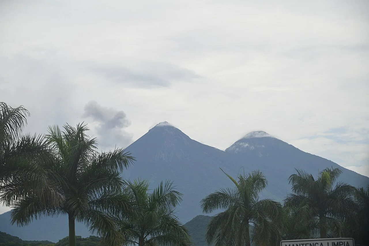
Climb through cloud forest to a high camp opposite active Fuego, then make an optional predawn ascent of 3,976-metre Acatenango. The two-day trek combines severe elevation gain, cold and one of Central America's great volcanic panoramas.
Compare operators by tents, sleeping bags, warm clothing, water, guide ratios and emergency plans. Acclimatize first. Never enter Fuego exclusion zones, and accept that cloud or activity restrictions may remove the famous eruption view.
2. Walk Pacaya's volcanic landscape
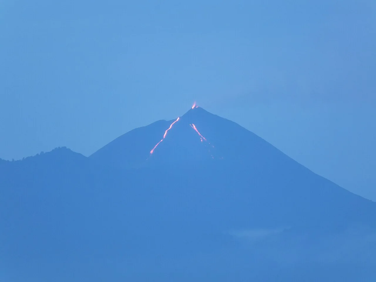
Pacaya offers a shorter guided encounter with ash fields, old lava and views of an active complex near Antigua and Guatemala City. Routes change with eruptions and restrictions; legitimate tours do not promise access to the crater.
Use an authorized guide, wear closed shoes and carry water, rain protection and a headlamp for sunset. Stay away from vents and unstable lava even when another group moves closer.
3. Explore Tikal at dawn
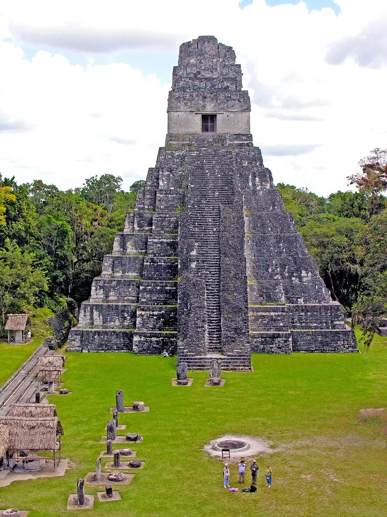
Tikal's causeways lead through rainforest to immense temples, reservoirs and plazas. Authorized early entry can bring cooler air and a forest soundscape before the busiest hours, while a full day reveals far more than the Great Plaza.
Buy the correct official ticket and guide arrangement in advance. Climb only designated structures, carry water and never feed monkeys or coatimundis. Sunrise itself is weather-dependent; archaeology and habitat are the reliable experience.
4. Trek five days to El Mirador
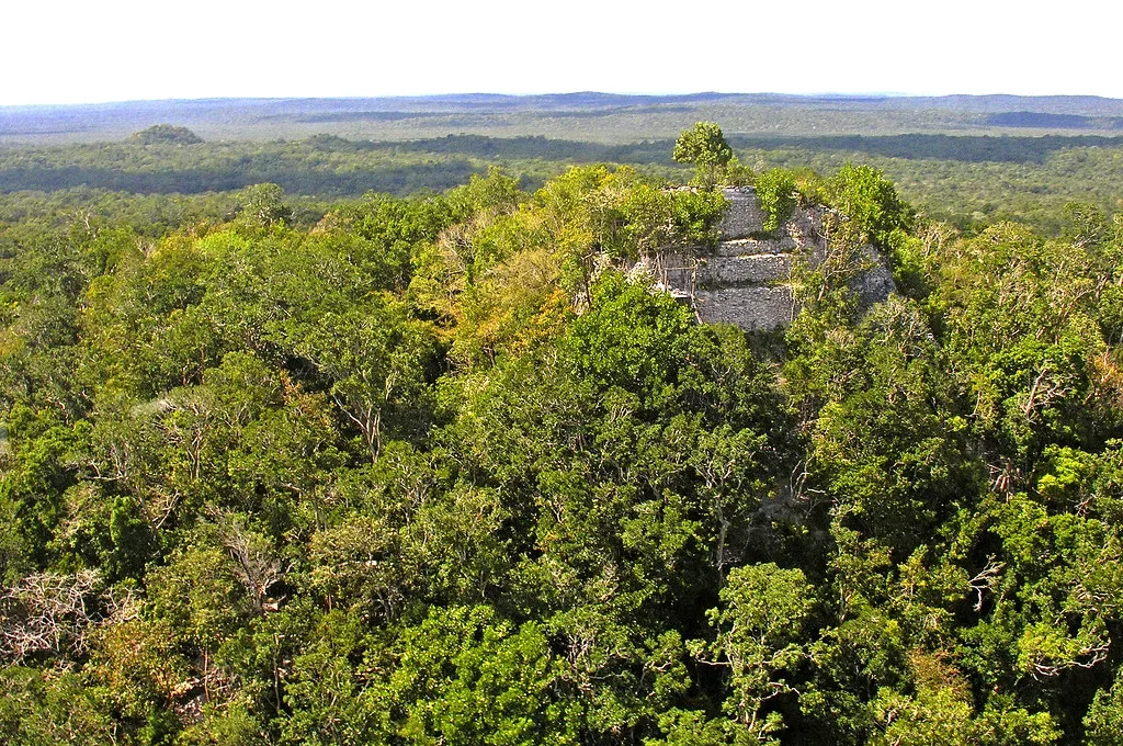
The expedition from Carmelita to El Mirador crosses Maya Biosphere Reserve forest to enormous Preclassic complexes. Walking commonly takes five or six days with community guides, camps and pack support.
Book an authorized community operator that explains safe water, food, animal welfare and fire-season policy. Heat, mud and insects make this a genuine endurance journey. Do not touch ceramics or enter excavations.
5. Hike and swim at Semuc Champey
A steep humid trail climbs to the Mirador above turquoise pools resting on a limestone bridge, then descends to designated swimming areas. The Cahabón River rushes invisibly beneath the formation.
Use grippy shoes and obey pool closures. Never approach the river sink or outflow. The rough 12-kilometre road from Lanquín takes time, so stay locally rather than attempting a rushed cross-country day trip.
6. Kayak Lake Atitlán
Paddling from villages such as Santa Cruz, San Marcos or San Pedro reveals steep volcanic shorelines without relying on road travel. Mornings are typically calmer; afternoon wind can create steep chop surprisingly quickly.
Rent from an established operator, wear flotation and stay close to shore unless guided. Ask about boat traffic and safe landing points. A one-way paddle with arranged luggage or return boat can create a richer village-to-village day.
7. Paraglide above Lake Atitlán
Tandem flights from the high rim near Panajachel can soar over the lake with volcanoes filling the horizon. Launch, route and landing depend on thermal and wind conditions rather than a fixed itinerary.
Use a qualified tandem pilot who provides a safety briefing and cancels conservatively. Wear secure shoes and long trousers. Keep a hiking or village alternative instead of pressuring a marginal launch.
8. Surf El Paredón
El Paredón's black-sand Pacific beach has powerful, consistent surf and established schools. Beginners can learn in carefully selected whitewater, while larger days and strong currents challenge experienced surfers.
Take a lesson, use a secure leash and follow local flags and instructor advice. The shorebreak can be dangerous for swimmers. Start around dawn to avoid heat, and support mangrove and turtle programs that prioritize conservation over handling wildlife.
9. Explore Candelaria's cave system
The Candelaria caves form a major karst system in Alta Verapaz, with river passages, large chambers and Maya cultural significance. Guided visits vary from dry cave walks to tubing or boat travel depending on the sector and water.
Use a community or registered guide, helmet, headlamp and flotation where required. Rain upstream can raise water rapidly. Never touch formations, disturb bats or enter a passage outside the authorized route.
10. Enter the Lanquín caves
Grutas de Lanquín open into large limestone chambers near the town used as a base for Semuc Champey. Evening bat emergence can be observed from a respectful position, while guided cave routes introduce the region's underground hydrology.
Bring a proper headlamp and grippy footwear, and use local guidance beyond developed sections. Do not shine strong lights continuously at bats or block their exit. Combine the cave with an overnight in Lanquín, not a same-day race from Antigua.
11. Raft the Cahabón River
Commercial rafting on the Cahabón passes tropical forest, rapids and limestone country in Alta Verapaz. Difficulty changes greatly with section and water level, so trip labels should be discussed directly with the operator.
Wear the supplied helmet and flotation, disclose swimming ability and ask about safety kayaks or rescue procedures. Heavy rain may make a section inappropriate. Caves and waterfalls should be entered only as part of the guide's assessed route.
12. Climb Tajumulco
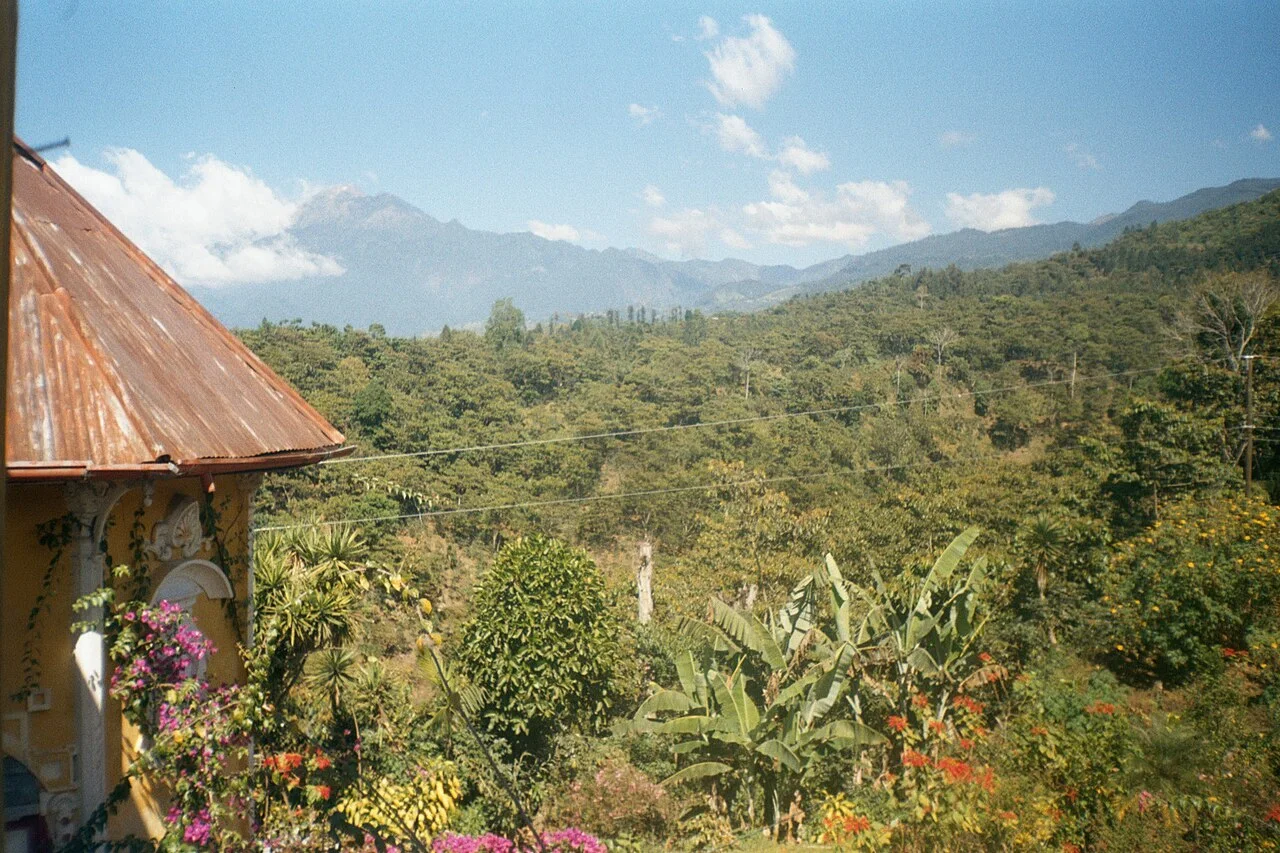
The 4,220-metre summit is Central America's highest point. A guided overnight from the San Marcos highlands allows a cold sunrise ascent, while a long one-day itinerary suits acclimatized, strong hikers.
Carry real insulation, shelter and water; altitude and cloud are the principal hazards. Spend time at elevation beforehand and descend when symptoms worsen. A community guide provides navigation and local access.
13. Mountain bike around Antigua
Routes through the Panchoy Valley and surrounding coffee country connect villages, farm tracks and volcano views. Guided rides range from gentle valley roads to technical descents on loose volcanic soil.
Ask for distance, elevation, traffic and surface—not just “intermediate.” Wear a helmet, inspect brakes and avoid fast descents through settlements. Rain turns dust into slick mud, making the dry season more predictable.
14. Climb the Rostro Maya ridge
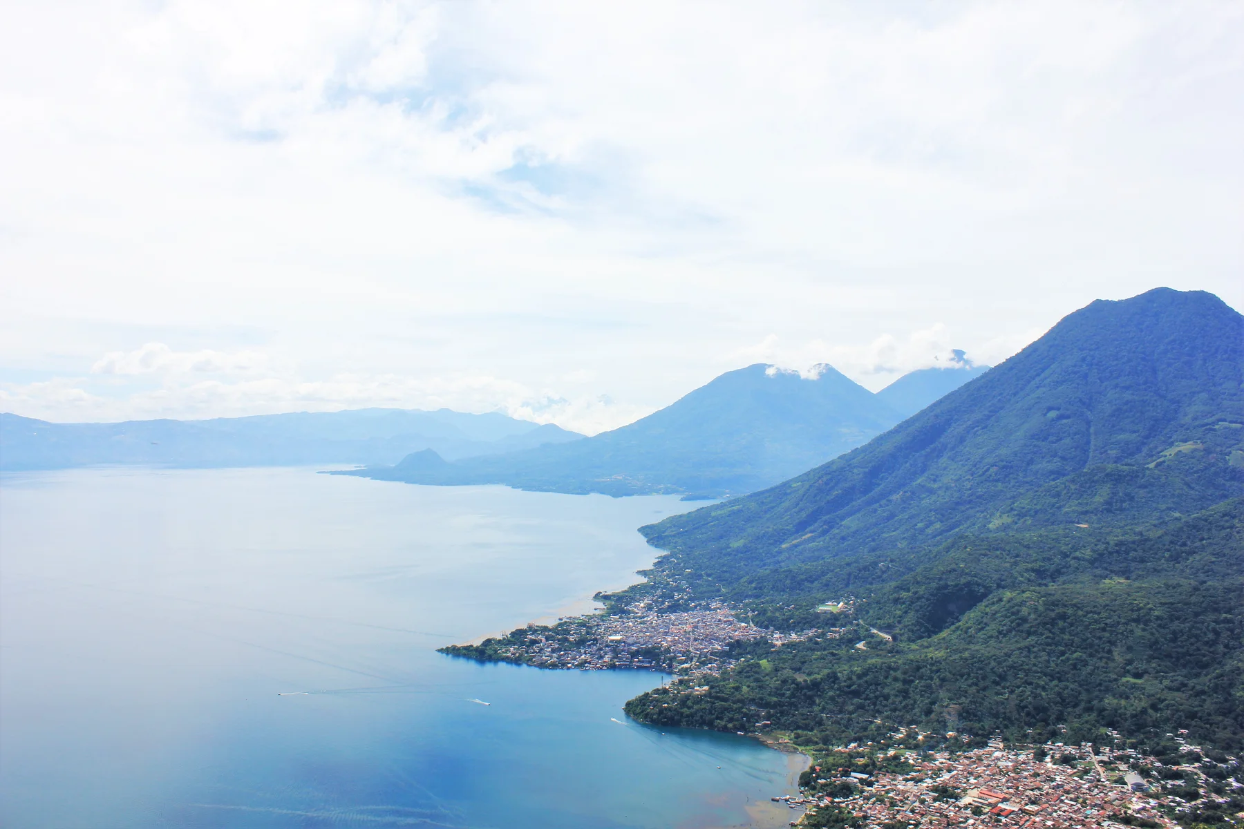
This Lake Atitlán ridge provides a famous sunrise profile above the water. Community-guided routes from Santa Clara or San Juan differ in length and access, with headlamp starts and cool predawn conditions.
Use an approved local guide because paths cross community and private land and security has varied. Pay official fees, remain at designated viewpoints and respect ceremonies. For more detail, see Guatemala's best hikes.
15. Sail the Río Dulce gorge
The river journey between Lake Izabal and Livingston passes Castillo de San Felipe, hot springs, bird habitat and a steep green gorge before reaching the Caribbean. A small-boat trip with a knowledgeable captain makes transport an exploration day.
Wear flotation, protect against sun and confirm whether stops are included. Keep distance from manatees and nesting birds. Weather on the coast can change return arrangements, so avoid tight onward connections.
16. Hike to Siete Altares
From Livingston, reach this chain of forest pools by boat or a coast walk when tide and weather permit. Recent rain controls water clarity and whether individual pools are safe.
Use local Garifuna guides, wear water shoes and never jump without an on-site assessment. Support community management and leave enough time to experience Livingston beyond the excursion.
17. Search for quetzals in cloud forest
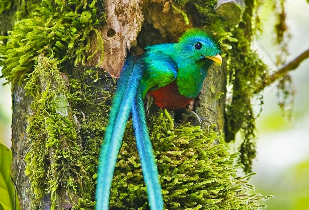
Protected forest around the Biotopo del Quetzal and Sierra de las Minas provides habitat for Guatemala's national bird. Quiet dawn walks with a naturalist guide are more rewarding than pursuing a guaranteed sighting.
Remain on trail, avoid playback calls and wear rain protection. Learn about fruiting trees, cloud-forest water and other species so the outing retains value when no quetzal appears.
18. Ride horseback through highland villages
Guided rides around Antigua or Lake Atitlán can follow farm roads and ridge routes between communities. The slower pace creates more contact with working landscapes than an enclosed resort trail.
Choose a stable that supplies helmets, matches horses to ability and demonstrates good animal care. Avoid overloaded animals and steep technical routes beyond your experience. Ask before photographing people in villages.
19. Boat and hike to Aguateca
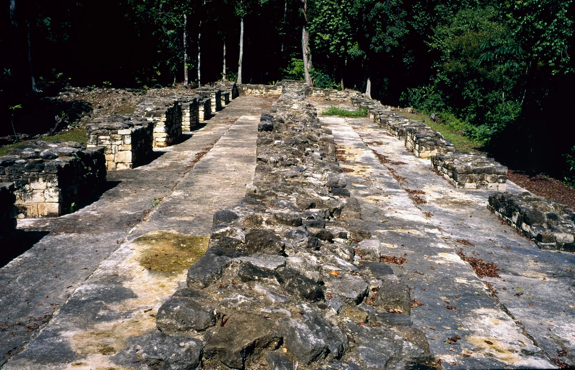
Reach Aguateca's Maya ruins by boat through the Petexbatún landscape, then walk forest trails to plazas, defensive walls and a dramatic chasm. The combination of river, archaeology and remoteness makes it one of Petén's best alternatives to the main road sites.
Arrange an established guide from the Sayaxché area, confirm water levels and bring insect protection. Stay on marked paths and out of fissures. Allow a full day rather than compressing boat travel.
20. Journey to Laguna Brava
Remote Laguna Brava in Huehuetenango offers blue water, forest, cenotes and basic community camping near the Mexican border. Reaching it is an expedition over difficult roads, not an ordinary lake day.
Organize permission, a guide, food and overnight logistics through local community tourism. Carry cash and offline navigation, respect border restrictions and swim only where guides approve. Weather can make access impossible.
How to choose your Guatemala adventure
Base in Antigua for Acatenango, Pacaya and cycling; Lake Atitlán for kayaking, paragliding and ridge walks; Flores or Sayaxché for Maya forest expeditions; Lanquín or Cobán for Semuc, caves and rafting; and Livingston or Río Dulce for Caribbean water journeys. Longer stays reduce road fatigue and direct more spending toward local guides and hosts.
Continue planning with Guatemala's volcano experiences, Maya ruins, waterfalls and natural pools and best hikes.
Before booking
- Use INGUAT-registered services or established community operators where available.
- Check CONRED, INSIVUMEH and CONAP information for volcanic and protected-area conditions.
- Ask about guide ratios, equipment, insurance, water and evacuation plans.
- Build extra time around remote roads, ferries and rainy-season travel.
- Respect Maya ceremonies, community land, wildlife and photography boundaries.