

Guatemala's volcanoes offer some of Central America's most dramatic hiking, but the five best experiences have very different risk profiles. Acatenango is a cold, high overnight climb with a distant view of active Fuego. Pacaya is a shorter guided outing on a changing volcanic landscape. Tajumulco is the country's highest summit, while Santa María and San Pedro demand long ascents with fewer facilities.
Volcanic activity, crime risk on isolated trails, weather and local access rules can change faster than travel articles. Use a registered local guide, check official civil-protection information and never approach Fuego's cone, lava flows or restricted areas. Operators should be compared on guide ratios, shelter, insulation, water and emergency plans—not only camp views or price.
Guatemala volcanoes at a glance
| Volcano | Elevation | Main experience | Typical commitment |
|---|---|---|---|
| Acatenango | 3,976 m | Camp opposite active Fuego | 2 days |
| Pacaya | 2,552 m | Accessible active landscape | Half day |
| Tajumulco | 4,220 m | Guatemala's highest summit | 1–2 days |
| Santa María | 3,772 m | High viewpoint over Santiaguito | Full day |
| San Pedro | 3,020 m | Steep Lake Atitlán climb | 6–9 hours |
The 5 best volcano experiences in Guatemala
1. Camp on Acatenango
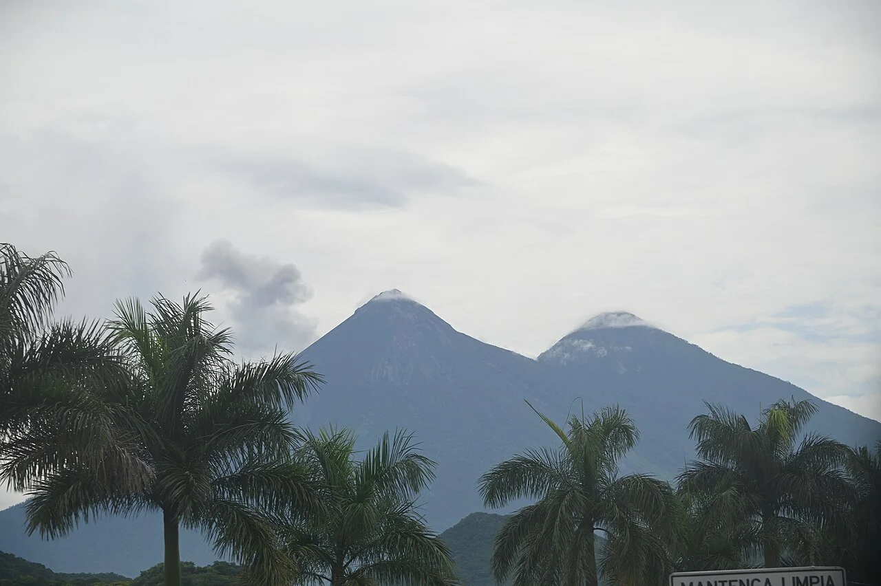
The climb to Acatenango's high camps reveals Fuego across a deep saddle, with possible ash plumes or glowing eruptions visible from a legally distant viewpoint. Most trips climb through farmland and cloud forest on day one, camp around 3,500–3,700 metres and make a cold predawn attempt on Acatenango's summit.
The altitude gain is severe and temperatures can fall below freezing. Choose an operator providing adequate tents, sleeping bags, warm clothing options, drinking water and a realistic guide-to-client ratio. An extra “Fuego hike” toward the saddle adds fatigue and exposure and should never enter exclusion zones. Eruptions are not guaranteed, and observation instructions must override the desire for a closer view.
2. Hike Pacaya with an authorized guide
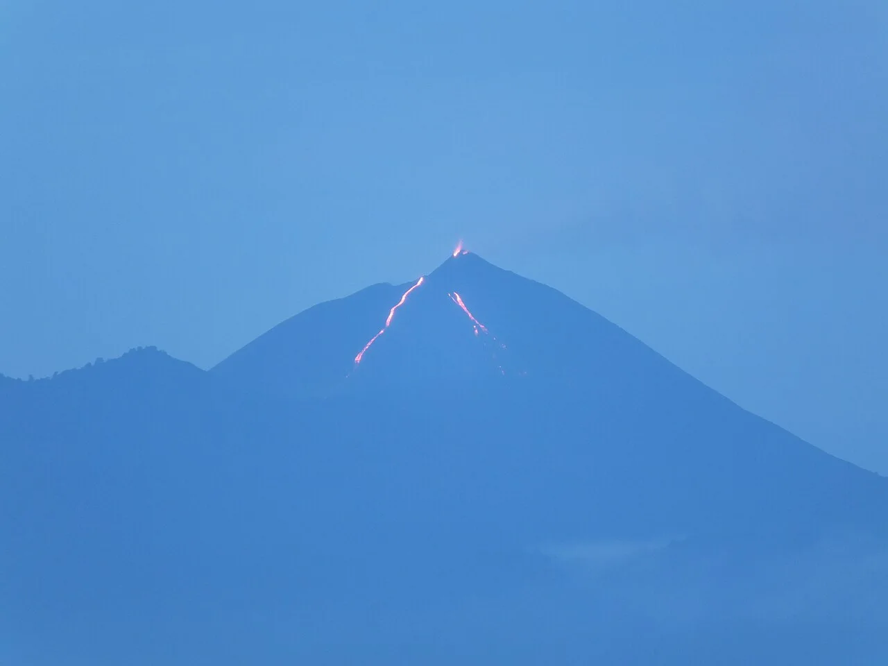
Pacaya is the most accessible active-volcano outing from Antigua or Guatemala City. Guided paths cross older lava, ash and open slopes with views toward the active complex. The precise route changes with eruptions, gas and CONRED restrictions; reaching the actual crater is neither normal nor appropriate.
Plan three to five hours of walking plus transport. Wear closed shoes, carry water and a rain layer, and keep well away from hot cracks or unstable lava. Horses may be offered on the ascent; if using one, assess animal condition and handler practices. Sunset trips require a headlamp and warm clothing for the descent.
3. Summit Tajumulco
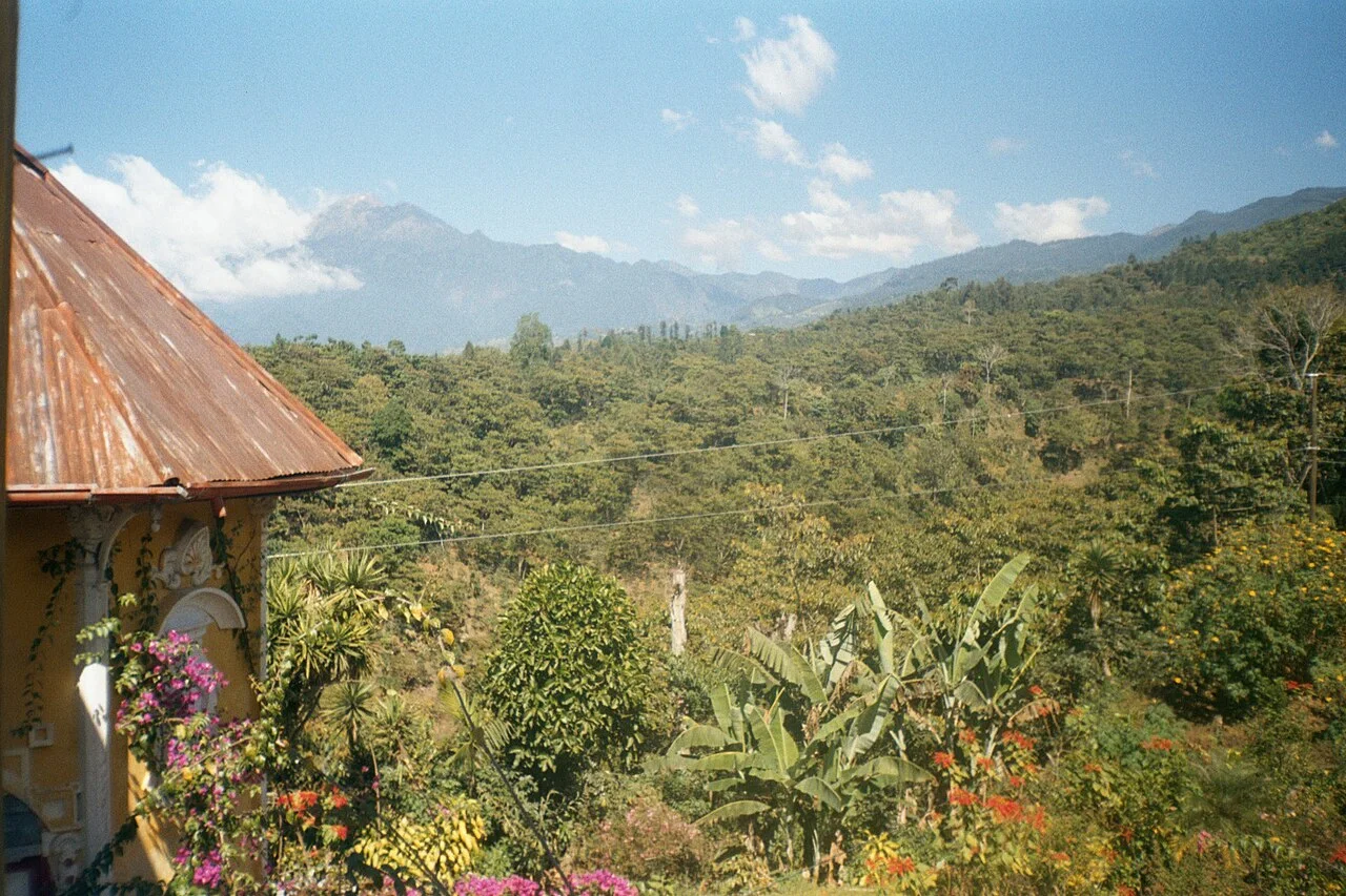
At 4,220 metres, Tajumulco is Guatemala's and Central America's highest summit. Routes generally begin high in San Marcos department, making the climb shorter than the elevation suggests but still vulnerable to altitude, cold and cloud. It can be completed in one long day or with a camp below the summit.
A locally guided overnight allows better acclimatization and reduces a middle-of-the-night road departure. Carry proper insulation, shelter and water; frost and strong wind are possible. Spending a night at moderate altitude beforehand is wiser than arriving directly from the lowlands. The broad upper terrain becomes confusing in cloud, so download a route but rely on local expertise.
4. Climb Santa María above Quetzaltenango
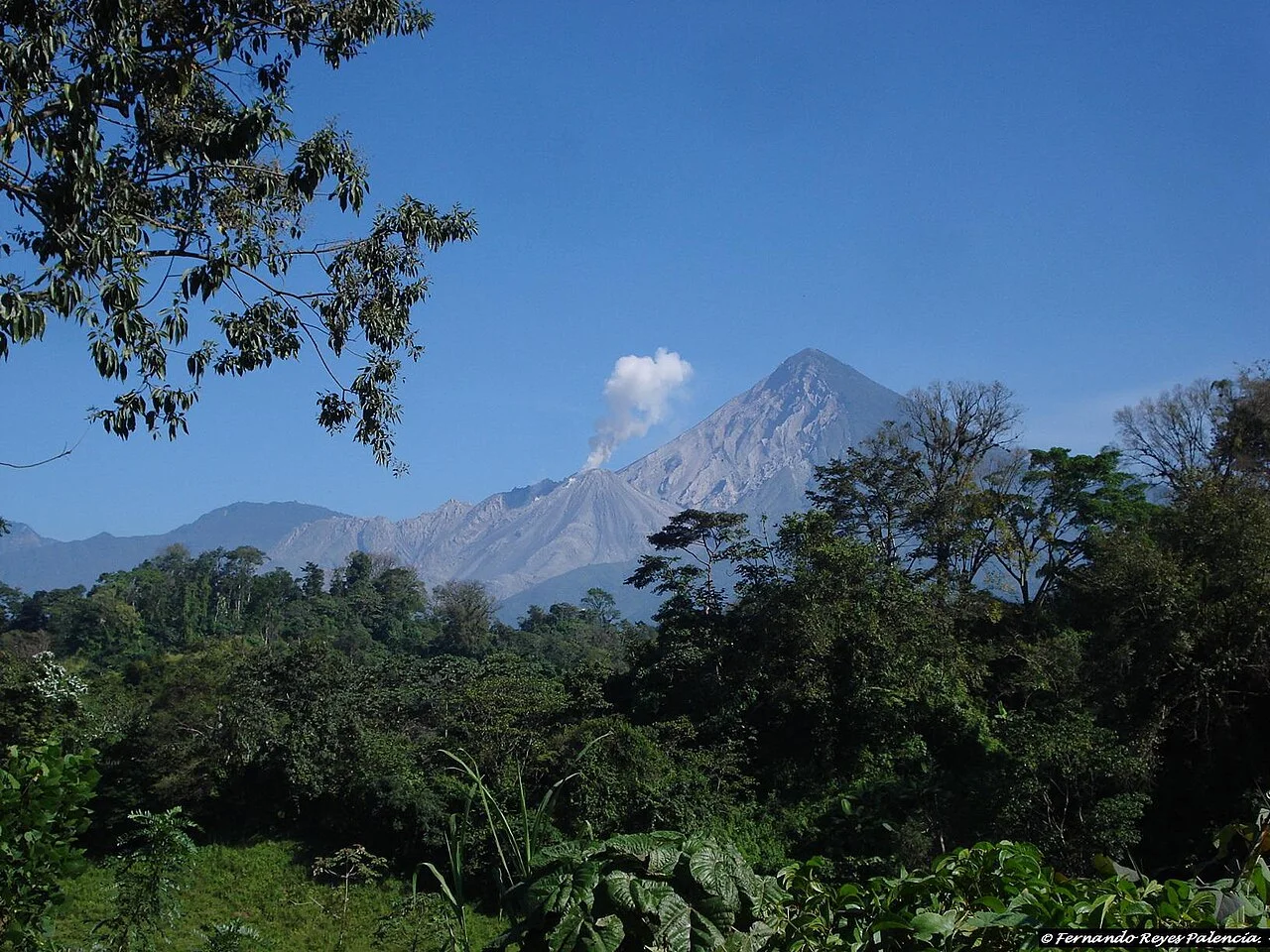
Santa María rises steeply above Xela, with a summit view toward the active Santiaguito dome complex far below. The standard climb is a strenuous full day with roughly 1,200 metres of ascent on forest, dirt and eroded trail. Cloud often gathers later, favoring an early departure.
Go with a reputable local guide because route security and access can change. Keep to the summit's safe viewing area and never descend toward Santiaguito; explosions, ash and pyroclastic flows make its vicinity lethal. Bring sun protection, warm layers and enough water for a long descent that often feels harder than the climb.
5. Hike San Pedro above Lake Atitlán
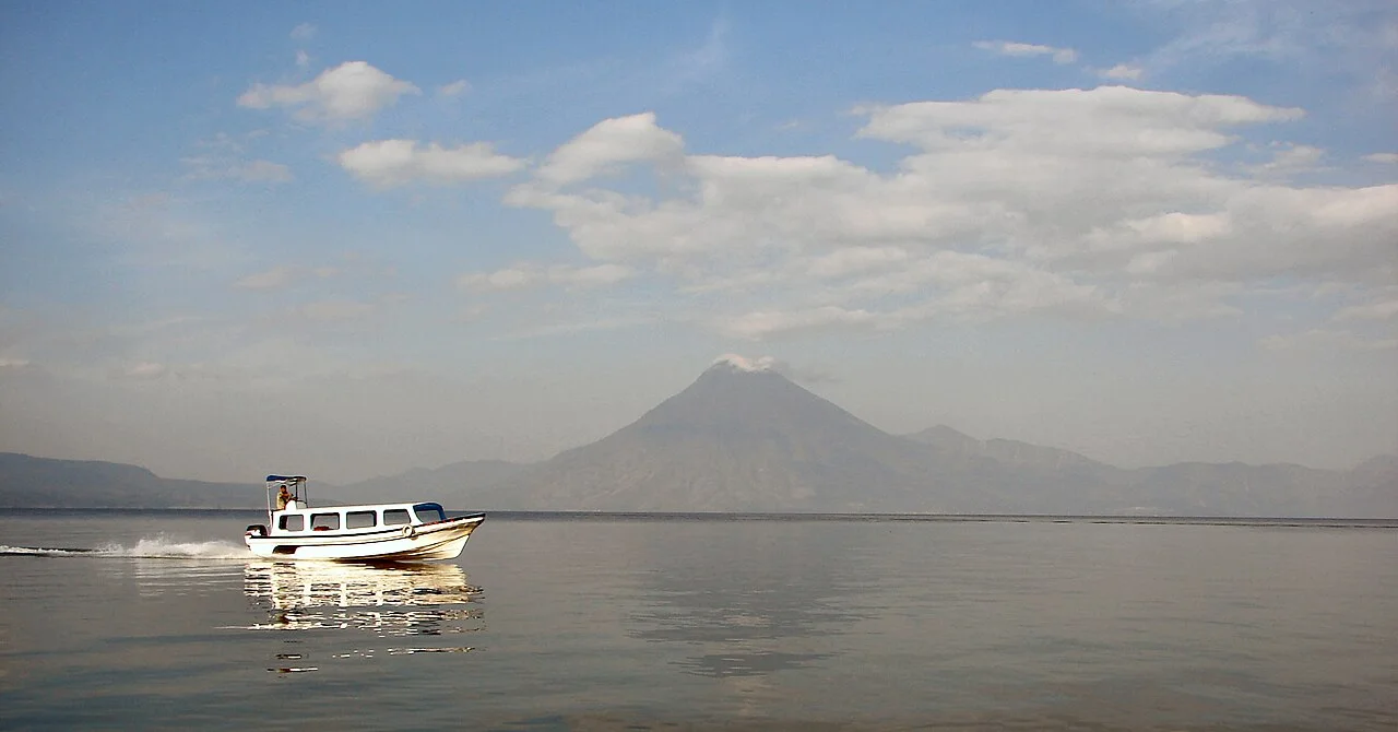
Volcán San Pedro provides a sustained forest climb from the lakeside town to a 3,020-metre summit. The route is commonly six to nine hours return, gaining around 1,500 metres, with changing vegetation and lake views when cloud permits.
Current security and official access must be confirmed in San Pedro La Laguna. Use a local guide, start early and do not continue alone if the trail is quiet or weather closes in. The summit is not guaranteed to be clear; the physical journey through coffee, cloud forest and high vegetation is the more reliable reward.
Which Guatemala volcano should you choose?
Choose Pacaya for a first volcano walk with modest time, Acatenango for the iconic high camp and a strenuous overnight, Tajumulco for the national high point, Santa María for a hard day from Quetzaltenango and San Pedro for a steep climb based at Lake Atitlán. None should be approached as an unplanned solo hike.
For more mountain routes, see the best hikes in Guatemala. For caves, rafting and jungle trips, explore the best adventure activities in Guatemala.
Volcano safety
- Check CONRED alerts and INSIVUMEH bulletins before departure.
- Use a registered guide who follows park, municipal and evacuation restrictions.
- Acclimatize, hydrate and descend when altitude symptoms worsen.
- Carry rain gear, insulation, headlamp, food and water even on a guided trip.
- Never approach active vents, fresh lava, ashfall or Fuego and Santiaguito exclusion areas.