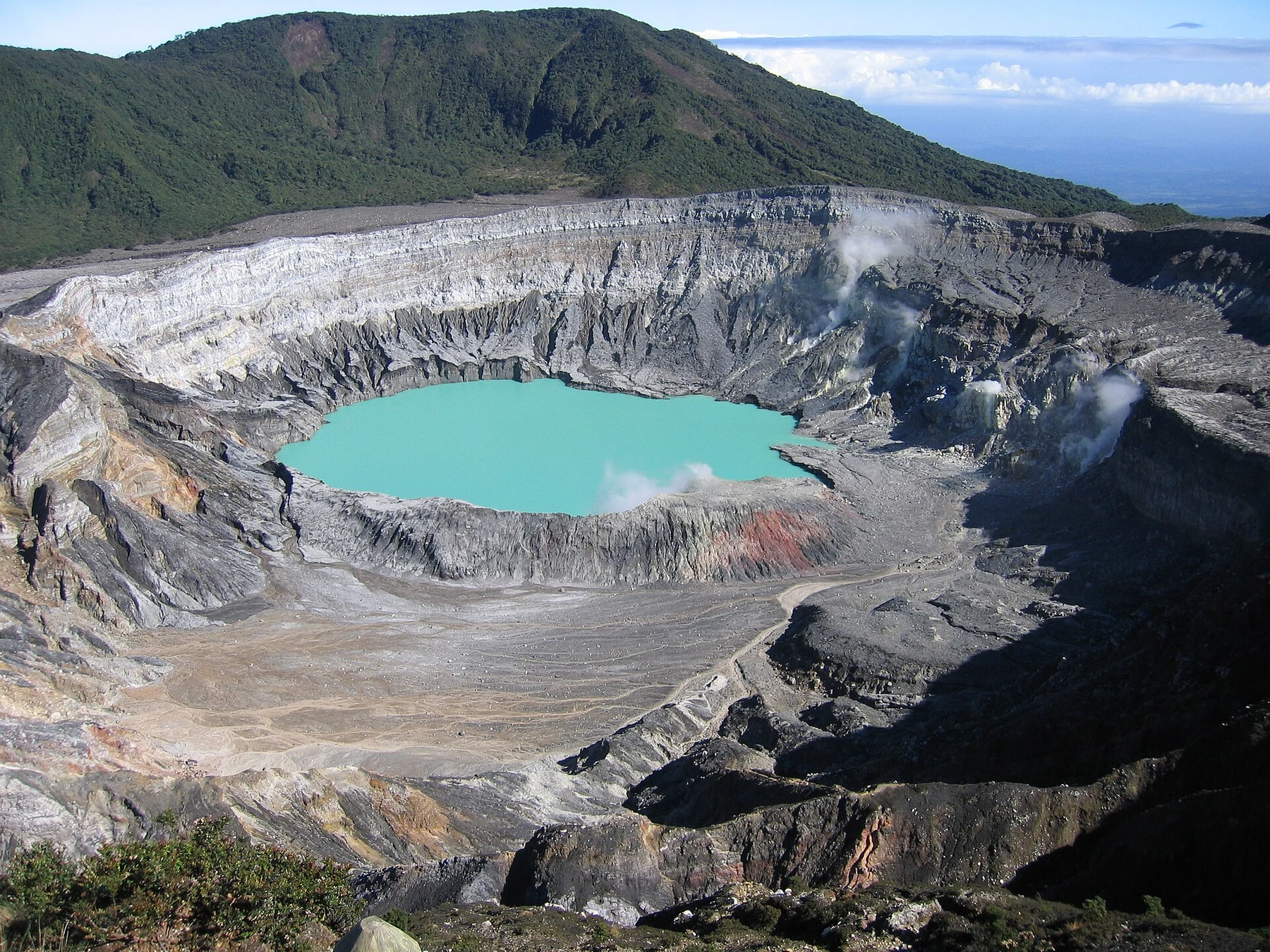

Costa Rica's volcanoes are not all summit climbs. The strongest experiences range from standing at a managed active-crater viewpoint to walking among fumaroles, crossing old lava flows or following cloud forest to a crater lagoon. Arenal is best understood from its lower trails, while Poás and Irazú make high volcanic terrain accessible to travelers who do not want a long hike.
Activity, gas, weather and trail damage can change access with little notice. The fact that a route appears in an old guide or map does not mean it is legal today: Rincón de la Vieja's active-crater trail, for example, remains closed. Reserve the exact park sector through the current official system, check alerts on the morning of travel and build an alternative into any day centered on a crater view. Cloud is normal in high country and should never justify crossing a barrier.
Costa Rica volcanoes at a glance
| Volcano | Signature experience | Effort | Best base |
|---|---|---|---|
| Poás | Active crater viewpoint | Low | Alajuela or San José |
| Irazú | High-altitude crater landscape | Low | Cartago |
| Arenal | Old lava-flow trails | Moderate | La Fortuna |
| Rincón de la Vieja | Fumaroles and mud pots | Moderate | Liberia |
| Tenorio | Río Celeste volcanic river | Moderate | Bijagua |
| Barva | Cloud-forest crater lagoon | High | Heredia |
The 9 best volcano experiences in Costa Rica
1. Look into Poás Volcano's active crater
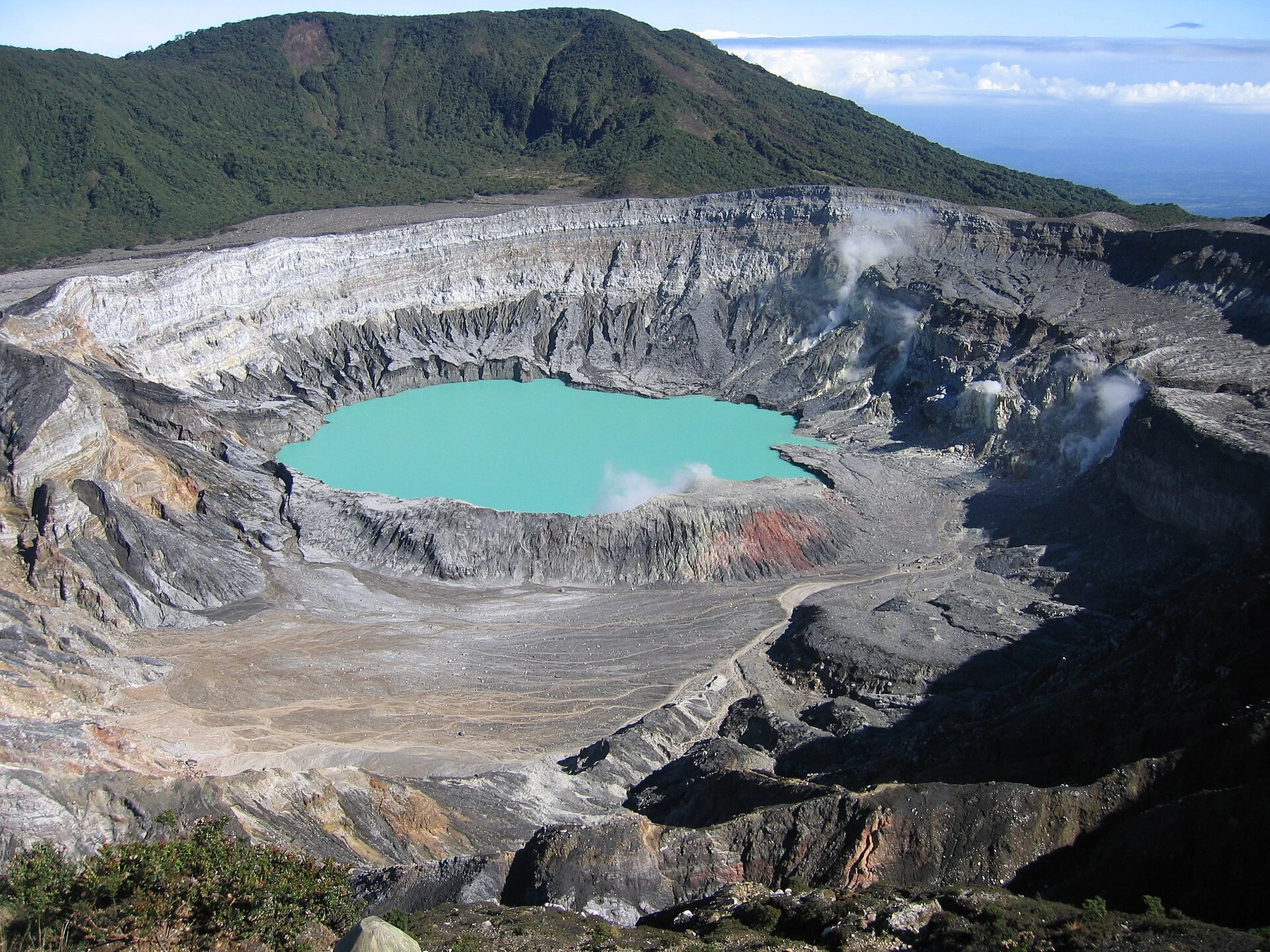
Poás offers Costa Rica's most direct encounter with a large active crater. A short paved approach leads from the visitor center to a managed viewpoint over the crater lake and steaming vents. Visibility can shift from a clear basin to complete cloud in minutes, making an early timed entry useful but never a guarantee.
Reserve through SINAC and arrive for the selected slot rather than treating the ticket as open-ended. Bring a layer for cool wind and follow current limits on time, masks or shelter instructions. Additional lagoon trails may open or close independently, so check what the reservation actually includes before planning a longer walk.
2. Explore Irazú's crater sector
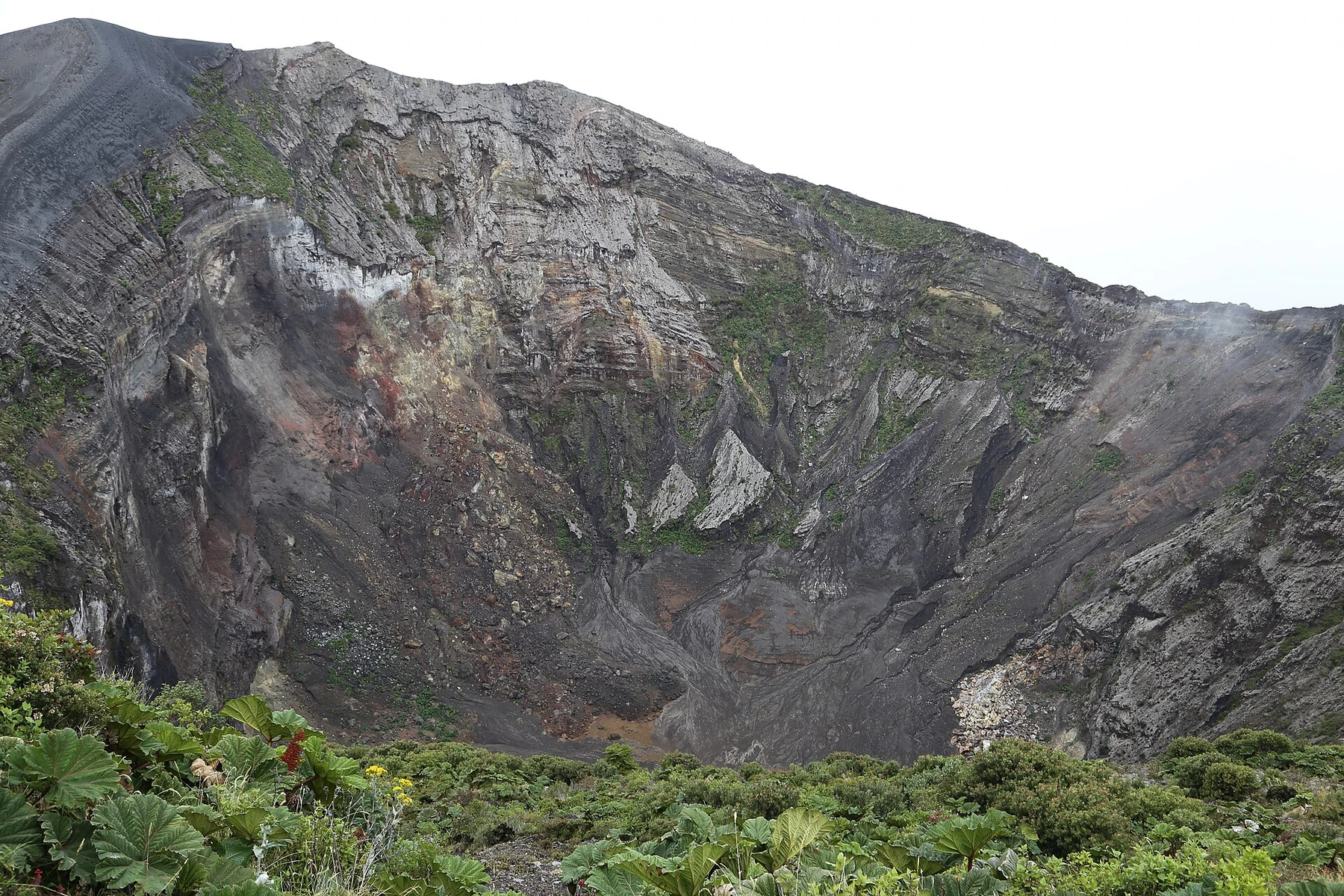
At 3,432 metres, Irazú is Costa Rica's highest volcano and feels starkly different from the green valleys below. The Cráteres sector places visitors in a broad, wind-exposed landscape with the main crater, Playa Hermosa ash plain and high viewpoints reached with relatively little walking.
Altitude, cold wind and strong sun can still be tiring. Reserve the Cráteres sector specifically, start early and carry a warm layer. The separate Prusia sector offers forest trails but uses a different access point and plan; combining both requires enough driving time and should not be assumed from one ticket.
3. Walk Arenal's old lava landscape
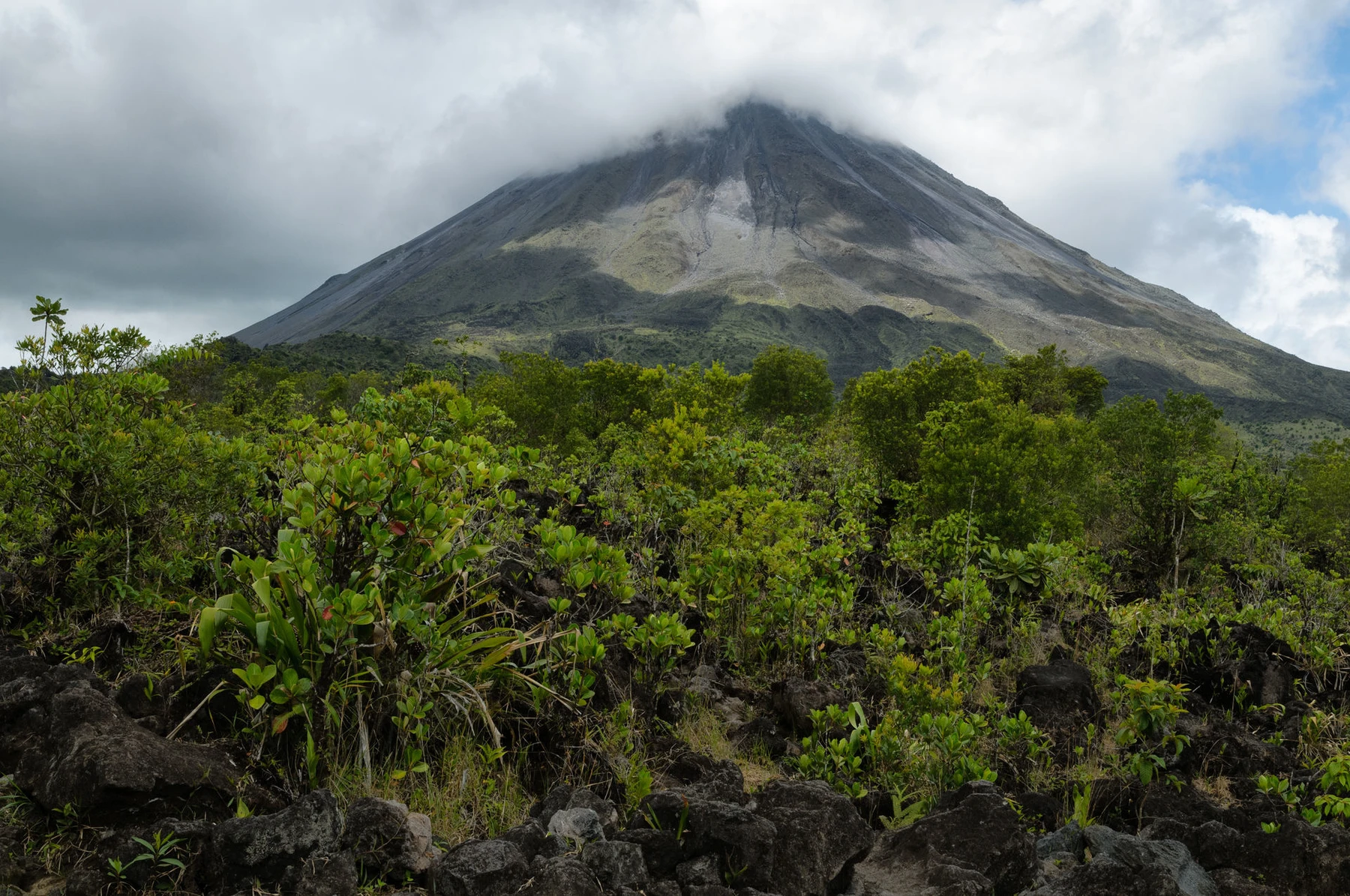
Arenal's symmetrical cone dominates the northern lowlands, but the summit is not an authorized visitor objective. The meaningful experience is walking through regenerating forest and across old lava remnants while the volcano appears and disappears behind cloud. National-park paths and neighboring managed reserves offer circuits commonly lasting two to four hours.
La Fortuna is the practical base, though trail entrances sit on roads west of town. Confirm the exact entrance before leaving and do not follow unofficial summit routes. A naturalist guide can connect eruption history with forest recovery, turning a cloudy day into more than a search for the cone.
4. Walk through Rincón de la Vieja's geothermal field
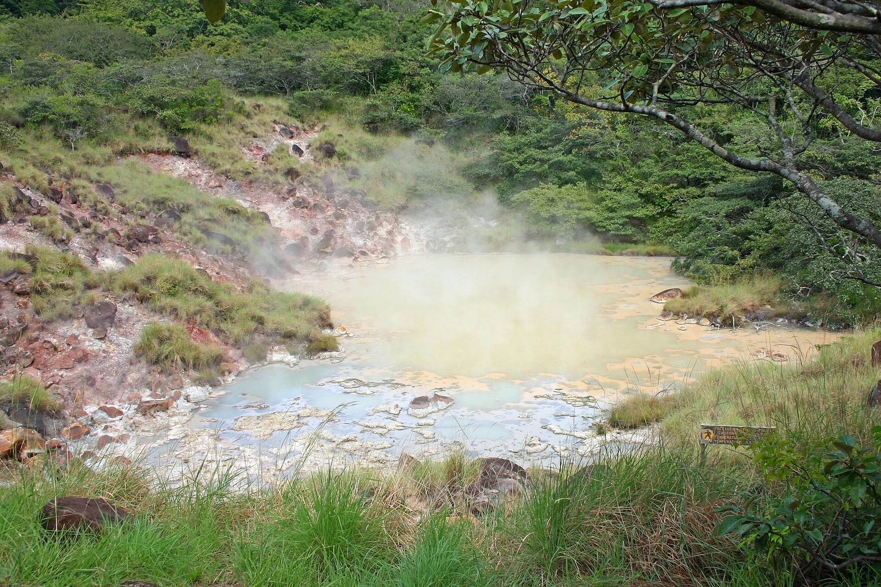
The three-kilometre Las Pailas loop passes fumaroles, boiling water, hot mud and thin volcanic ground within a transition from dry to wetter forest. SINAC estimates about two hours, and the path provides the country's strongest walk-through geothermal experience without demanding summit fitness.
Reserve entry, carry water and remain behind every barrier; official information notes temperatures at geothermal features high enough to cause severe burns. The active-crater trail is closed because of volcanic activity. Longer waterfall routes are separate four-to-five-hour hikes and currently do not permit swimming.
5. Experience Tenorio through Río Celeste
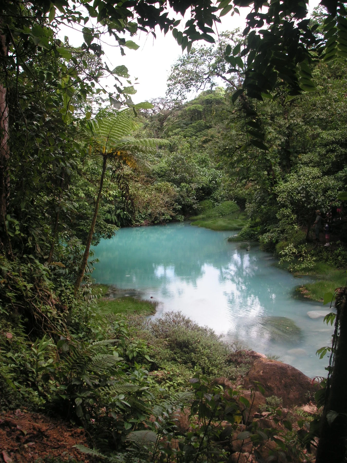
Tenorio is best understood through the chemistry and hydrology of Río Celeste. A humid-forest trail descends to the blue waterfall and continues toward geothermal features and the confluence where mineral-rich streams produce the river's color. Completing the principal sights normally takes three to five hours.
Reserve Tenorio National Park through SINAC and base in Bijagua for an early start. Swimming is prohibited in the protected river inside the park. Heavy rain may reduce the visible blue effect and make steps muddy, but visitors should remain on trail rather than seeking unofficial river access.
6. Hike to Barva's crater lagoon
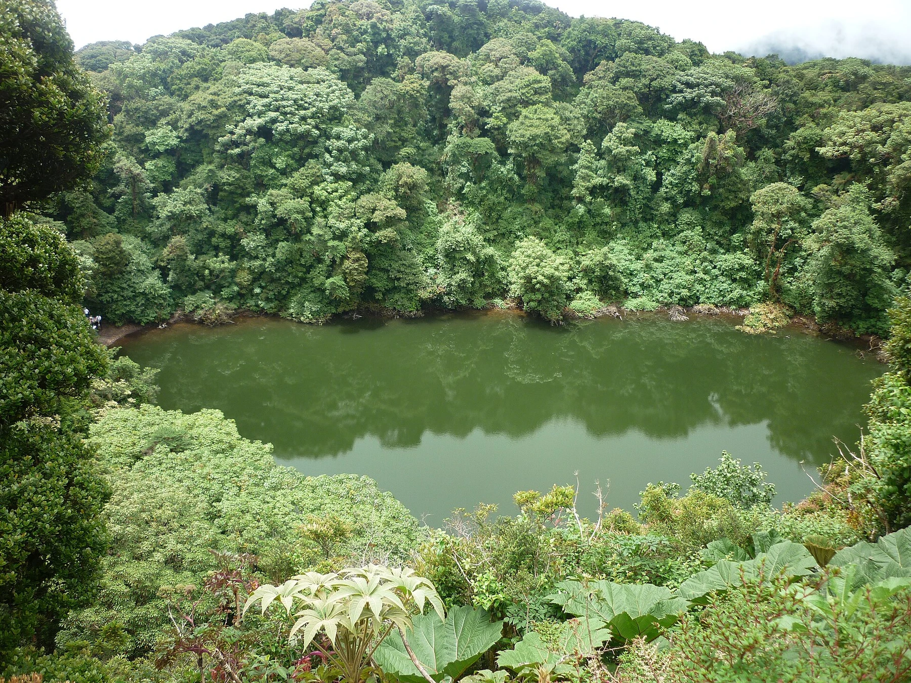
Barva replaces exposed ash with deep cloud forest. Trails in Braulio Carrillo National Park's Barva sector climb through wet highland habitat toward Laguna Barva, a crater lagoon enclosed by dense vegetation. The longer route is a real half- or full-day hike rather than a drive-up volcano visit.
Reserve the correct sector and confirm the final road condition; a high-clearance vehicle may be advisable depending on recent weather. Bring rain protection, food and water, and expect mud even in a nominally drier period. The forest, not a panoramic crater rim, is the defining experience.
7. Visit Turrialba under current controls
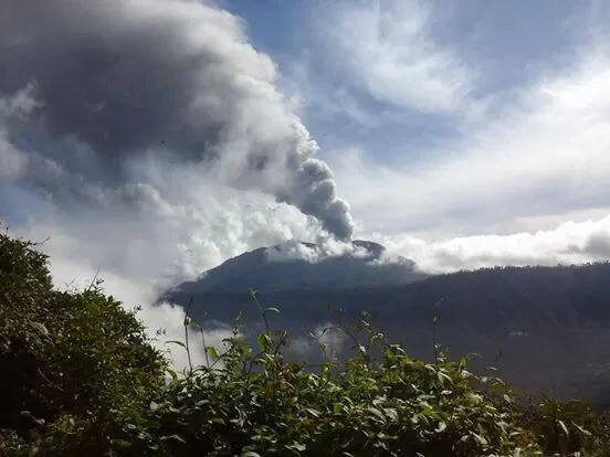
Turrialba's recent eruptions have repeatedly reshaped visitor access. When authorized tours operate, the high, open terrain provides a close look at an active volcanic system and broad views over the central highlands. Access may use locally managed transport or guiding rather than the main SINAC booking flow.
Verify the current arrangement immediately before travel and never plan around an unofficial road or trail. Bring warm, wind-resistant clothing and follow helmet, mask or shelter instructions when provided. Keep Guayabo National Monument or a coffee-country visit as a meaningful alternative if activity or weather closes the volcano.
8. Explore the Miravalles geothermal landscape
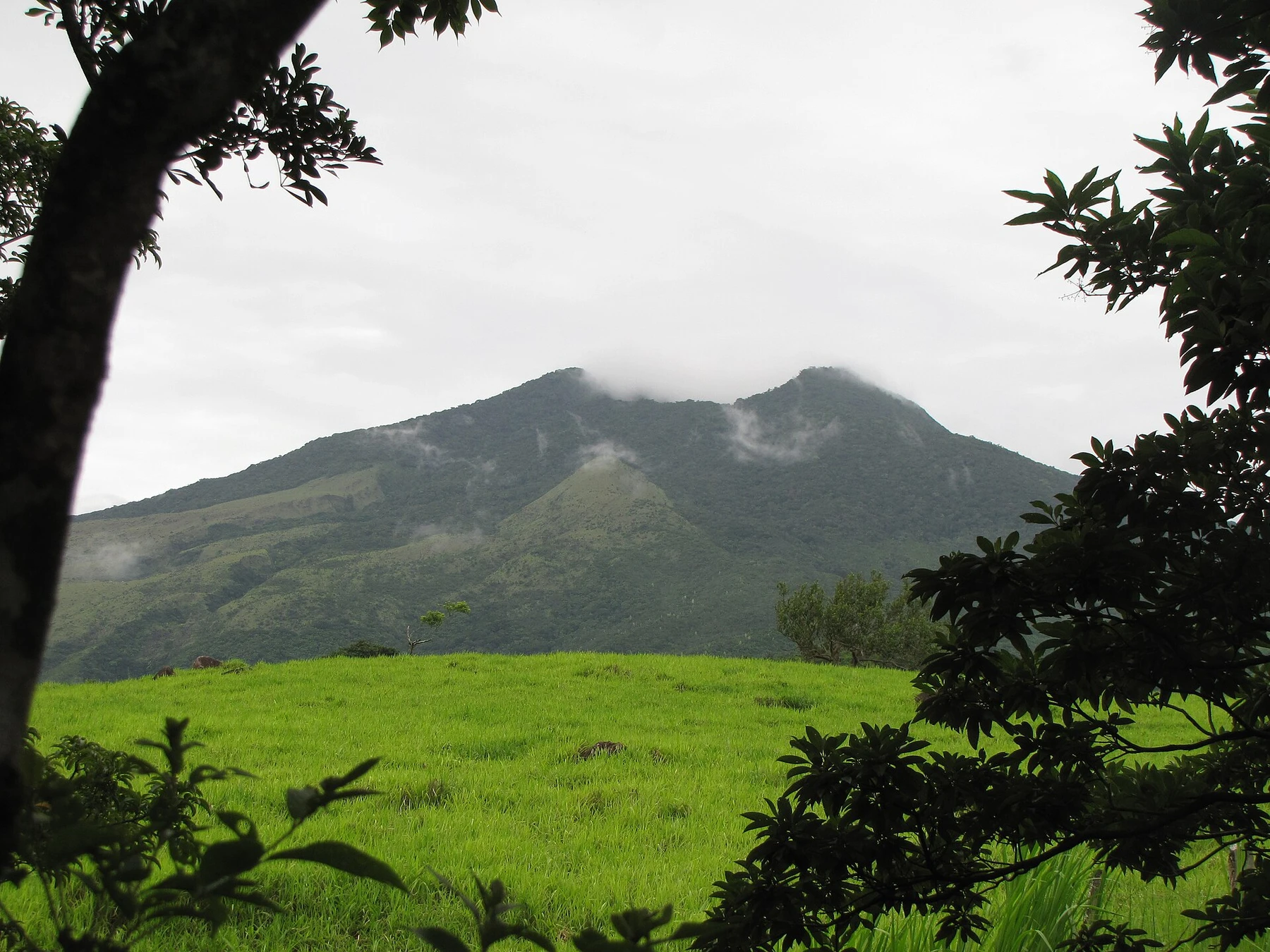
Miravalles is best experienced through the wider geothermal landscape around its slopes rather than a conventional crater trail. Managed properties offer hot springs, steaming ground, mineral mud and views toward the massif, often combined with short forest or waterfall walks.
Compare facilities by setting and activity rather than assuming every “volcano tour” visits the same place. Stay on marked ground: thin crust and near-boiling water make wandering dangerous. Bagaces is the nearest service town, while Liberia works for a longer day trip. Confirm whether transport, towels and trail access are included.
9. See Orosí from the Guanacaste conservation landscape
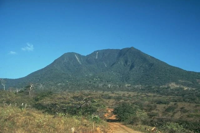
Orosí rises near the Nicaraguan border within the broader Área de Conservación Guanacaste. Its forested cone is compelling precisely because it is not a developed, straightforward summit attraction. Legal roads, research and protected-area restrictions make distant observation more appropriate than pursuing an online track.
For most travelers, pair views of the massif with an authorized visit to Santa Rosa or another open conservation-area sector. Confirm current road and sector access directly with the protected-area authority. Choose Orosí for a sense of remote volcanic geography, not for a promised crater or summit photograph.
Which Costa Rica volcano should you choose?
Pick Poás for the most accessible active-crater view, Irazú for altitude and stark terrain, Arenal for lava walks near a full-service base, and Rincón de la Vieja for geothermal features encountered on foot. Strong hikers seeking cloud forest should consider Barva, while Tenorio suits travelers more interested in volcanic water chemistry than a summit.
Continue planning with the best hikes in Costa Rica, pair Tenorio and Rincón de la Vieja with the best waterfalls in Costa Rica, or compare broader adventure activities.
Volcano safety and access
- Reserve the exact park and sector through the current official system.
- Check volcanic activity, gas, weather and trail status on the day of travel.
- Never enter a closed crater trail, unofficial summit route or geothermal area.
- Carry water, sun protection, rain gear and a warm layer for high viewpoints.
- Treat cloud, gas and authority instructions as reasons to change plans, not barriers to bypass.