

Portugal's active volcanic identity lies in its Atlantic islands. The Azores preserve calderas, fumaroles, lava tubes and a mountain cone rising directly from the ocean, while Madeira's eroded ridges reveal the interior of an older volcanic island. These are landscapes to walk through, not just viewpoints to collect.
Geothermal and cave access is controlled for good reason. Stay on marked routes, check gas or trail restrictions and never test an unregulated warm pool.
Portugal's volcanic landscapes at a glance
| Landscape | Island | Best experience | Main caution |
|---|---|---|---|
| Mount Pico | Pico | Summit climb | Cloud and exposure |
| Algar do Carvão | Terceira | Volcanic chimney walk | Opening schedule |
| Sete Cidades | São Miguel | Crater-rim hike | Fog and wind |
| Furnas | São Miguel | Fumaroles and food | Hot ground |
| Capelinhos | Faial | Young eruption terrain | Wind and erosion |
| Ponta de São Lourenço | Madeira | Volcanic coastal hike | Heat and cliffs |
The 10 best volcanic landscapes in Portugal
1. Climb Mount Pico
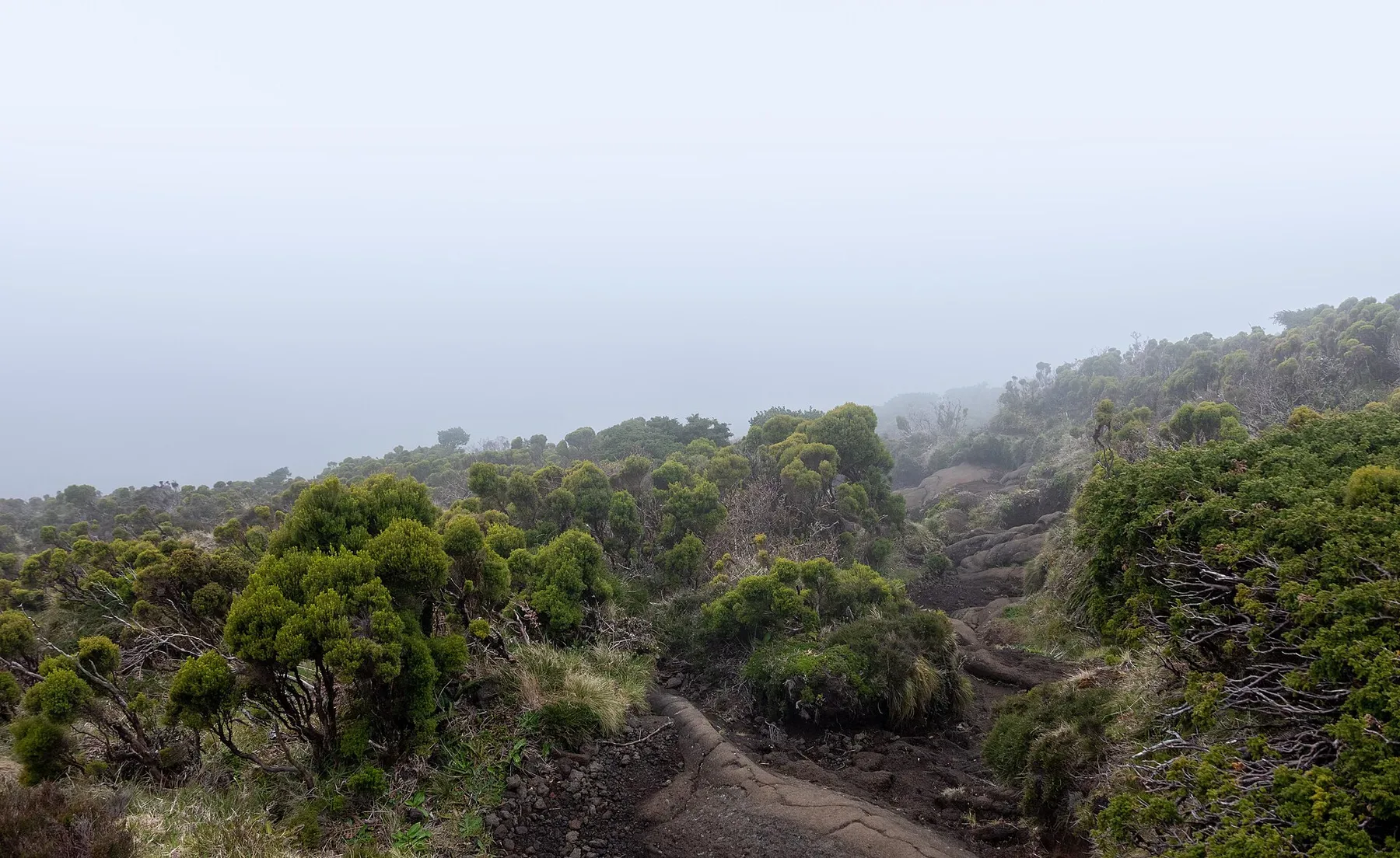
Portugal's highest mountain is a near-perfect volcanic cone above Pico Island. The registered route climbs rough lava to the crater rim, with authorized parties sometimes continuing to Piquinho.
Book through the current mountain system, carry layers and turn around in cloud or strong wind. A guide adds value when volcanic terrain makes the line difficult to read.
2. Descend into Algar do Carvão
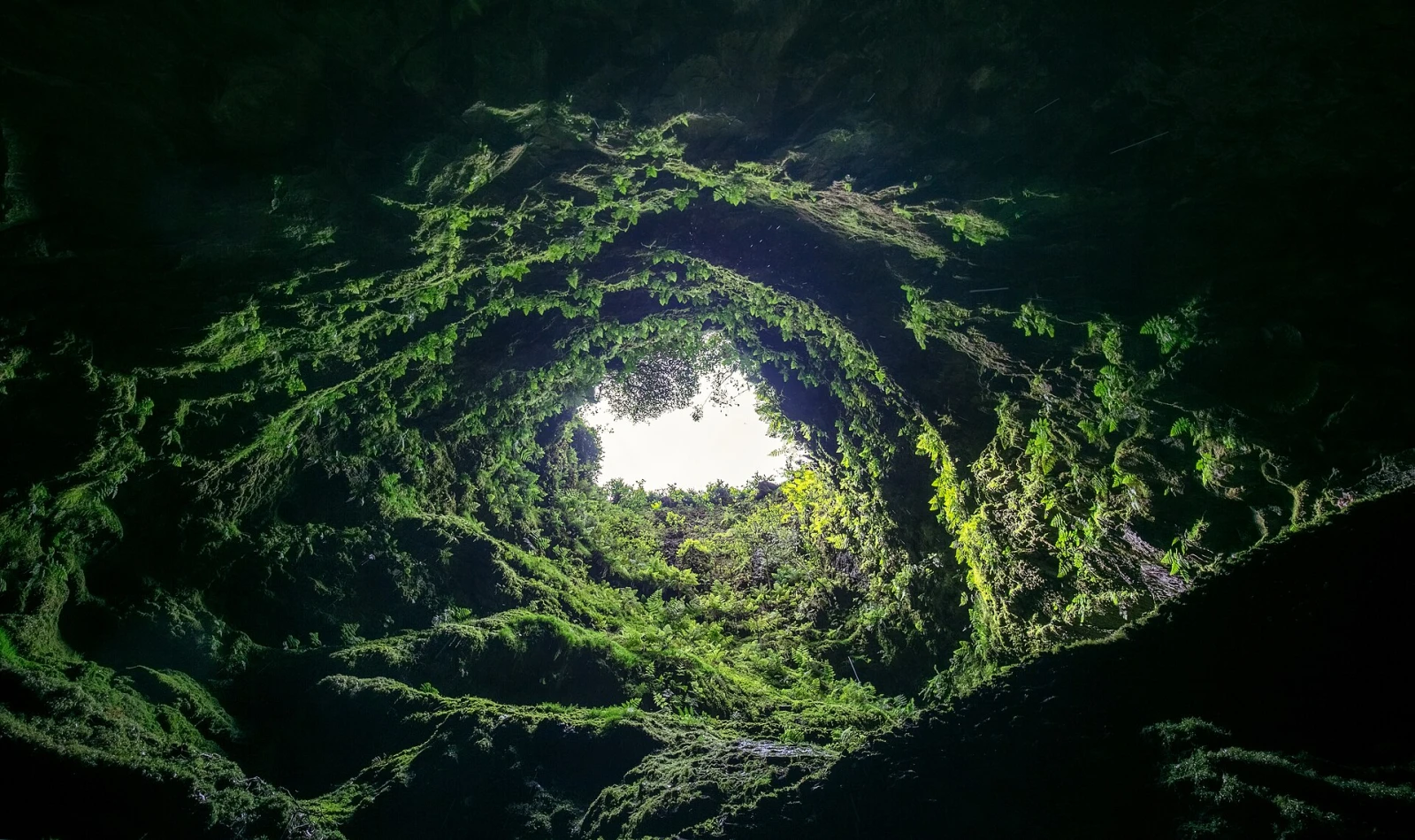
Algar do Carvão allows visitors to walk down inside a volcanic chimney on Terceira. Fern-covered walls give way to a tall chamber and seasonal water, creating an unusual vertical section through the island.
Check seasonal opening, wear grippy shoes and remain on the stairs. The cave's apparent accessibility does not permit touching walls or entering closed sections.
3. Explore Gruta das Torres
On Pico, a guided visit enters a long lava-tube system formed by flowing basalt. The minimally lit route preserves a much stronger sense of underground geology than a conventional show cave.
Reserve through the visitor centre, use the helmet and light provided and meet mobility requirements. Never remove lava fragments or step beyond the guide's route.
4. Hike the Sete Cidades rim
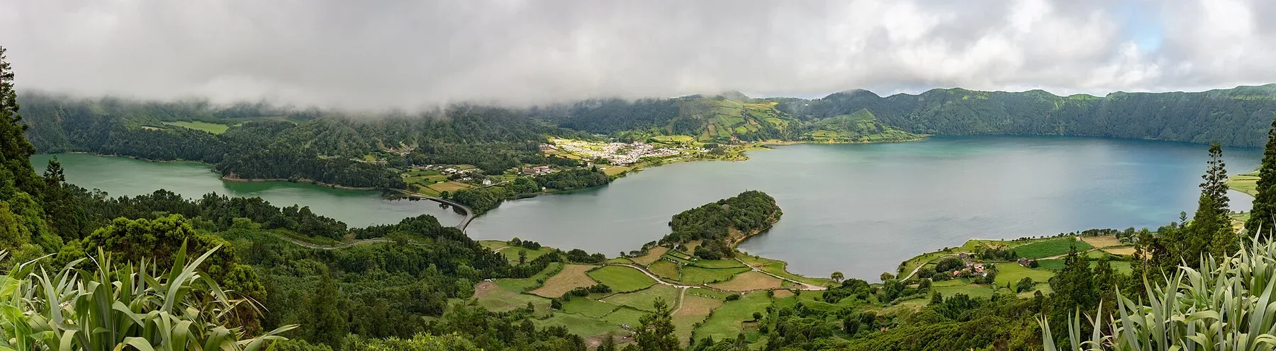
São Miguel's Sete Cidades caldera holds lakes, pasture and a village within its broad walls. Rim trails reveal the crater's scale and its direct relationship with the Atlantic.
Use a marked route and arrange one-way transport. Fog and wind can remove visibility quickly. Close gates and keep off working pasture.
5. Walk the Lagoa do Fogo landscape
Lagoa do Fogo occupies a high central caldera on São Miguel surrounded by protected slopes. Access and shuttles may be regulated during busy periods, while some trails reach the lake through longer approaches.
Check current transport and trail rules, remain on designated paths and carry weather protection. Swimming and shoreline access must follow reserve restrictions.
6. Watch Furnas at work
Furnas combines fumaroles, mineral springs and lake-edge geothermal cooking within an inhabited caldera. Seeing cozido pots lifted from hot ground connects volcanic heat with local food culture.
Stay behind barriers because crust can be thin and steam scalding. Join a legitimate cooking or tasting experience rather than approaching work areas uninvited.
7. Soak at Caldeira Velha
Warm, iron-rich water flows through forest at Caldeira Velha on São Miguel. Timed entry controls pressure on the pools and protected setting.
Reserve under current rules, shower before entry and follow temperature or health guidance. The surrounding geothermal area is not an invitation to leave the managed boardwalk.
8. Swim at Ponta da Ferraria
At Ferraria, geothermal water mixes with the Atlantic in a rocky natural pool during suitable tide and swell. The experience depends on the ocean being calm enough to enter safely.
Check timing and warnings, use the ropes only when open and wear water shoes. Never enter during heavy surf; a managed thermal pool is the alternative.
9. Walk the Capelinhos eruption landscape
The 1957–58 eruption extended Faial with dark ash and lava around the old lighthouse. Trails and interpretation reveal how rapidly a new coast forms and then erodes.
Stay on official paths, protect yourself from windblown ash and avoid unstable edges. The interpretation centre provides essential human context about evacuation and emigration.
10. Hike Ponta de São Lourenço
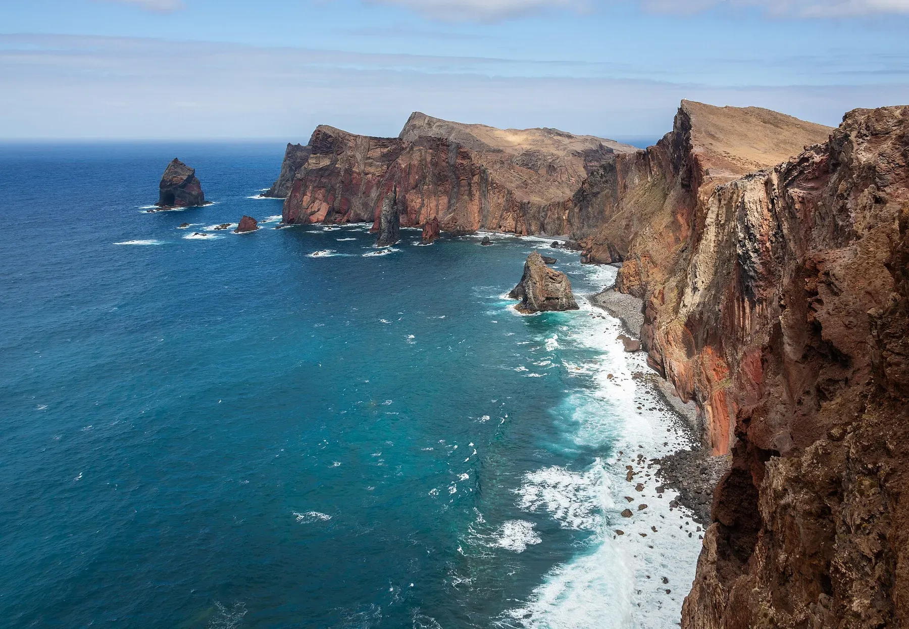
Madeira's eastern peninsula exposes bands of volcanic rock sculpted by wind and sea. The marked trail crosses dry ridges above coves and ends near the Casa do Sardinha area.
Carry water, start early and remain back from cliffs. Strong wind or closures may shorten the route. The barren geology is fragile despite the lack of forest.
Choosing an island
Choose São Miguel for the broadest mix of calderas and geothermal water, Pico and Faial for a summit and young eruption history, Terceira for volcanic caves and Madeira for deeply eroded ridges. Allow weather days rather than moving islands after every night.
Continue with Portugal's adventure activities, best hikes and surf beaches.
Before exploring
- Check official mountain, cave and trail status.
- Stay on boardwalks around fumaroles and thin geothermal crust.
- Enter caves only with authorized guides and equipment.
- Follow tide and swell warnings at ocean hot springs.
- Leave flexible time for island flights, ferries and cloud.