
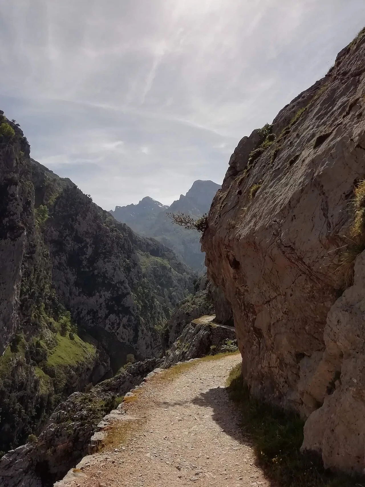
Spain’s hiking choices include long gorge paths, Pyrenean valleys and island trails with very different weather. A clear forecast on the coast tells you little about conditions on Peñalara. Choose a route for its terrain and access arrangements, then decide how it fits into your trip.
Plan each outing separately. The table compares physical effort; technical difficulty and exposure can differ. Each mission on the map has its location and preparation details.
Compare the experiences
| Experience | Physical effort |
|---|---|
| Hike Ordesa Valley to Cola de Caballo | High |
| Hike the Cares Gorge from Poncebos to Caín | Moderate |
| Climb Peñalara from Puerto de Cotos | High |
| Hike to Estany de Sant Maurici | Moderate |
| Hike the Camí de Cavalls from Es Grau to Favàritx | Moderate |
| Climb Alto de Garajonay from Contadero | Low |
Choose your route
Ordesa and Sant Maurici suit a Pyrenean trip, though the walking distances differ. Cares is a gorge crossing with sustained exposure. Peñalara is a mountain objective near Madrid, while the Camí de Cavalls and Garajonay give you two very different island outings.
Hike Ordesa Valley to Cola de Caballo
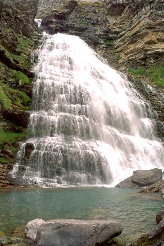
Walk from Pradera de Ordesa through the valley forest, pass the stepped Gradas de Soaso and continue into the glacial Circo de Soaso to Cola de Caballo.
The walk ends at Cola de Caballo beneath the Monte Perdido massif, after crossing Ordesa’s forest, the Gradas de Soaso and the glacial cirque.
The trail is free and needs no permit, guide or specialist equipment. During high-use periods, private vehicles cannot continue to Pradera de Ordesa and you must use the shuttle bus from Torla; outside those periods, vehicle access is allowed until the Pradera car park reaches capacity. Check the current park and OrdesaBus access notices before travelling.
View in GoExploringFor more on this route, read Cola de Caballo hike: Ordesa valley route and Torla bus.
Hike the Cares Gorge from Poncebos to Caín
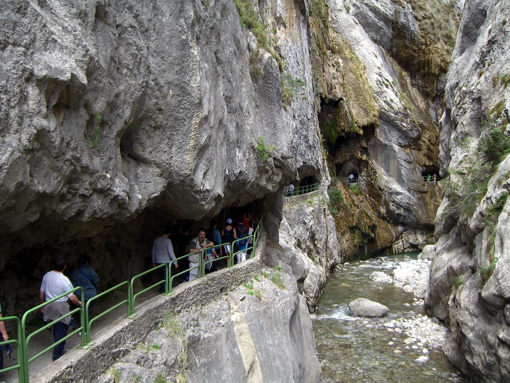
Walk about 11 kilometres from Poncebos to Caín on a path cut into the limestone gorge, passing tunnels, bridges and long exposed ledges above the Cares. No climbing technique is needed, but loose rock, sustained drop-offs and the possibility of rockfall mean you need to stay focused for much of the route.
The path was built to service a hydroelectric canal and still follows that infrastructure through the gorge. Its tunnels, bridges and ledges let you see the industrial route and the limestone canyon at the same time.
Check the Asturias Tourism route notice before planning a crossing. As of 17 October 2026, bridge works prevent the full Poncebos–Caín walk; the notice describes partial out-and-back walks from either end. Once the crossing reopens, a one-way walk needs confirmed return transport.
View in GoExploringFor more on this route, read Cares Gorge hike: one way, return transport and trail closures.
Climb Peñalara from Puerto de Cotos
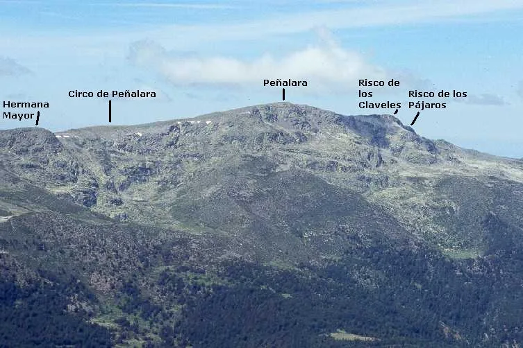
Climb from Puerto de Cotos past Dos Hermanas and continue along the ridge to Pico Peñalara.
Peñalara is the highest point in the Sierra de Guadarrama at 2,428 metres. The ascent also crosses protected glacial terrain that preserves some of the range’s clearest high-mountain landforms.
Individual visitors normally need no ticket, booking, permit or guide in snow-free conditions. Visitor and parking capacity limits apply at Peñalara and Puerto de Cotos, so check the park’s current access status before travelling. In winter, do not attempt the route without the experience and equipment suited to the conditions.
View in GoExploringHike to Estany de Sant Maurici
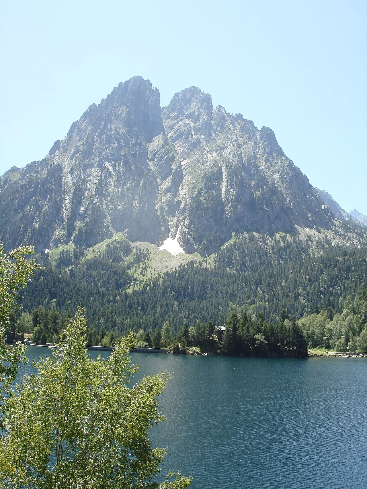
Follow the Ruta de l’Isard from Prat de Pierró through high-mountain forest to Estany de Sant Maurici. The walk is about 9 kilometres with roughly 260 metres of ascent, enough to feel like a proper half-day mountain outing without technical terrain.
The walking approach passes through forest before opening onto the glacial lake in Aigüestortes i Estany de Sant Maurici National Park. Park taxis provide a more direct approach.
Walking access is free and needs no booking, permit, guide or specialist equipment. Private vehicles are restricted inside the park, so use the Prat de Pierró access arrangements or walk from Espot when parking is unavailable. Winter road access can close.
View in GoExploringFor more on this route, read Sant Maurici lake: walk from Prat de Pierró or take a taxi?.
Hike the Camí de Cavalls from Es Grau to Favàritx
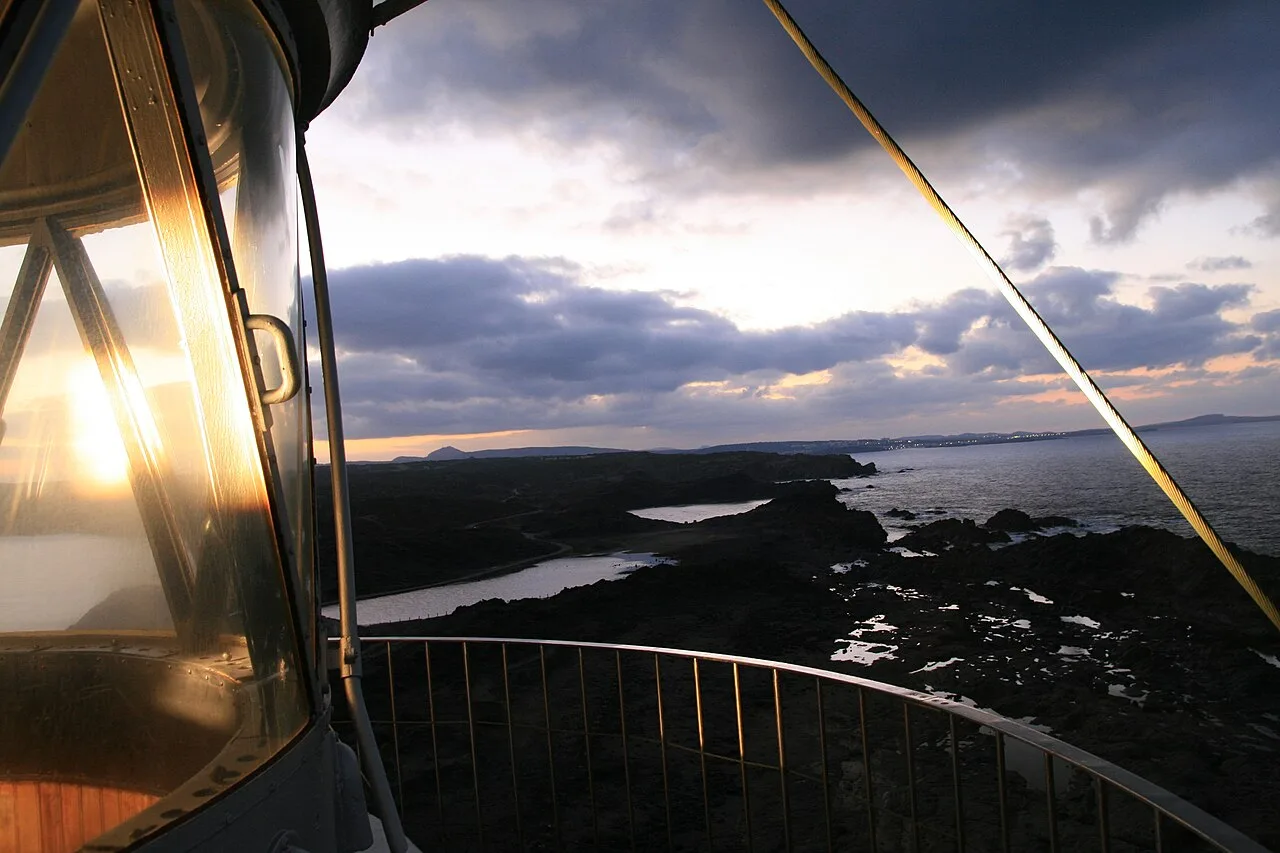
Follow the Camí de Cavalls for about 8.6 kilometres from Es Grau through the protected landscapes of s’Albufera des Grau Natural Park to Cap de Favàritx.
This section combines Menorca’s historic perimeter path with some of the core landscapes of the island’s biosphere reserve. The route finishes on the stark rocky cape around Favàritx, giving a short stage an unusually varied setting.
The walking route is free and needs no booking, permit, guide or specialist equipment. Arrange return transport or leave enough time to walk back. Check current seasonal access measures near Favàritx before travelling.
View in GoExploringFor more on this route, read Es Grau to Favàritx walk: Camí de Cavalls route and return.
Climb Alto de Garajonay from Contadero
Follow official Route 7 from Contadero through high-elevation vegetation to Alto de Garajonay, then return on the marked loop. The route is only about 2.5 kilometres with roughly 110 metres of climbing, but cloud, wind and wet ground can change conditions quickly near the summit.
At 1,478 metres, Alto de Garajonay is the highest point on La Gomera. The summit also contains archaeological and cultural features protected within Garajonay National Park.
The marked route is free and needs no booking, permit, guide or specialist equipment. Check current park notices and weather before departure, and stay on the trail to protect vegetation and archaeological features.
View in GoExploringBefore you set out
Check the chosen park’s notices before setting out. Snow or wet rock can change the difficulty of a familiar route. Save the map offline and arrange your return from Caín or Favàritx if you are walking one way. Confirm accommodation in advance for any longer trek.
Explore more adventure activities in Spain.
For a different active day, compare water sports in Spain.
Our Caminito del Rey planning guide covers ticket choices, approach time and the return connection.