

Colombia's most memorable hikes cross radically different worlds: glaciated Andean massifs, high páramo, humid cloud forest, Caribbean dry forest and Indigenous cultural landscapes. Distance tells only part of the story. Altitude, heat, mud, river crossings and access rules can turn a short route into a serious undertaking.
The ten hikes below favor distinctive journeys with established visitor access. Conditions change, so confirm the route with the park, community or authorized operator before travelling.
Colombia hikes at a glance
| Hike | Landscape | Difficulty | Typical commitment |
|---|---|---|---|
| Ciudad Perdida | Tropical forest and archaeology | Hard | 4–5 days |
| El Cocuy high-mountain routes | Páramo and glaciated peaks | Hard | Full day |
| Valle de Cocora | Cloud forest and wax palms | Moderate | 4–6 hours |
| Chingaza's Lagunas de Siecha | High-altitude páramo | Hard | Full day |
| Tayrona to Cabo San Juan | Caribbean forest and coast | Moderate | Full day |
| Puracé volcano | Volcanic páramo | Hard | Full day |
The 10 best hikes in Colombia
1. Trek to Ciudad Perdida
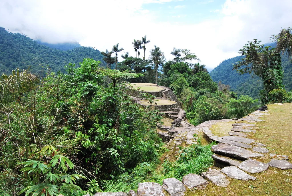
The journey to the Teyuna archaeological terraces in the Sierra Nevada de Santa Marta is Colombia's defining multi-day trek. The route follows forest paths, climbs steep stone steps and repeatedly crosses the Buritaca River before reaching a place of continuing importance to the region's Indigenous peoples.
Access is through authorized operators working with local communities, normally over four or five days. Expect humidity, rain, simple camps and sustained climbing. Follow community instructions at cultural sites and do not confuse the trek corridor with permission to enter closed high-mountain sectors of the national park.
The longer five-day version suits walkers who want more recovery time and a less hurried visit at Teyuna. Camps provide meals and basic beds or hammocks, but dry clothing and foot care remain your responsibility. Santa Marta is the usual departure base, with transfers to the rural trailhead included by established operators.
2. Hike El Cocuy's authorized high-mountain trails
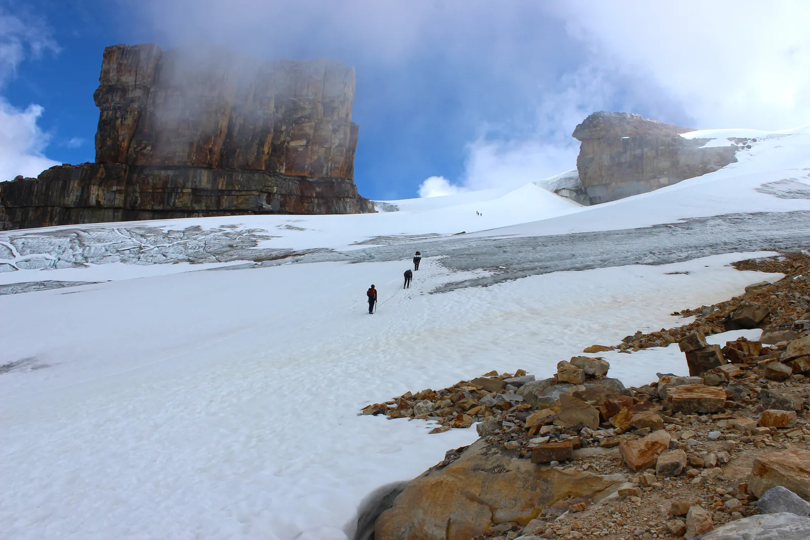
El Cocuy's immense rock walls, lagoons and remaining glaciers create Colombia's most dramatic alpine walking. Official visitor routes have included Laguna Grande de la Sierra, Ritacuba and the Pulpito del Diablo sector, although the exact trails and limits can change.
This is a high-altitude day, commonly reaching well above 4,000 metres. Use an authorized local guide, acclimatize first and verify the current entry, insurance and registration rules. Glacier contact and summit climbing are not part of normal park access.
Spend at least two nights in El Cocuy or Güicán before the hike and choose the route with your guide. Laguna Grande de la Sierra provides a broad glacial amphitheatre; Ritacuba emphasizes the massif's vertical scale. Whichever route opens, the return is long enough to demand food, water and an early start.
3. Walk the Valle de Cocora loop
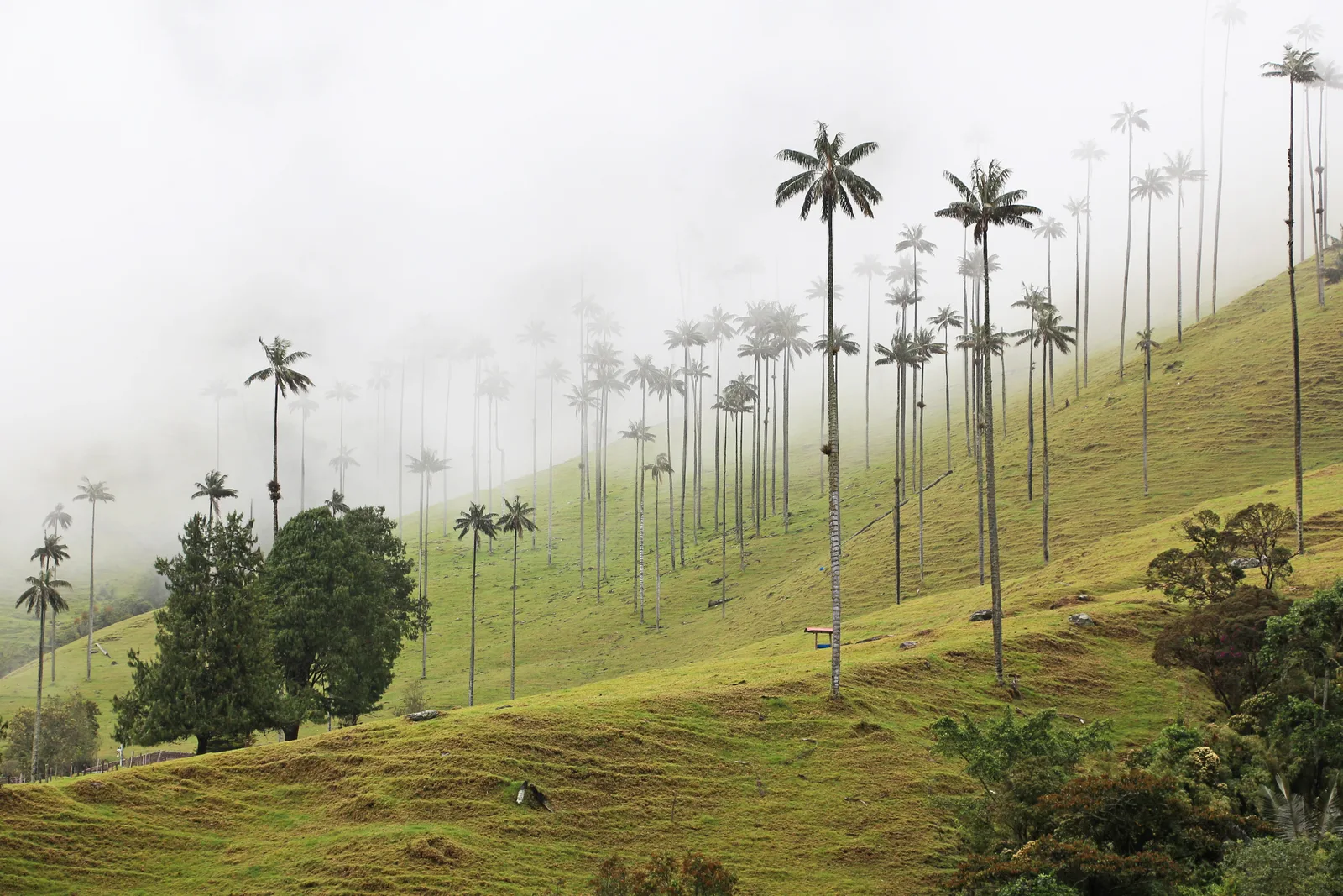
The Cocora Valley near Salento is famous for Colombia's towering wax palms, but the longer loop adds cloud forest, suspension bridges and a steep return across open hills. Mud and repeated climbs make it much more rewarding than a quick photo stop.
Routes cross separately managed land and signs can be confusing. Confirm the day's circuit and fees locally, start early and avoid attempting flooded crossings after heavy rain. A shorter out-and-back among the palms is a sensible wet-weather alternative.
For the full loop, many walkers climb through the cloud forest and return across the open palm valley, but the best direction depends on mud and bridge conditions. Salento is the convenient base, with early shared transport to Cocora. Pack food rather than relying on every trail concession being open.
4. Hike to the Lagunas de Siecha in Chingaza
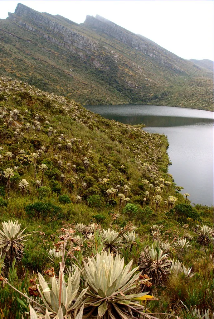
The Siecha route climbs through frailejón-covered páramo to a group of high lagoons with deep cultural significance. Weather moves quickly across the exposed ridges, and the thin air makes the roughly 13-kilometre outing feel harder than a lowland hike of the same length.
Arrange entry in advance and confirm capacity with the park's authorized ecotourism contact before paying. Bring waterproof layers, sun protection and footwear for wet ground. A local guide is strongly recommended and may be required under current arrangements.
Bogotá is geographically close, yet the rough approach and controlled entry make this a full-day excursion. The landscape opens gradually from farmland into wet páramo, rewarding a slow pace. If altitude or weather makes Siecha too ambitious, ask about a shorter authorized Chingaza trail.
5. Cross Tayrona to Cabo San Juan
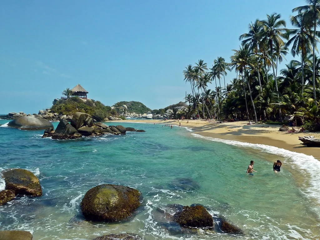
This coastal hike links the Cañaveral or El Zaino side of Tayrona with beaches such as Arrecifes and Cabo San Juan. Forest, boulders and humid hills make the journey the main event; the sea provides the views but is not safe for swimming everywhere.
Check the park's annual cultural and ecological closure dates before planning. Start early, carry water and swim only where the park explicitly permits it. Horses share parts of the route, so step aside carefully on narrow or eroded sections.
The walk is hot and humid rather than technically difficult. Arrecifes is striking but unsafe for swimming, which makes the gradual arrival at permitted water farther along especially satisfying. Staying near the park entrance the previous night helps you beat both heat and the busiest arrival period.
6. Climb Puracé volcano
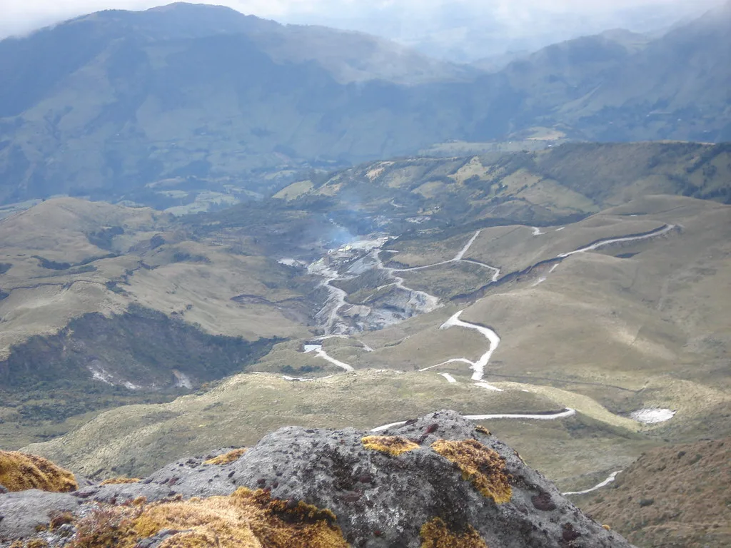
Puracé rises above an open volcanic páramo southeast of Popayán. On an authorized ascent, hikers move through cold, windy high country toward an active volcanic landscape, with the possibility of seeing Andean condors elsewhere in the wider area.
Access depends on volcanic risk and agreements with the Indigenous authorities who govern the territory. Arrange the hike through current local channels, use a guide and accept closure without seeking an informal route. The altitude and exposure demand warm waterproof clothing.
Popayán is the usual travel base, but the ascent begins early enough that nearby rural lodging may reduce the morning transfer. Volcanic ground, sulfurous air and wide views distinguish the day from a conventional summit hike. Ask in advance whether current access reaches the crater or only lower authorized sectors.
7. Trek through Los Nevados
Los Nevados National Natural Park contains a network of demanding routes across páramo, valleys and volcanic terrain. Multi-day journeys between gateways such as Salento, Cocora, El Cedral and the highlands reveal far more than a rushed attempt on a summit.
Volcanic alerts, erosion and conservation measures can close sectors with little notice. Choose an authorized guide who plans a legal route around the current park status. Prepare for cold rain, altitude and long distances between reliable shelter.
A crossing is usually a three- to five-day commitment, with basic fincas or refuges breaking up the route. The landscape shifts from wax-palm valleys to high wetlands and volcanic horizons. Operators should explain daily elevation gain, sleeping altitude and contingency exits—not merely advertise a summit.
8. Follow the Camino Real to Laguna de Iguaque
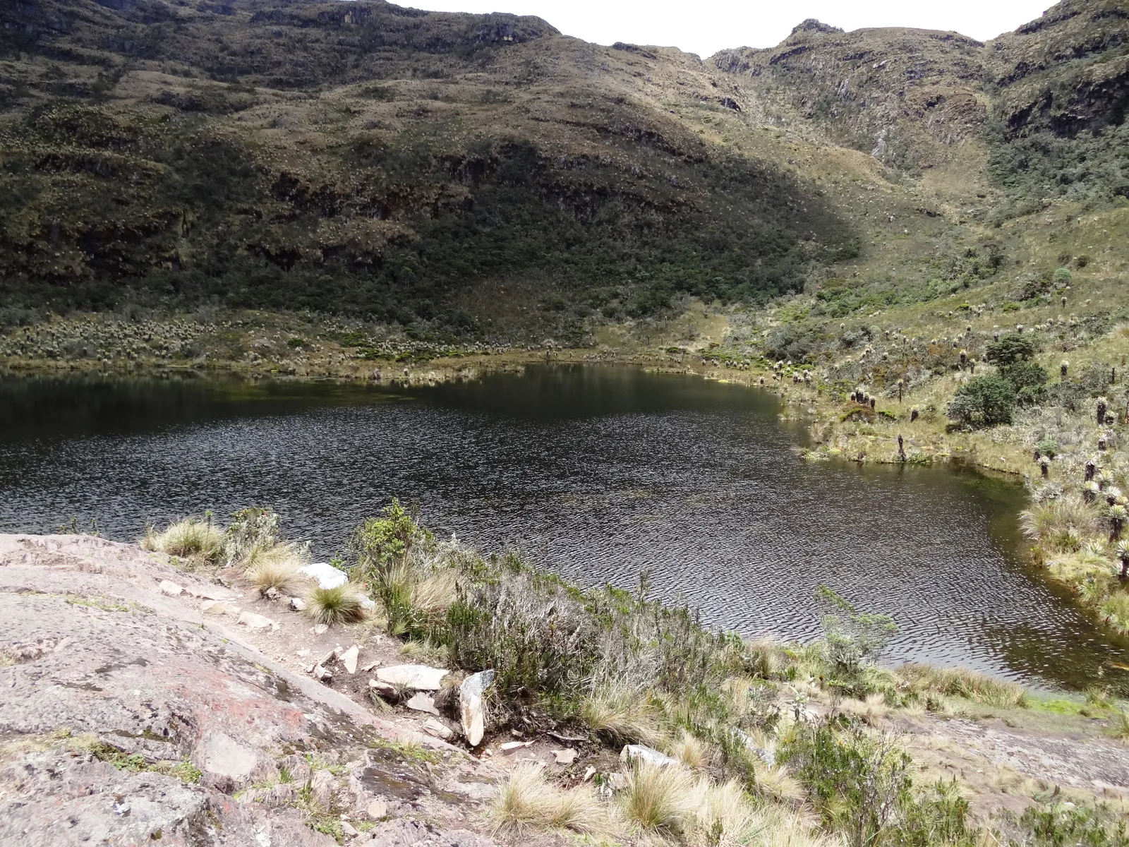
Above Villa de Leyva, the Iguaque trail rises from Andean forest into páramo toward a lagoon sacred in Muisca tradition. The climb is sustained, often muddy and significantly colder than the town below.
The sanctuary has experienced extended closures and controlled reopenings, so verify access directly rather than assuming the trail is available. When open, reserve as required, stay on the stone path and treat the lagoon as a cultural place rather than a swimming destination.
Villa de Leyva makes an easy base, but the cool páramo above feels far removed from its sunny plazas. The sustained ascent is more demanding than many visitors expect, especially after rain. If the sanctuary remains closed, do not accept an unofficial workaround; choose another authorized regional walk.
9. Hike to Cerro Kennedy
Cerro Kennedy offers a long ascent through the coffee-growing foothills of the Sierra Nevada de Santa Marta to a ridge facing the snow peaks. Most hikers begin near Minca and divide the route with an overnight stay, hoping for clear views around dawn.
The route uses rural roads and paths outside the forbidden high sectors, but local guidance remains valuable. Expect a large elevation change, cold at the ridge and limited services. Confirm accommodation and transport instead of relying on an improvised night walk.
Most itineraries climb from the Minca area to a simple mountain hostel, then wake before dawn for the clearest chance of seeing the distant snow peaks. Coffee farms and changing vegetation add interest to the ascent. A 4×4 transfer can shorten the road section for walkers with limited time.
10. Walk the Fin del Mundo trail
Near Mocoa, this humid forest hike crosses streams and smaller cascades before reaching the top and base areas of a tall waterfall. It is a warm, wet counterpoint to Colombia's high-altitude routes.
Enter through the locally managed access system and use the required guide arrangements. Rocks become extremely slick, and heavy rain upstream can suspend entry or make pools unsafe. Respect every barrier at the exposed top of the fall.
The walk is strongest when treated as a sequence rather than a race to the final drop. Smaller waterfalls, river crossings and swimming places divide the humid route into natural stages. Stay in Mocoa and begin early enough to enjoy them without hurrying back before closing time.
When is the best time to hike in Colombia?
There is no single national hiking season. The Andes commonly have relatively drier periods around December to February and June to August, but local patterns vary and rain is possible year-round. Caribbean routes are hotter and often driest early in the year, while Amazonian and Pacific foothill trails remain humid.
For high mountains, current park and volcanic conditions matter more than a generic climate calendar. For rivers and waterfalls, recent rainfall upstream is the decisive safety factor.
What makes hiking in Colombia different?
Many routes cross more than one kind of jurisdiction. A journey may begin on a public road, enter privately managed land and continue through a national park or Indigenous territory. Paying one entrance fee does not necessarily cover the whole route, and a trail visible on a mapping app may not be authorized for visitors.
Altitude changes are equally important. Bogotá already sits high enough for newcomers to feel exertion, while El Cocuy and Los Nevados rise into genuinely hypoxic terrain. Build up gradually, keep the first day easy and remember that fitness does not prevent altitude illness.
Before you go
- Confirm that the park, trail and exact sector are open; a park described as open may still have closed routes.
- Acclimatize before hiking above 3,500 metres and turn back for worsening altitude symptoms.
- Use authorized guides where required and locally based guides where navigation or cultural access is complex.
- Carry both sun and rain protection; equatorial UV remains strong in cool cloud.
- Do not enter glaciers, sacred highlands or closed trails because an unofficial guide offers access.
Continue exploring with Colombia's best national parks, best waterfalls and best adventure activities.