

The best hikes in Albania are not simply viewpoints reached from a car park. They are journeys between mountain villages, old shepherd paths above the Ionian Sea, high summits on international borders and river valleys where the guesthouse at the end matters as much as the trail. That variety is the country's great strength: you can make a serious multi-day trek in the Accursed Mountains, spend a morning above Tirana or walk from a stone village directly into a beach cove.
Infrastructure is improving quickly, but trail markings, transport and rescue coverage remain uneven. Distances that look modest on a map can involve loose limestone, strong sun, snowfields or an unbridged stream. Download an offline route, confirm conditions locally and use a qualified guide whenever navigation, scrambling or a border crossing makes the day more complex than a normal marked walk.
Albania hikes at a glance
| Hike | Best for | Difficulty | Typical time |
|---|---|---|---|
| Theth to Valbona | Classic village-to-village trek | Hard | 6–8 hours |
| Maja e Jezercës | Albania's highest alpine objective | Very hard | 10–12 hours |
| Theth Blue Eye | River and swimming-hole scenery | Moderate | 5–7 hours |
| Mount Korab | Highest summit in Albania | Hard | 7–10 hours |
| Southern Coastal Trail | Villages, cliffs and beaches | Moderate | 5–7 days |
| Gamti Mountain | Lake Bovilla panorama | Moderate | 3–5 hours |
The 10 best hikes in Albania
1. Cross from Theth to Valbona
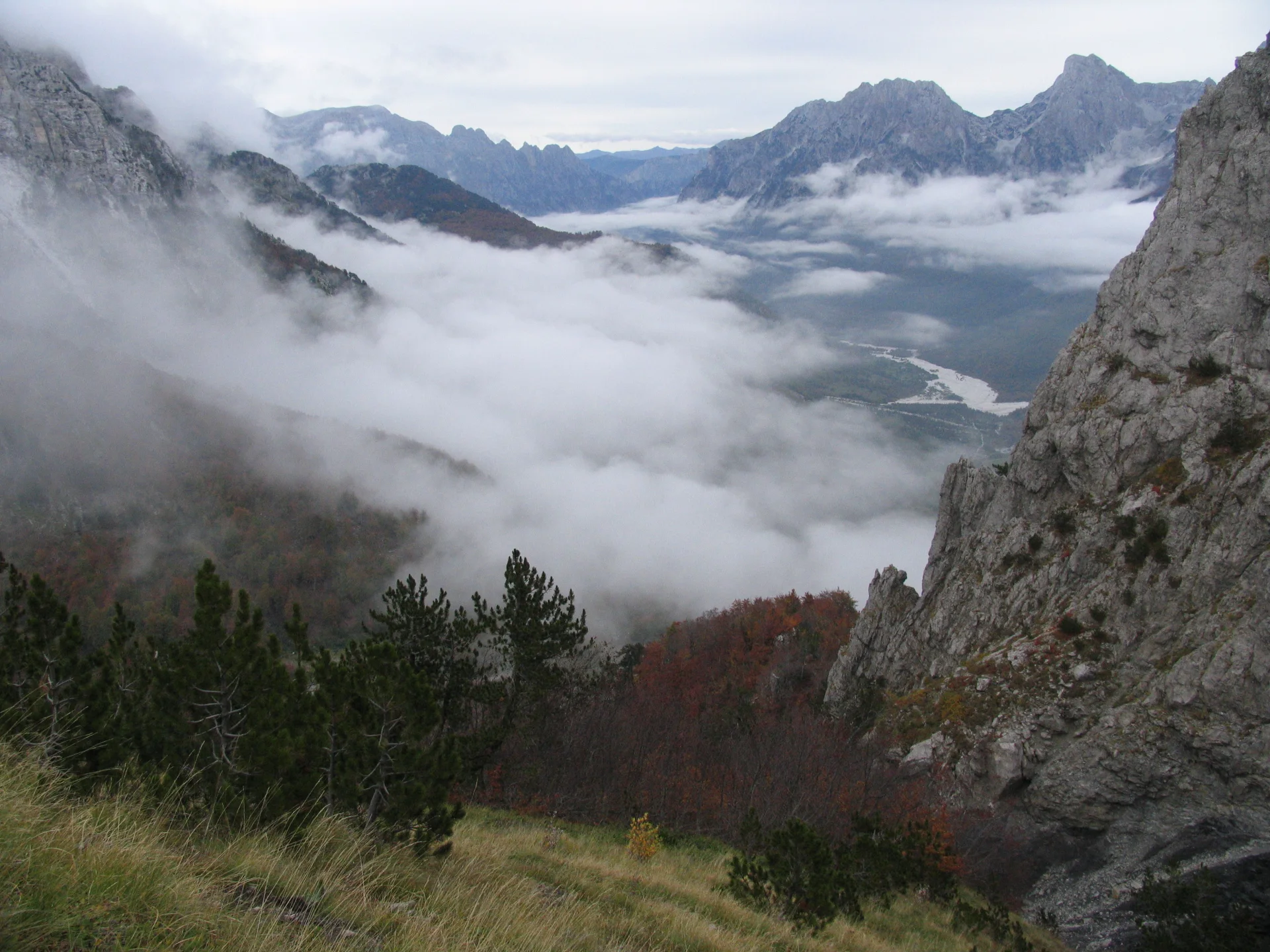
The trail over Valbona Pass is Albania's signature day hike: a full crossing between two inhabited valleys rather than a climb that returns to the same place. Forest gives way to a rocky saddle with a wide view into both valleys, then a long descent leads toward scattered guesthouses in Valbona. Expect roughly 17 kilometres, around 1,000 metres of ascent from Theth and a day of six to eight hours for a prepared walker.
The logistical puzzle is part of the experience. Most walkers travel from Shkodër to one valley, hike with only what they can carry, stay overnight and leave from the other; the Lake Koman ferry is often folded into the Valbona approach. Ask your accommodation to confirm transfers and luggage options. Snow can make the pass unsafe outside the normal summer season, while heat and limited water on the upper section punish a late start.
2. Climb Maja e Jezercës
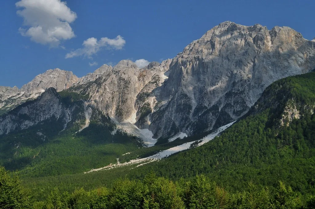
At 2,694 metres, Jezercë is the highest peak wholly inside Albania and a far more serious undertaking than the Valbona crossing. Routes from Valbona or the Gusinje side pass through remote karst terrain, scree and exposed summit ground. A long ascent from Valbona can consume ten to twelve hours; some itineraries use an overnight camp or a staged approach.
This is a guide-worthy mountain even for fit hikers. Markings are inconsistent, water disappears into limestone and old snow may remain in gullies. Arrange a local mountain guide who knows the current route, carry a proper headlamp and turn around if cloud erases the terrain. The reward is not only the summit: the approach reveals the scale and wildness of the central Albanian Alps.
3. Walk from Theth to the Blue Eye
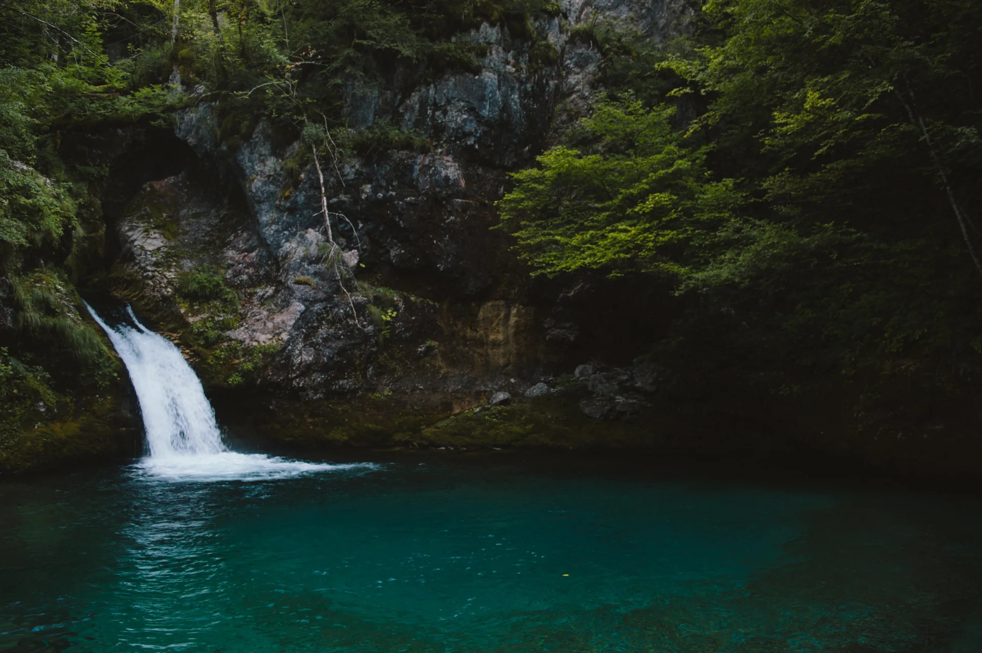
The Blue Eye of Theth, a cold turquoise pool at Nderlysaj, makes a satisfying lower-level adventure when the high pass is unsuitable. From central Theth, the complete return walk is commonly 17–20 kilometres; travelers can shorten it by arranging transport to Nderlysaj and hiking only the final river section.
Do not confuse this mountain pool with the better-known Blue Eye spring near Sarandë. The route follows valley tracks, crosses near the Grunas canyon area and ends with a steeper path above clear water. The pool is fed by mountain water and remains extremely cold even in summer. Treat swimming as optional, never jump from the rocks and allow time for the uphill return rather than lingering until dusk.
4. Hike to Grunas Waterfall and canyon
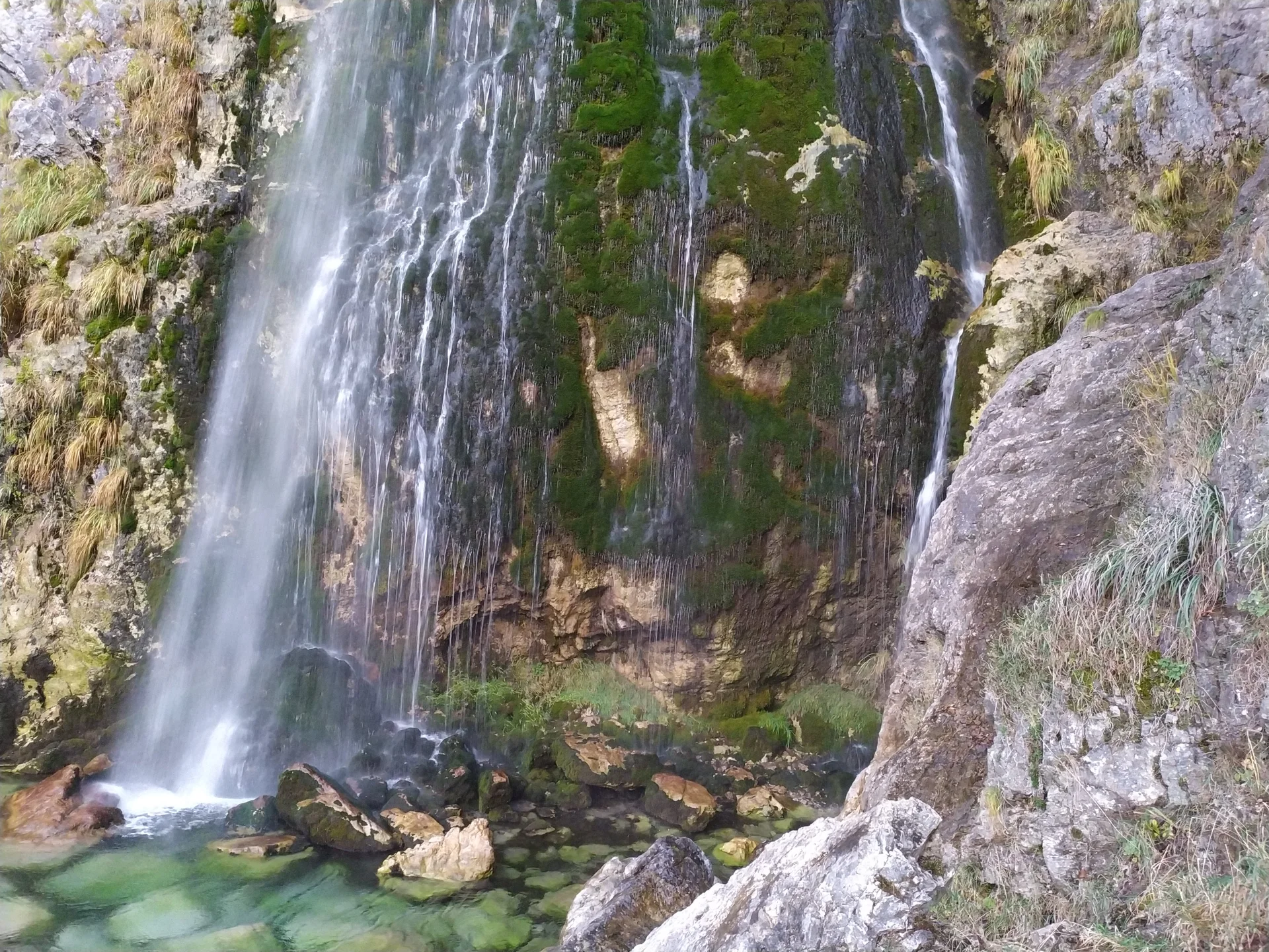
Grunas is the best short hike from Theth village and an excellent first outing after the drive into the valley. A path through farmland and woodland reaches the approximately 25-metre waterfall, while a related route gives views into the narrow Grunas canyon. Taken together, the excursion usually fills two to four hours depending on the starting guesthouse and how much of the canyon path you explore.
The waterfall is strongest with snowmelt and spring water; late-summer flow can be smaller. Trails around the gorge can be slick, and a viewpoint is not an invitation to descend into the canyon. Combine Grunas with the village's stone church and lock-in tower for a slower day that connects landscape with Theth's human history.
5. Summit Mount Korab
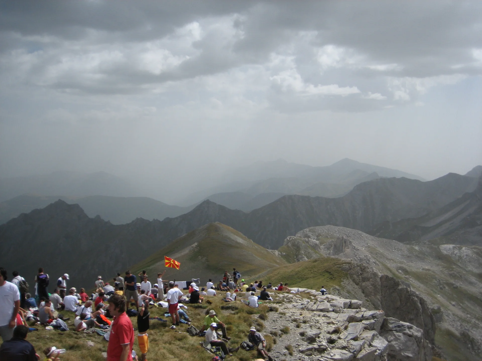
Mount Korab rises to 2,764 metres on the Albania–North Macedonia border and is the highest point in both countries. The standard Albanian route begins near Radomir and climbs through pasture, broad ridges and increasingly rocky high ground. Figures vary with the exact trailhead, but plan on roughly 16–20 kilometres return, well over 1,300 metres of ascent and seven to ten hours.
The route is less technically complicated than Jezercë in settled weather, yet it is remote, exposed and easy to underestimate. Carry all-day water, navigation and layers for rapid temperature changes. Because the summit sits on an international boundary and approaches may change, confirm the current route and any local registration expectations in Radomir before leaving.
6. Walk the Southern Coastal Trail
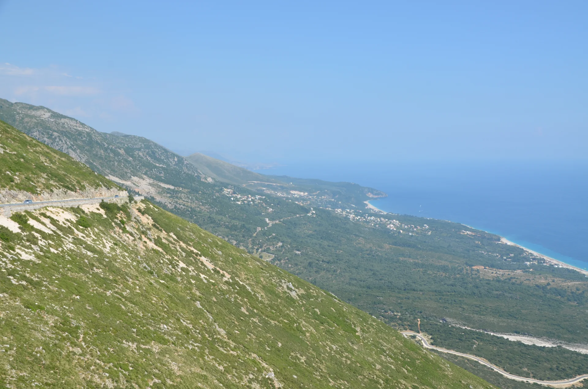
Albania's Southern Coastal Trail strings together approximately 74 kilometres of the Riviera from the Dhërmi area toward Sarandë. Rather than staying beside the sea, it climbs old paths through olive groves and stone villages, crosses dry ridges and repeatedly drops to beaches. The official route is designed as a multi-day journey, commonly split into about six stages.
Spring and autumn are much better than high summer, when exposed climbs become brutally hot and beach accommodation may be crowded. Water and waymarking cannot be assumed on every segment, so use the official stage descriptions and reserve village stays in advance. If time is short, walk a single section such as Vuno–Himarë or Lukovë–Borsh and arrange a taxi rather than improvising a road walk back.
7. Climb Mount Çika from Llogara
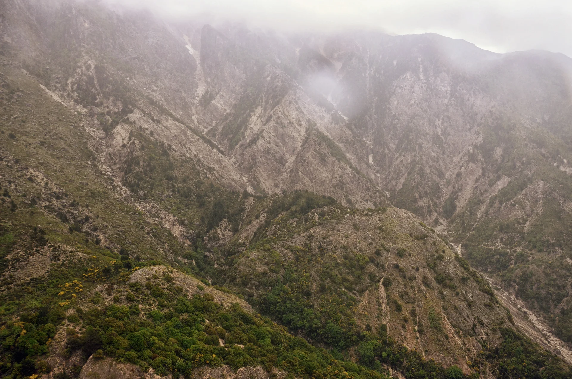
Mount Çika towers above the Ionian coast and gives the Riviera its dramatic mountain wall. Routes from Llogara Pass climb through pine forest and exposed ridges toward high points with sea views; the full summit day is long, steep and far more demanding than a roadside viewpoint stop. Exact distance depends on the chosen start and whether the nearby Qorre summit is included.
Loose rock, limited shade and route-finding make a local guide a sensible choice. Start at dawn, carry more water than the altitude suggests and avoid the ridge in thunderstorms or strong wind. Less experienced walkers can choose a shorter marked outing around Llogara National Park and still experience the rare meeting of alpine forest and coast.
8. Hike Gamti Mountain above Lake Bovilla
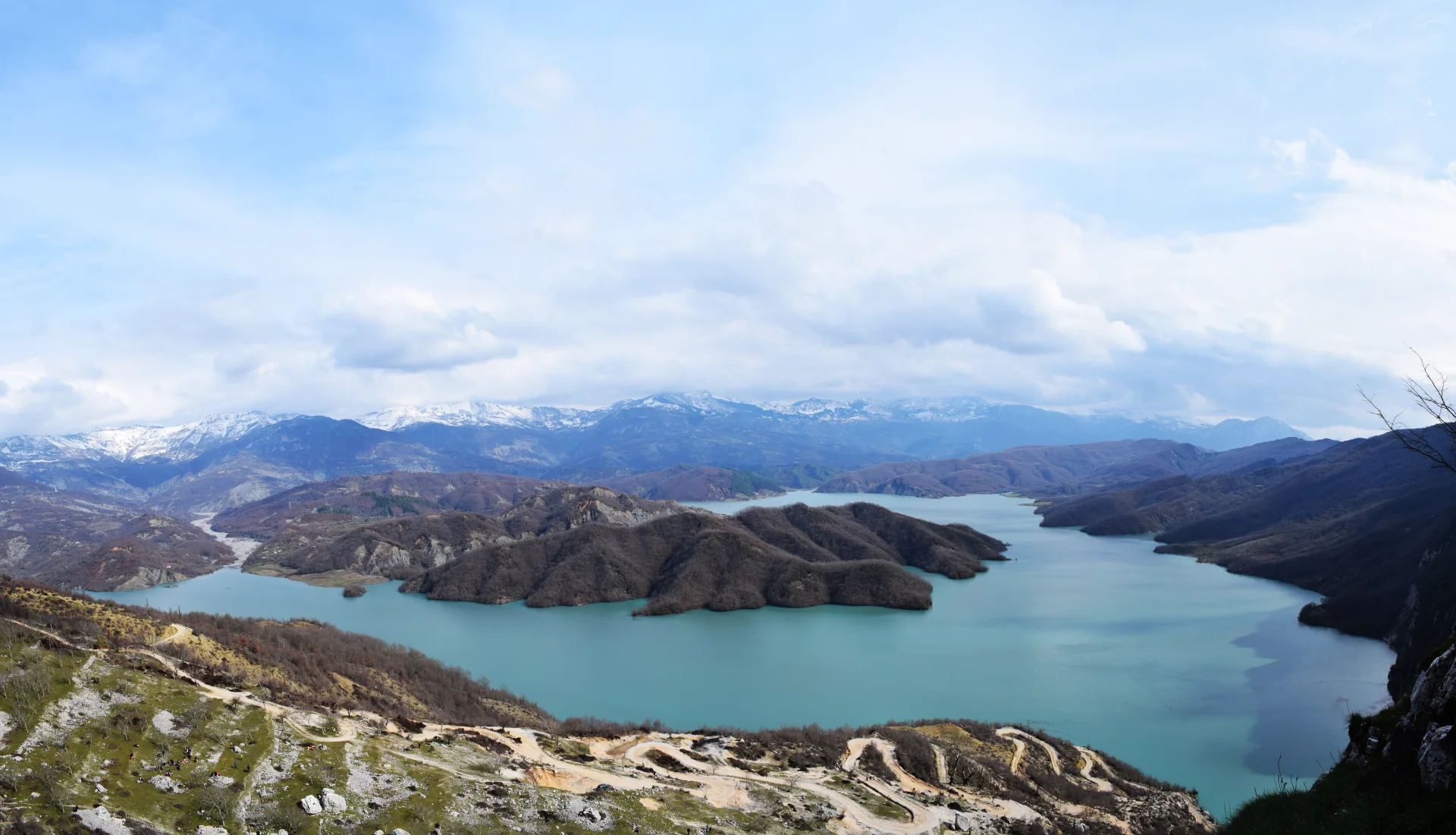
Gamti's limestone ledges reveal the crooked blue reservoir of Lake Bovilla below, making this the most accessible mountain panorama from Tirana. Many tours use a rough road to reach a trailhead above the dam and then complete a short but steep climb. A longer self-guided route may involve three to five hours depending on where the vehicle can safely stop.
The frequently photographed final ledge is exposed and has no magical protection because it appears on social media. Keep well back from drops, wear real walking shoes and do not obstruct other hikers for a photograph. The access road can be rutted; if you are not comfortable driving it, use an experienced local transfer rather than risking a low-clearance rental car.
9. Walk a Peaks of the Balkans stage
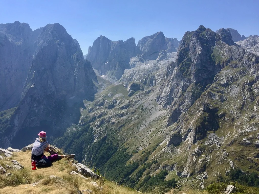
The full Peaks of the Balkans route forms a roughly 190-kilometre circuit through Albania, Kosovo and Montenegro. Albania's sections pass remote settlements such as Theth, Dobërdol and Çerem, with guesthouses turning a high-mountain traverse into a supported cultural journey. Even one or two stages reveal quieter terrain than the main Theth–Valbona crossing.
International border crossings away from official roads require permits arranged in advance. Do not assume a passport alone makes an unstaffed mountain crossing legal. A specialist operator or guesthouse network can coordinate permits, bags and beds; independent hikers should begin the process early and carry offline navigation. June snow and autumn storms can affect high passes even when valleys feel summery.
10. Climb Mount Tomorr
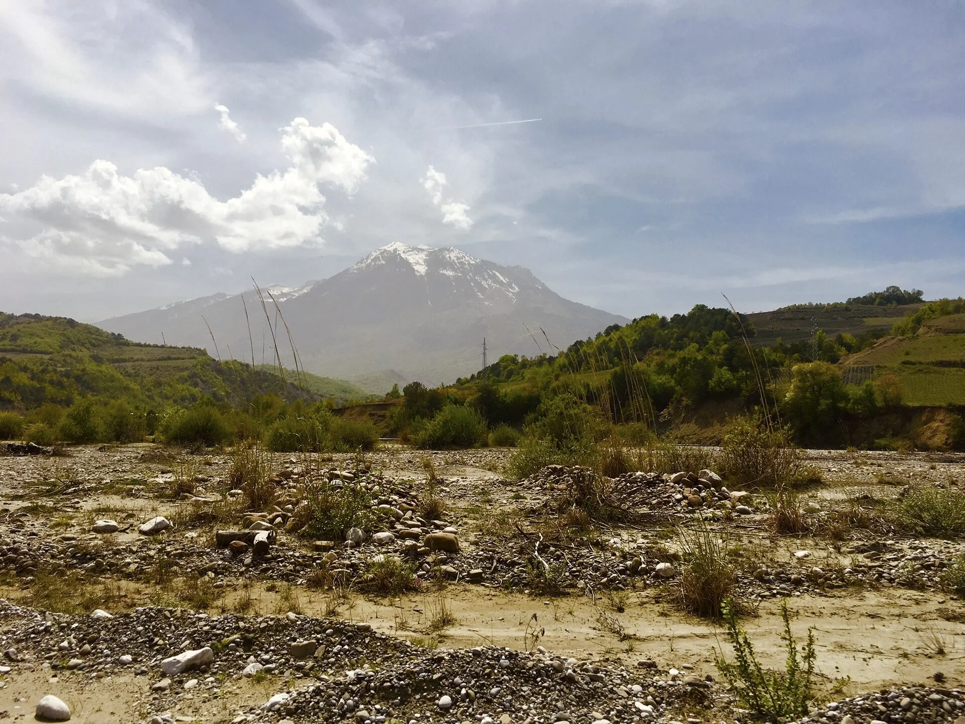
Mount Tomorr rises above Berat as a long, culturally significant massif rather than a single neat cone. Routes approach high points including Çuka e Partizanit, with expansive views over central and southern Albania. The mountain is associated with Bektashi pilgrimage, and roads become especially busy around the annual August observance.
Choose the route with a local guide because trailheads, driving surfaces and distances vary considerably. The upper massif is exposed, water is scarce and weather can change rapidly. Outside the pilgrimage period, a climb can feel remarkably solitary; during it, hikers should respect ceremonies, traffic controls and the fact that the mountain is a living sacred landscape, not just a summit target.
When is the best time to hike in Albania?
For the Albanian Alps, the most reliable hiking window is usually late June through September, after high passes lose winter snow and before autumn storms. Conditions vary each year, so guesthouses and guides are better evidence than a fixed calendar. The Riviera and lower mountains are best in April–May or September–October, when temperatures are kinder and water needs are easier to manage.
Winter transforms these routes completely. Roads, passes and mountain accommodation may close; a familiar summer track can become an avalanche or navigation problem. Choose a purpose-built winter outing with local expertise instead of applying summer timings to snow.
Continue planning with Albania's best beaches, waterfalls, canyons and springs and adventure activities.
Before you go
- Download an offline map, but confirm the route with a guesthouse or guide.
- Carry cash in remote villages and reserve beds during the main trekking season.
- Do not enter international border terrain without the permits required for your route.
- Pack sun protection, a rain layer, warm insulation and enough water for exposed ridges.
- Turn around for snow, lightning, rising water or fading daylight; mountain rescue is not immediate.