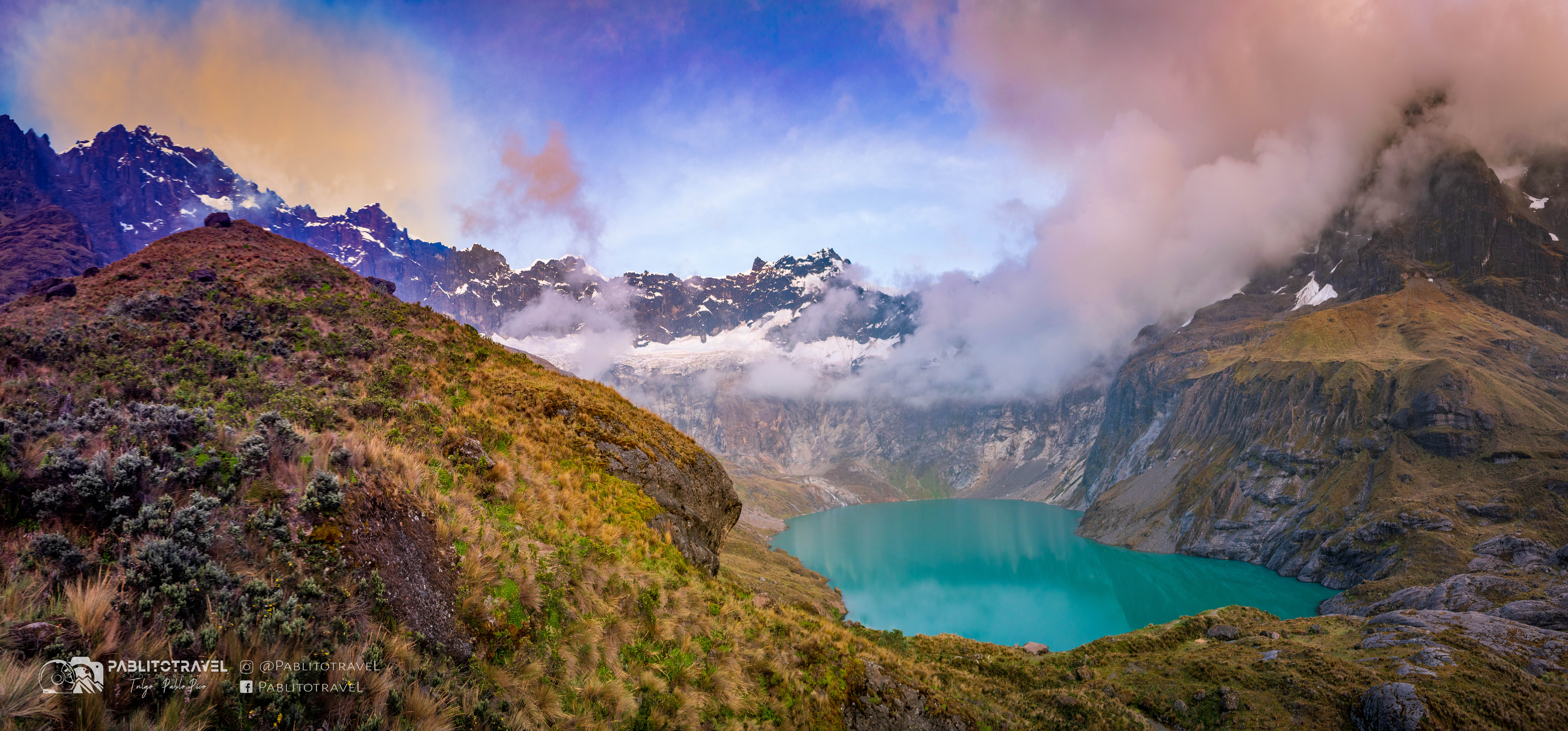

Ecuador's strongest hikes follow the country's dramatic change in elevation. Trails climb directly from Quito, circle water-filled calderas, cross páramo beside ancient roads and descend through cloud forest. In the Galápagos, walking reveals young lava and wildlife found nowhere else.
Altitude is the main separator. Build gradually from city and crater walks toward 4,000-metre objectives, and treat any route involving glacier travel as mountaineering rather than hiking. Rain, volcanic alerts and protected-area rules can change access at short notice.
Ecuador hikes at a glance
| Hike | Region | Commitment | Main challenge |
|---|---|---|---|
| Rucu Pichincha | Quito | Full day | Altitude and weather |
| Cuicocha rim | Northern Andes | Full day | Repeated climbing |
| Quilotoa crater rim | Central Andes | Half day | Altitude and exposure |
| El Altar | Central Andes | Multi-day | Mud and remote weather |
| Laguna Toreadora | Cajas | Half day | Wet highland conditions |
| Sierra Negra | Galápagos | Full day | Heat and regulated access |
The 10 best hikes in Ecuador
1. Hike to Rucu Pichincha
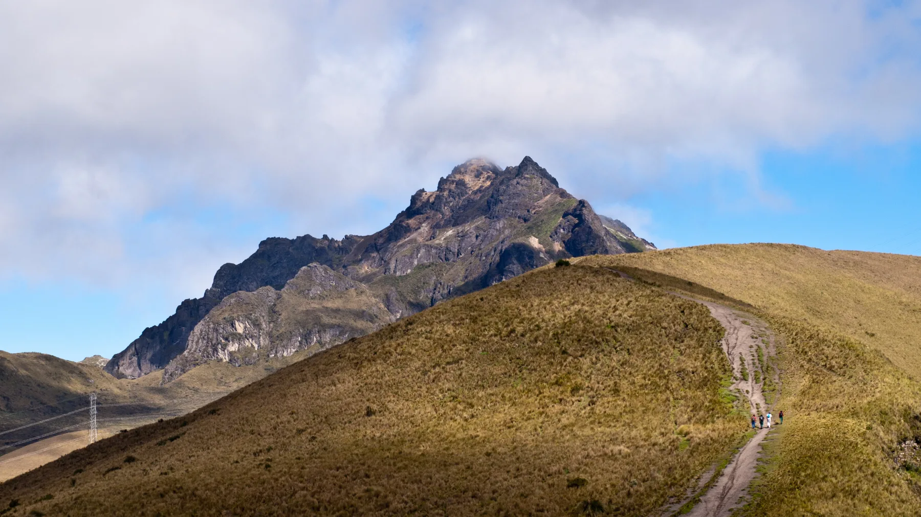
Quito's TelefériQo places hikers at Cruz Loma above 3,900 metres, where the trail continues across open ground to 4,696-metre Rucu Pichincha. The route gives an immediate sense of the capital's volcanic setting but should not be attempted straight after arriving from sea level.
Start early, turn back when cloud or thunder builds and avoid the mountain alone in poor visibility. The final section is loose and steep. A shorter walk around Cruz Loma is a useful acclimatization day without committing to the summit.
2. Circle the Cuicocha crater
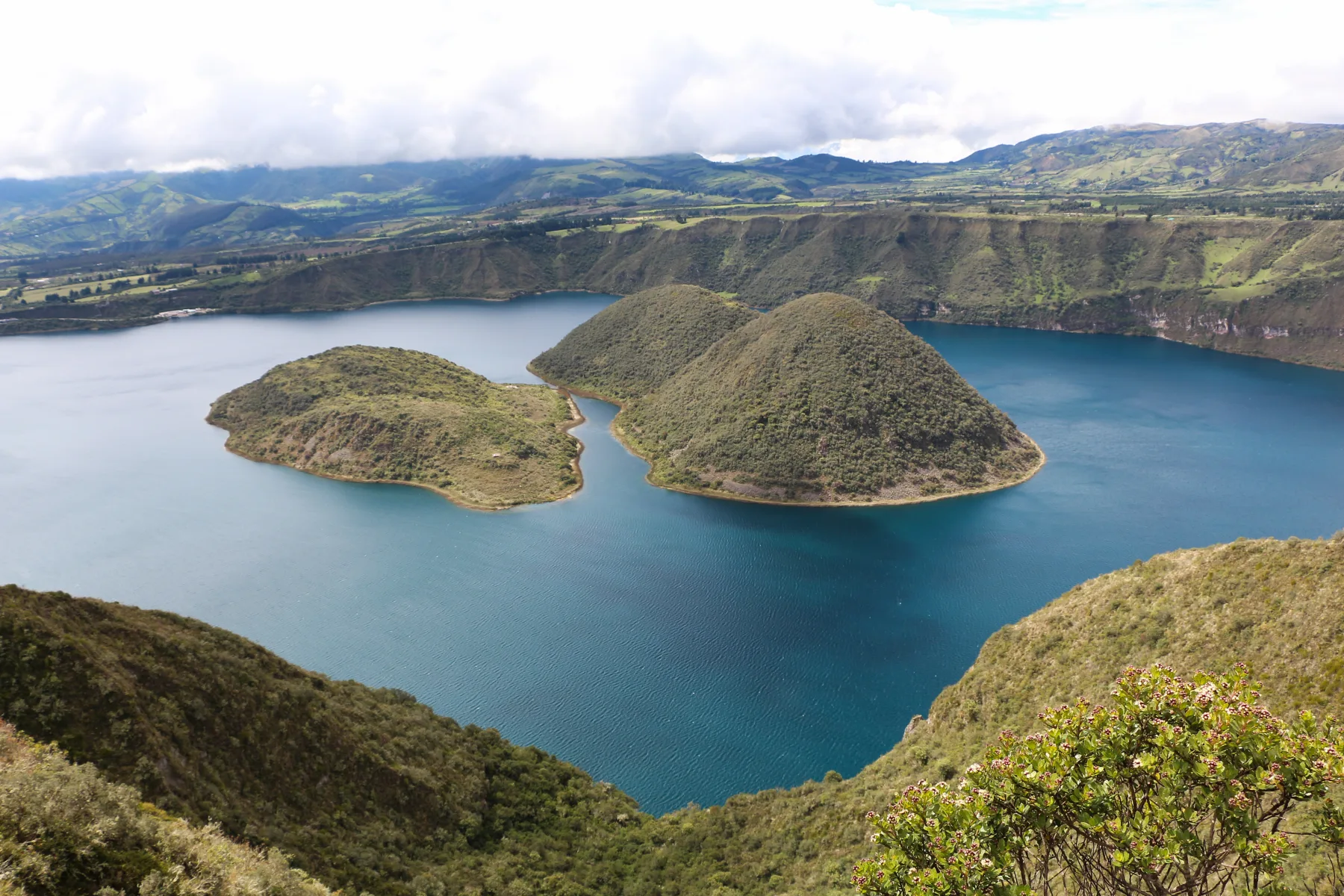
The Cuicocha loop follows the rim of a deep caldera above a lake and two central islands. Its repeated ascents add up, and the full circuit commonly fills most of a day despite its approachable trail.
Clear mornings offer the best views toward Imbabura. Carry water, sun and rain protection and confirm current reserve registration. Cotacachi makes a relaxed base and allows the hike to support local accommodation rather than becoming a rushed Quito excursion.
3. Walk the Quilotoa crater rim
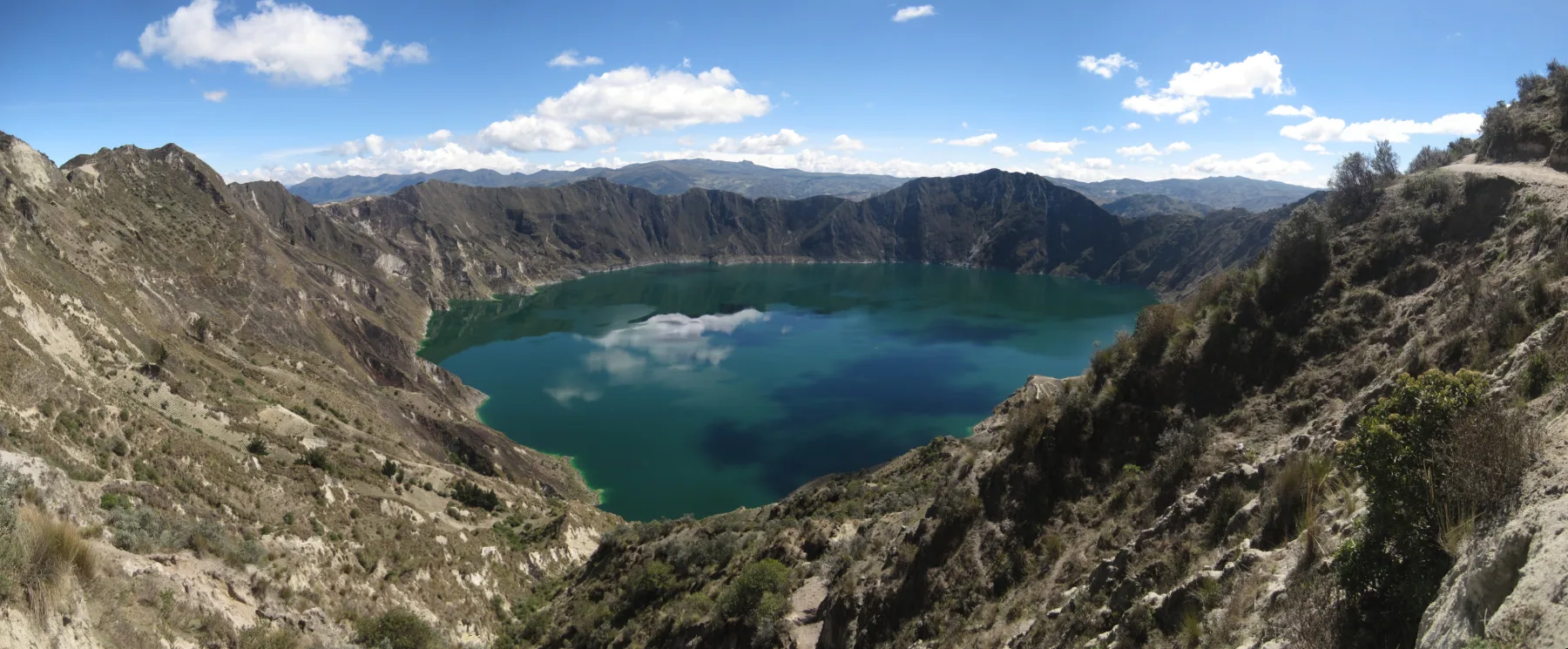
Quilotoa's high rim provides changing perspectives across its mineral-colored lake and the surrounding patchwork of Andean farmland. Complete circuits are exposed and more demanding than the popular short viewpoint walk.
Acclimatize first and remain back from eroded edges. Cloud, strong sun and thunderstorms can all arrive within one circuit. For a longer journey, connect villages on the Quilotoa Loop over several days instead of descending to the lake and climbing out in one hurried visit.
4. Trek to Laguna Amarilla beneath El Altar
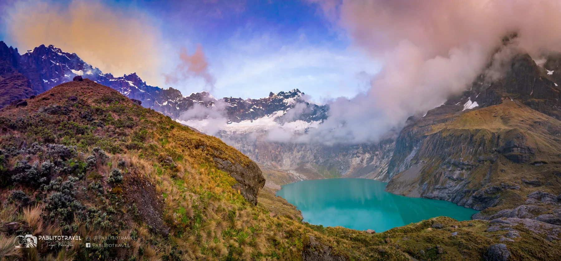
The trail toward Laguna Amarilla crosses pasture and wet páramo before reaching a lake enclosed by the broken summit crown of El Altar. Deep mud and unstable mountain weather make the journey feel far more remote than its distance from Riobamba.
Plan at least two days, use local guidance and bring genuinely waterproof footwear and shelter. Ask about horse welfare if pack support is included. The objective is the glacial basin; the surrounding summits require separate technical mountaineering preparation.
5. Hike the Laguna Toreadora circuit in Cajas
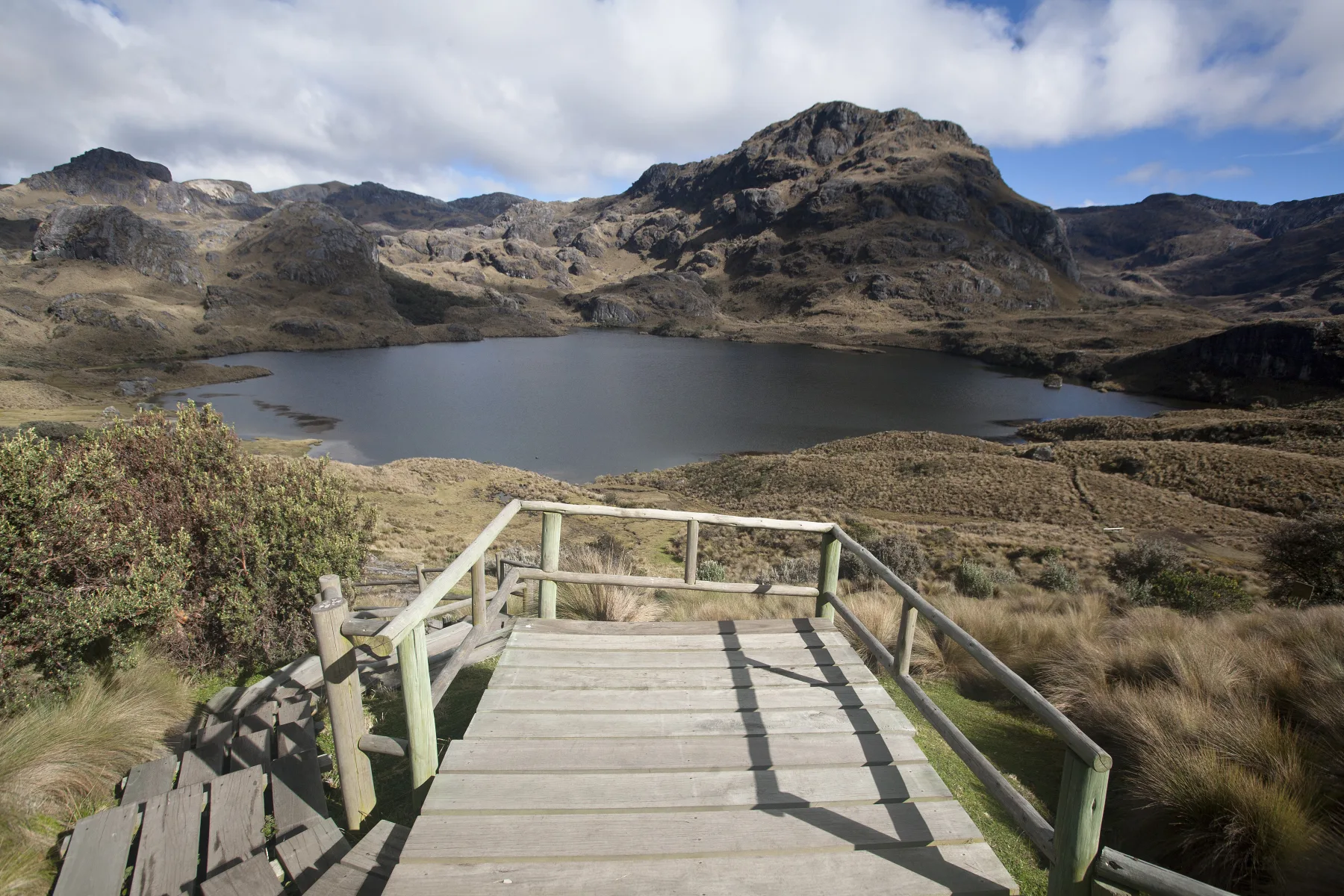
Cajas National Park protects a high plateau of lakes, wetlands and paper-barked polylepis woodland west of Cuenca. Trails around Laguna Toreadora provide a manageable introduction, while longer marked routes continue across saturated páramo.
Register as required, carry layers and protect maps and electronics from rain. Fog complicates navigation quickly, so stay with the official route. Spend time in Cuenca first: even the easier circuit sits at significant altitude.
6. Follow the Qhapaq Ñan to Laguna Culebrillas
A surviving highland section of the Inca road approaches Laguna Culebrillas near Ingapirca. Walking the stone and grass route connects archaeology with a living Indigenous landscape rather than separating the trail from the communities around it.
Arrange access with a knowledgeable local guide and ask permission on community land. Cold rain and soft ground are common. Combine the walk with Ingapirca, keeping off masonry and allowing time for cultural interpretation beyond the headline Temple of the Sun.
7. Walk the Peguche waterfall trail
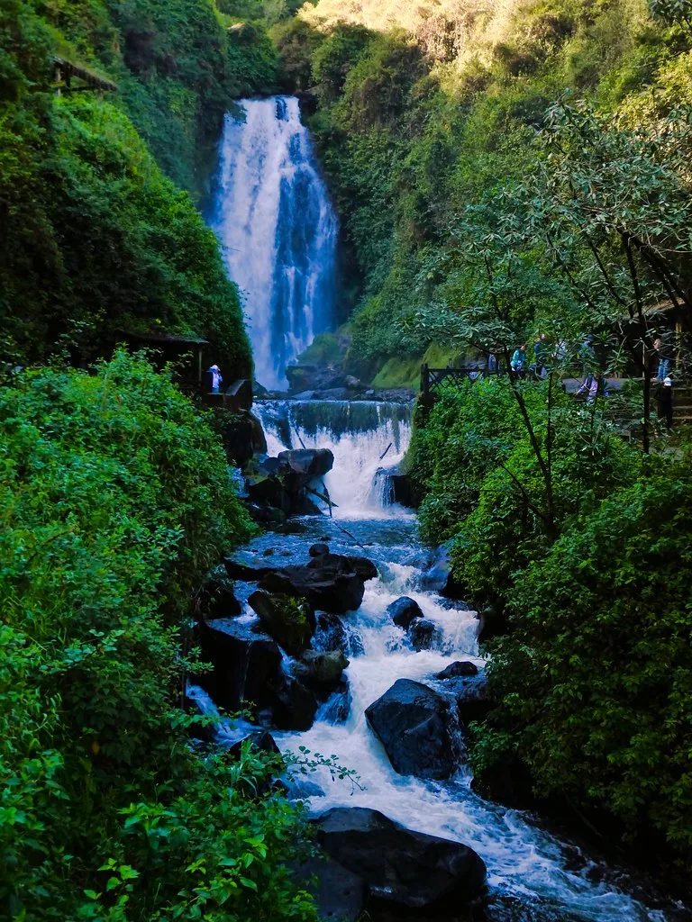
From Peguche village near Otavalo, a short forest path reaches a waterfall with deep cultural meaning for the local Kichwa community. The route is physically easy, but approaching it respectfully makes the experience more than a quick scenic stop.
Use the managed entrance, follow rules around ceremonial areas and avoid intrusive photography during community events. Continue on foot from Otavalo or stay locally to reduce traffic and add context through craft and market visits.
8. Hike the Los Frailes coastal trail
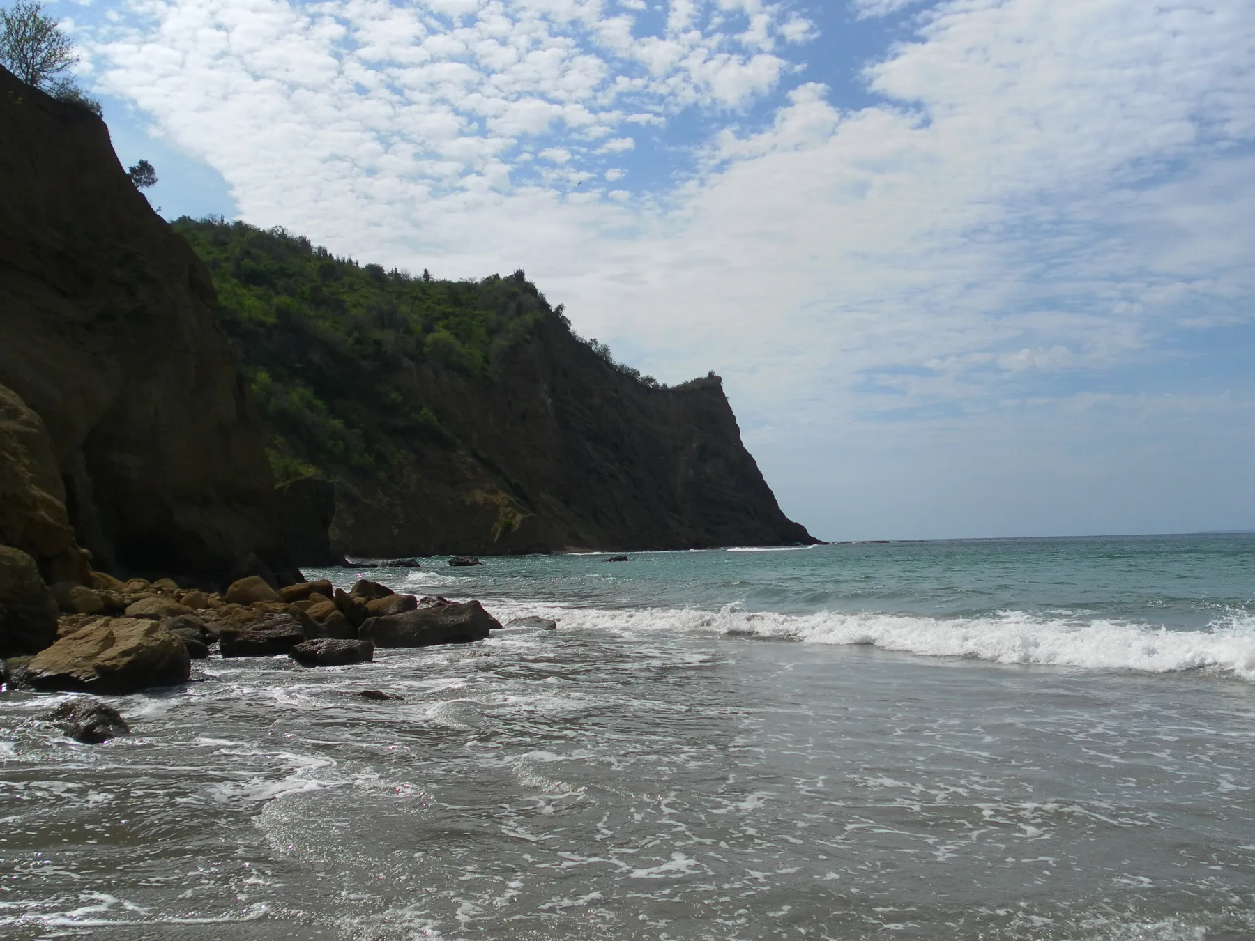
Within Machalilla National Park, the Los Frailes route crosses dry forest and viewpoints before reaching pale sand and sheltered bays. Heat and sun, rather than elevation, are the principal challenges.
Start early, carry water and follow current swimming and trail rules. Stay off closed nesting areas and take every item of waste out. Puerto López is the natural base and makes it possible to combine the walk with a responsible seasonal wildlife trip.
9. Hike Sierra Negra
On Isabela Island, a regulated trail reaches the immense Sierra Negra caldera and may continue through stark lava toward Volcán Chico. Little shade and reflected heat make the day strenuous even though much of the terrain is gradual.
Book through current Galápagos arrangements and remain with the required guide and route. Carry substantial water and accept volcanic closures. Several nights on Isabela protect the hike from becoming a casualty of ferry delays or unsuitable weather.
10. Walk Punta Suárez on Española
The visitor trail at Punta Suárez crosses rocky terrain through one of the Galápagos' richest seabird landscapes. Seasonal albatross, iguanas and cliff-nesting species may appear, but the experience depends on quiet observation rather than a guaranteed checklist.
Land only through an authorized itinerary, stay with the naturalist guide and give wildlife right of way. The lava is uneven and exposed to strong sun. Keep camera equipment controlled so it does not become litter or an obstacle to animals.
Choosing an Ecuador hike
Use Quito, Otavalo or Cotacachi for northern volcano and crater days; Latacunga or Riobamba for Quilotoa and El Altar; and Cuenca for Cajas and the Ingapirca highlands. Coastal and Galápagos hikes need separate weather and transport plans.
Continue with Ecuador's best adventure activities and volcano experiences.
Before setting out
- Acclimatize gradually and descend if altitude symptoms worsen.
- Check volcanic alerts, park registration and route closures.
- Carry waterproof layers and offline navigation on páramo routes.
- Respect community land, ceremonies and photography consent.
- Use authorized Galápagos services and follow biosecurity rules.