
El Salvador's volcanic chain offers far more than one summit. Trails cross cloud forest, young lava, coffee slopes, crater rims and landscapes shaped by recent eruptions. Some outings are established park walks; others cross community or private land and should only be attempted with current local arrangements.
Volcanic activity, weather and land access can change without notice. Treat the descriptions below as a way to choose a landscape, then confirm the route with the responsible park or local guide.
El Salvador volcano hikes at a glance
| Hike | Main reward | Difficulty | Access approach |
|---|---|---|---|
| Santa Ana | Crater lake | Hard | Official scheduled outing |
| Izalco | Young volcanic cone | Hard | Official scheduled outing |
| Cerro Verde | Cloud forest viewpoints | Easy | Park trails |
| Conchagua | Gulf of Fonseca views | Moderate | Local guide or transport |
| Tecapa | Laguna de Alegría | Easy–moderate | Established local access |
The 10 best volcano hikes in El Salvador
1. Santa Ana volcano
Ilamatepec, El Salvador's highest volcano, is the country's defining ascent. The route climbs from the Cerro Verde area through forest and exposed volcanic ground to a viewpoint above an acidic crater lake. It is strenuous rather than technical.
Use the current official departure and registration system; independent access may be restricted. Carry ample water, sun and rain protection, and remain behind every crater barrier. Clouds can erase the view, while gas or volcanic monitoring can close the route entirely.
Cerro Verde is the usual meeting point, and the return walk commonly occupies about four hours depending on pace and group organization. Arrive before assembly time and allow most of the day from San Salvador or the coast. The exposed final climb is loose and offers almost no shade.
2. Izalco volcano
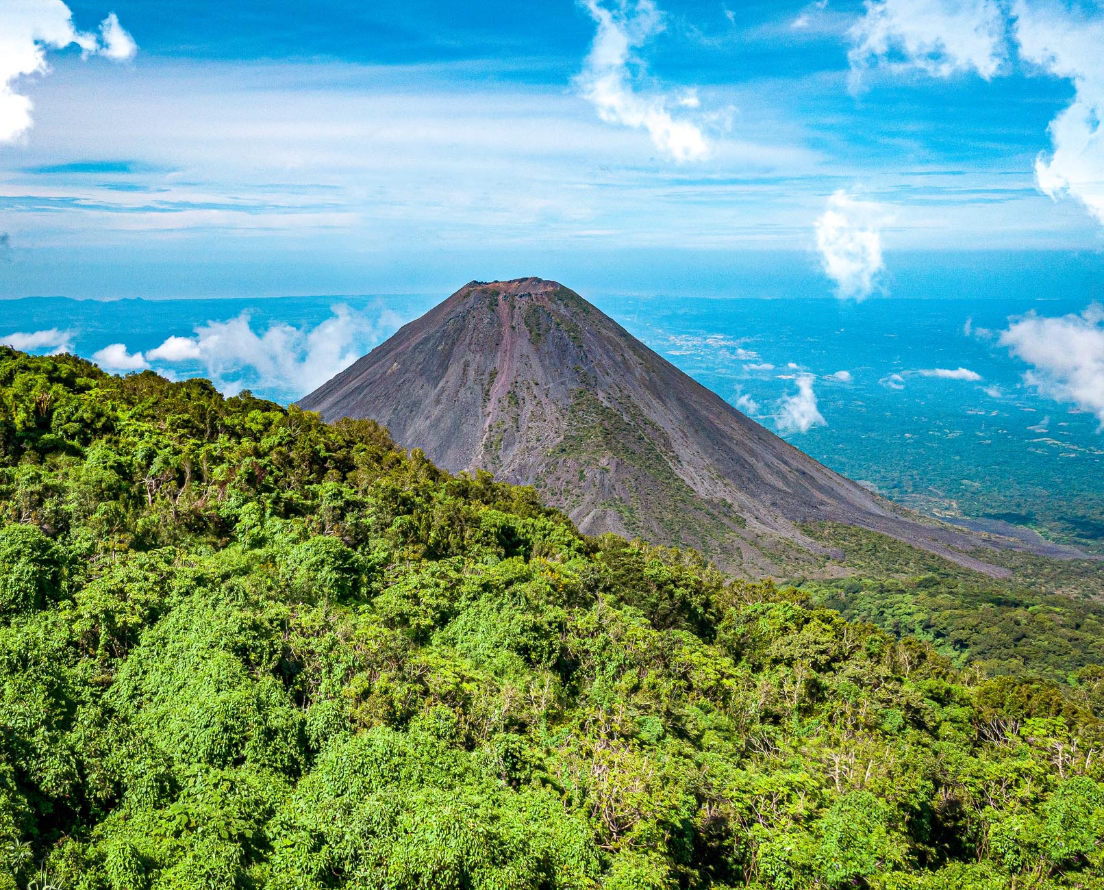
Izalco's dark, symmetrical cone rises dramatically beside Cerro Verde. The outing first descends from the park and then climbs steep, loose volcanic material, meaning the return ascent arrives after tired legs have already summited.
Join the authorized scheduled group and wear footwear with strong grip. Shade is scarce on the cone, and rolling stones make spacing important. This is a harder day than its distance suggests.
The route descends substantially from Cerro Verde before climbing the cone, so tired hikers finish with a long ascent back to the park. Trekking poles may help if permitted. Choose Izalco for stark lava scenery and physical challenge; Santa Ana offers the more colorful crater destination.
3. Cerro Verde
Cerro Verde is an eroded volcanic cone covered by cool forest, with short interpreted trails and viewpoints toward Santa Ana, Izalco and Lake Coatepeque. It is the most approachable volcanic walk in the complex and a good alternative when the higher ascents are closed.
Stay on park paths and bring a light layer for mist. The volcano views are weather-dependent, but cloud forest, birds and native plants make the walk worthwhile without a clear summit panorama.
Short interpreted circuits and several viewpoints make Cerro Verde suitable for families and travelers who cannot tackle a strenuous ascent. Allow one to two hours, or use the park as a relaxed base before an authorized volcano hike. Cafeterias, parking and toilets make logistics easier here than on the surrounding cones.
4. Conchagua volcano
Conchagua rises above the Gulf of Fonseca, where viewpoints frame islands and the volcanoes of Honduras and Nicaragua. The best-known camps and lookouts are commonly reached with locally arranged four-wheel-drive transport, followed by short walks.
Book through an established community or operator, especially for sunrise or overnight visits. Heat, rough roads and limited water make an improvised approach unwise.
Most visitors travel from Conchagua or La Unión by high-clearance vehicle and walk only near the upper viewpoints; a full ascent is a different undertaking. Confirm whether camping equipment, meals, water and return transfer are included. Wind can make the summit surprisingly cool after sunset.
5. Tecapa and Laguna de Alegría
The crater lagoon inside Tecapa is the accessible centerpiece of a highland visit from Alegría. Mineral water and fumarolic ground reflect the active geothermal setting, while surrounding paths reveal coffee country and ridges.
Do not swim in or closely approach hazardous sulfur areas. Ask locally before walking beyond the principal visitor zone because routes, property boundaries and conditions vary.
The lagoon visit itself is short, so base in Alegría and combine it with town viewpoints, coffee landscapes or a locally arranged walk on the massif. Morning usually offers clearer views before mist builds. The highland climate is noticeably cooler than the Pacific lowlands.
6. San Salvador volcano and El Boquerón
El Boquerón National Park provides a short, developed walk to viewpoints over the broad crater of San Salvador volcano. It is an easy half-day from the capital, with steps and cool highland weather rather than a backcountry summit.
Remain at designated overlooks; steep crater walls and cloud make off-trail shortcuts dangerous. Pair the walk with other nearby viewpoints instead of attempting an unofficial descent.
The signed park trail takes roughly 20 to 25 minutes to reach three crater viewpoints, making this the easiest true crater experience near the capital. Restaurants and cafés line the approach road. Allow a half-day so traffic and cloud do not turn the outing into a hurried photo stop.
7. Guazapa volcano
Guazapa's trails weave natural scenery together with tunnels, former camps and stories from the civil war. The value of the walk comes from local interpretation as much as elevation or summit views.
Use a community guide who can arrange access and explain the sites respectfully. Expect heat, vegetation and rough rural paths, and never enter a tunnel without explicit guidance.
Routes vary in length and may include former camps, trenches, tunnels and viewpoints rather than one canonical summit line. Ask exactly how many hours and how much climbing the chosen itinerary involves. Long trousers, water and insect protection are useful even on shorter historical walks.
8. San Vicente volcano
Chinchontepec's twin-peaked massif is one of the country's highest and most demanding volcanic hikes. Routes can be overgrown, steep and complicated by private land; this is not a marked tourist trail comparable to El Boquerón.
Attempt it only with an experienced local guide and a clear access plan. Start early, carry substantial water and turn around if cloud, heat or route-finding erodes the safety margin.
San Vicente is best reserved for fit hikers comfortable with overgrown, steep terrain. Nearby thermal vents are a separate, shorter visit and should also be approached with local guidance. Stay in San Vicente or arrange an early transfer; this is not a sensible add-on after another major hike.
9. Chinameca volcano
Chinameca, also known as El Pacayal, overlooks eastern coffee country and contains the Laguna Seca crater area. Visits focus on rural highland scenery and geothermal context more than a polished national-park route.
Arrange a local guide and permission before setting out. Avoid vents and unstable mineral ground, and do not assume an online track represents lawful current access.
Chinameca town lies about five kilometres from the El Pacayal area and is the practical place to arrange local knowledge. The broad dry-lagoon caldera, coffee vegetation and views toward Chaparrastique give the outing variety. Expect limited signage and bring everything needed for the walk.
10. Usulután volcano
The forested cone of Usulután creates a challenging eastern objective with broad views when clear. Visitor infrastructure is limited and approaches can cross farms or coffee land.
Go with a local guide who has confirmed the route and landowner consent. Long trousers, navigation backup and an early turnaround time are essential on overgrown terrain.
This is the least developed hike on the list and should appeal only to travelers specifically seeking a demanding local route. Clarify whether the objective is a summit, viewpoint or traverse, because names and paths may be used inconsistently. San Miguel or Usulután can serve as a regional base.
Which El Salvador volcano should you hike?
Choose Santa Ana for the iconic crater, Izalco for the hardest established volcanic ascent and Cerro Verde or El Boquerón for an approachable walk. Conchagua offers the best sunrise landscape, while Guazapa is the strongest choice for a journey combining terrain with modern history.
If time permits, spend two days around Cerro Verde rather than forcing Santa Ana and Izalco into one exhausting schedule. See more options in El Salvador's adventure activities guide.
Volcano safety
- Check official access, volcanic alerts and weather immediately before departure.
- Use required guides and scheduled groups; closures apply even in clear weather.
- Never descend into craters or approach fumaroles and crater lakes.
- Carry water, sun protection, rain layers and footwear for loose ground.
- Turn around for gas, thunderstorms, extreme heat, poor visibility or guide instruction.