
Choose your Italian hiking region before choosing a trail. The Dolomites reward time spent between refuges, while the Ligurian and Amalfi coasts call for attention to heat, steep slopes and return transport. Sardinia adds rough canyon walking to the choice.
Plan each outing separately. The table compares physical effort; technical difficulty and exposure can differ. Each mission on the map has its location and preparation details.
Compare the experiences
| Experience | Physical effort |
|---|---|
| Hike the Val Fiscalina circuit to Tre Cime | High |
| Trek Alta Via 1 from Braies to Belluno | High |
| Hike the Path of the Gods to Nocelle | Moderate |
| Hike from Camogli to Portofino via San Fruttuoso | High |
| Hike into Gorropu Canyon | High |
| Hike from Pont to Rifugio Vittorio Emanuele II | Moderate |
Choose your route
Tre Cime and Alta Via 1 belong in a Dolomites plan; the Pont refuge walk is a separate Alpine choice. Pick the Path of the Gods for a coastal crossing, Camogli for a longer promontory walk, or Gorropu if you are comfortable moving over rough canyon ground.
Hike the Val Fiscalina circuit to Tre Cime
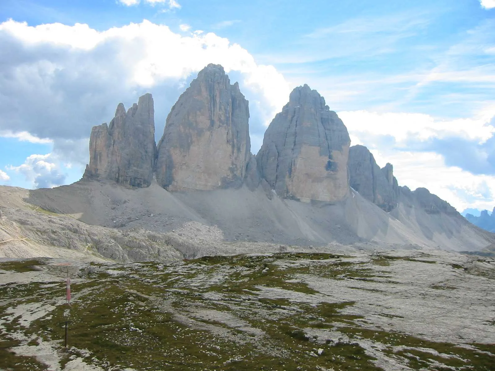
Climb from Val Fiscalina through the Sexten Dolomites, passing Rifugio Comici and Rifugio Pian di Cengia before reaching Rifugio Locatelli beneath Tre Cime.
The circuit links three high refuges and brings you to the north faces of Tre Cime as part of one continuous walk.
No permit, guide or climbing equipment is required for the standard hiking circuit. The published hiking period runs from June to mid-October; check weather and trail conditions before setting out. Book a refuge only if you plan to split the route with an overnight stay.
View in GoExploringTrek Alta Via 1 from Braies to Belluno
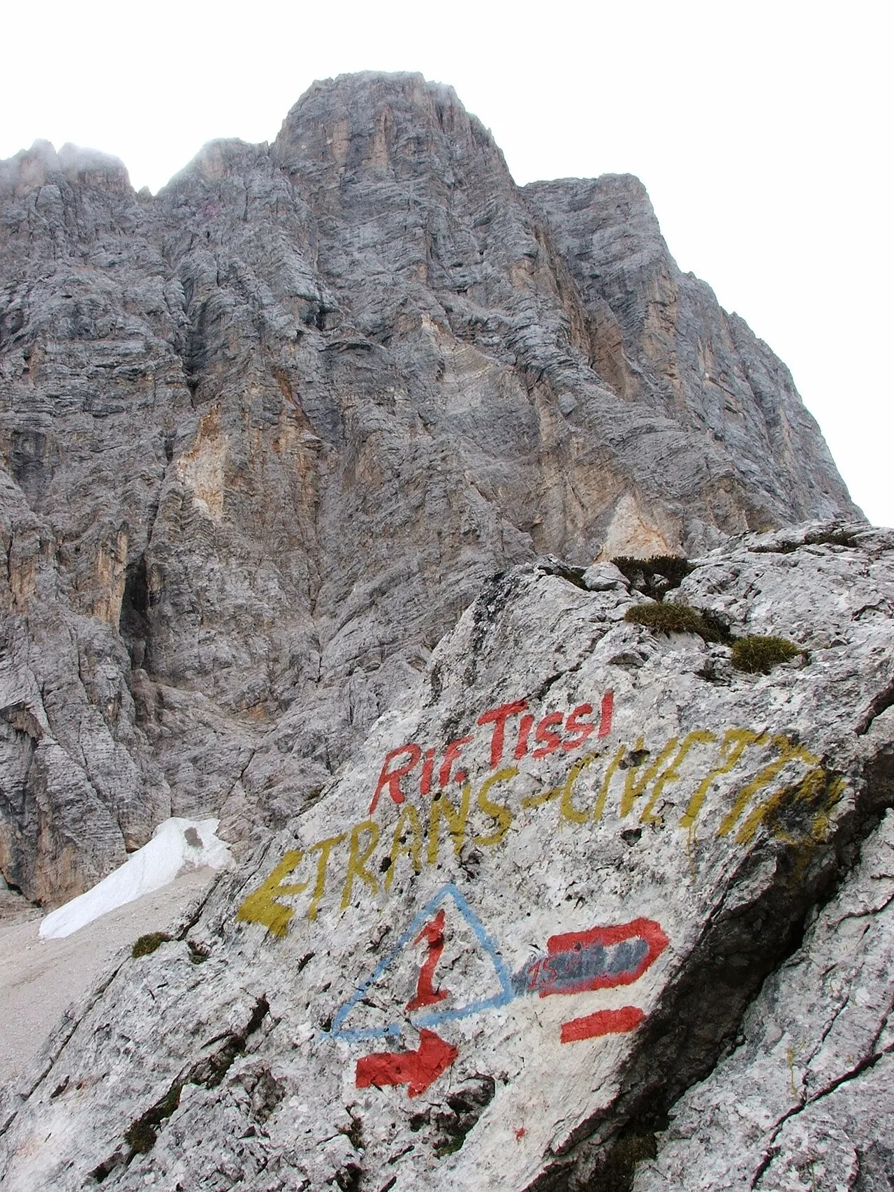
Start at Lago di Braies and walk south through the Dolomites toward Belluno, crossing high passes and moving between mountain huts. The classic route is about 125 kilometres over 12 stages with roughly 7,300 metres of ascent.
Alta Via 1 strings together major Dolomite groups from Braies to the Belluno side of the range. Over several days you move from plateaus and high valleys to the walls of the Tofane, Pelmo and Civetta, seeing how the range changes from north to south.
The route can be walked independently; no compulsory guide is listed for the classic hiking itinerary. Plan and book the hut nights you intend to use, arrange transport at both ends and check current trail, hut and weather conditions before each stage.
View in GoExploringHike the Path of the Gods to Nocelle
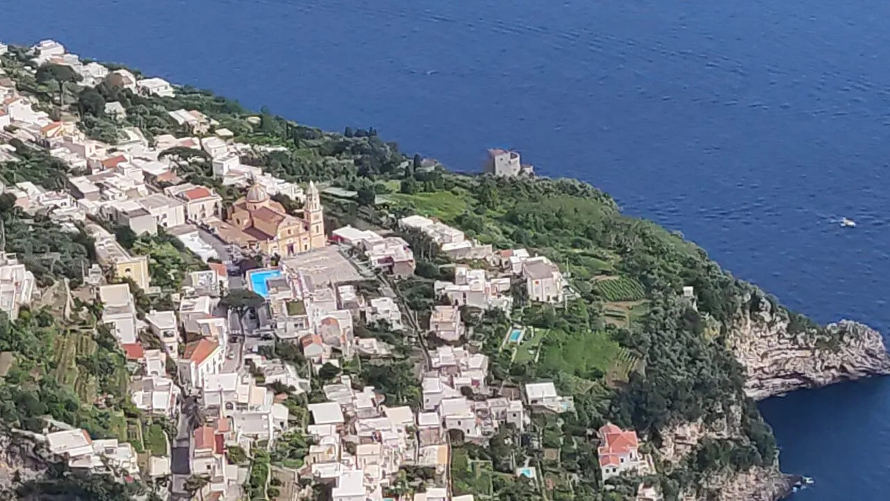
Walk from Bomerano in Agerola to Nocelle on CAI path 327, covering about 5.3 kilometres along steep coastal slopes. Near Colle La Serra you can take the more exposed branch or the less exposed 327a before the routes meet again. The trail is not technically difficult, but uneven ground, heat and open drops make comfort with exposed hiking important.
The path follows the steep terrain that linked settlements on the Amalfi Coast before modern roads changed how people moved between them. The footpath passes between villages and cultivated slopes above the sea cliffs.
No booking, permit or guide is required for the public trail. Check the current CAI trail status before leaving, use secure walking footwear and avoid poor weather or extreme heat. If exposed ground is a problem, take the less exposed 327a branch near Colle La Serra.
View in GoExploringHike from Camogli to Portofino via San Fruttuoso
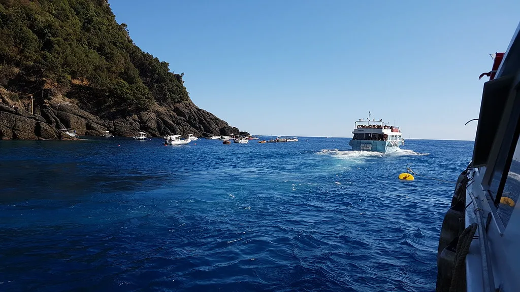
Climb from Camogli to San Rocco, cross the Portofino promontory by the Pietre Strette route and descend to San Fruttuoso before continuing on foot to Portofino. The first section from San Rocco is 4.6 kilometres with about 460 metres of descent, followed by another hilly coastal leg. Repeated climbing and descending make the full crossing a long day.
San Fruttuoso sits in a small bay without normal road access. The walk to Portofino continues across the protected promontory, through forest and along secluded coast before reaching the harbour.
Use the Pietre Strette itinerary and check the park’s current closures before departure. Arrange return transport from Portofino and avoid substituting a more exposed coastal variant without checking its status.
View in GoExploringHike into Gorropu Canyon
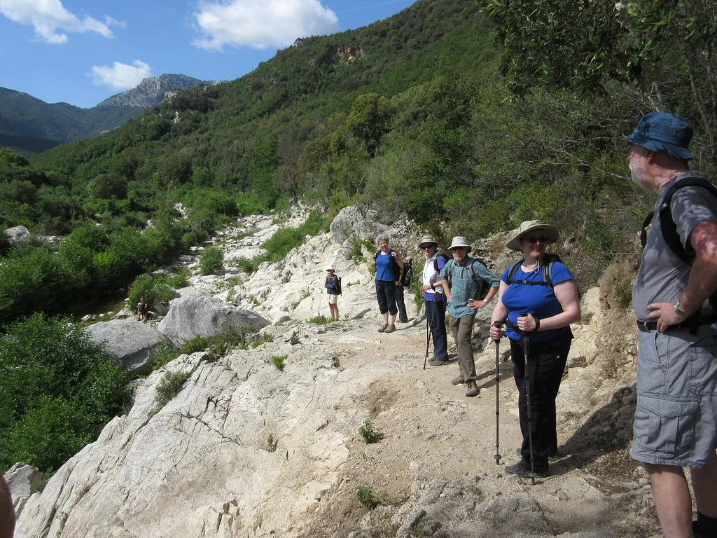
Descend into Gorropu from an official approach such as Ghenna Silana, then continue through the canyon only as far as the marked difficulty section suits you. Inside, the walking shifts to boulders and rough riverbed terrain. Add the climb back out and this becomes a demanding day even before heat or rain complicate conditions.
Gorropu cuts a deep, narrow corridor through the Supramonte limestone, with walls rising hundreds of metres above the gorge.
Check canyon opening, weather and the current ticket and payment arrangements before travelling. Choose an official approach and keep within the marked section suited to your ability.
View in GoExploringHike from Pont to Rifugio Vittorio Emanuele II
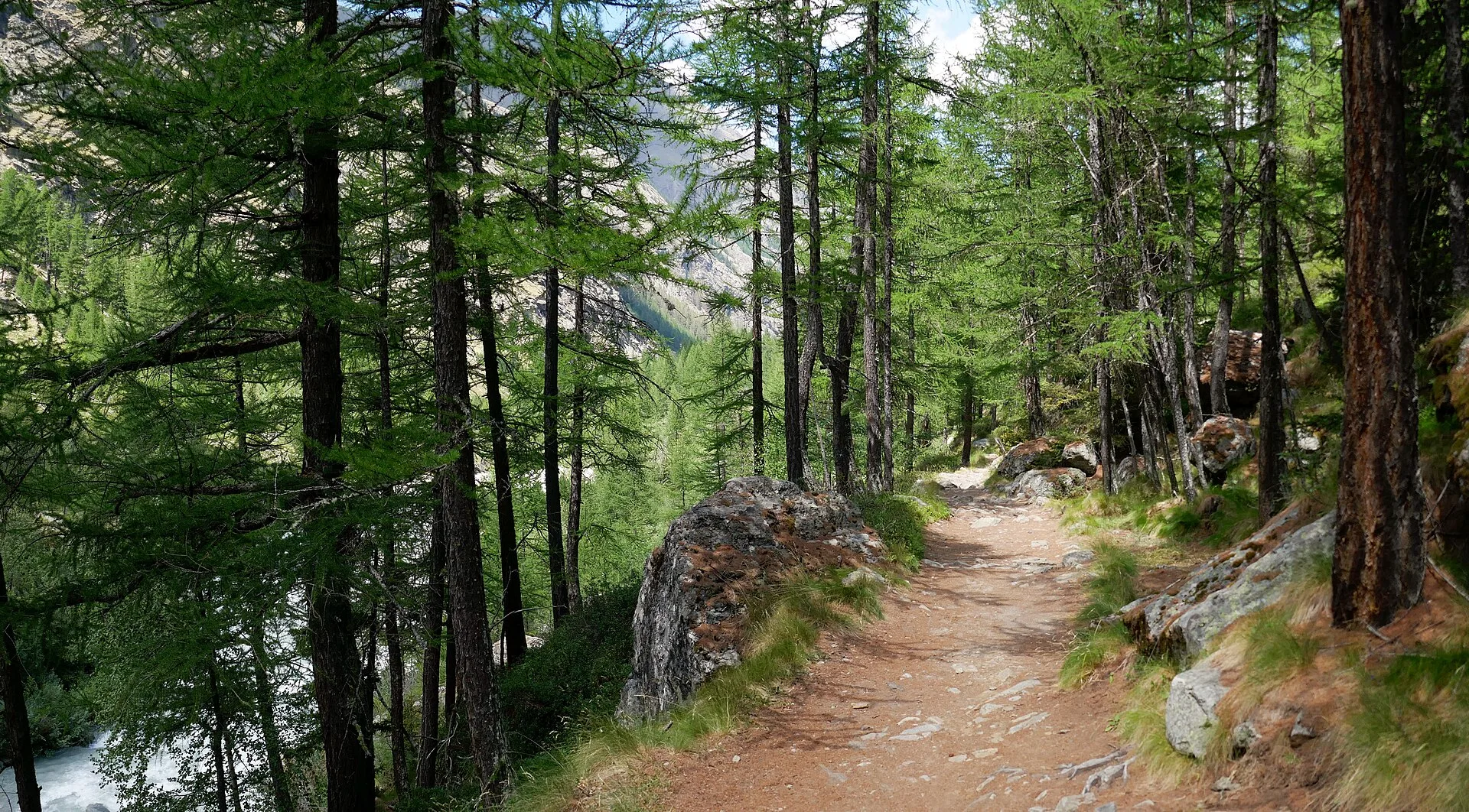
Start at Pont in Valsavarenche, cross the Savara and follow trail 1 uphill through larch forest, pasture and increasingly rocky ground. The path gains about 770 metres over roughly five kilometres to reach Rifugio Vittorio Emanuele II beside Lago di Moncorvé.
The hiking route ends at the refuge; Gran Paradiso’s glacier ascent is a separate undertaking.
The route moves from the inhabited valley floor into the high terrain at the heart of Gran Paradiso National Park without requiring glacier travel.
At the refuge, the surrounding Ciarforon, Tresenta and Gran Paradiso massif make the park’s alpine scale immediately visible.
The standard trail does not require a permit, compulsory guide or specialist equipment. Check trail and refuge conditions before departure; the refuge’s staffed season is limited, and snow can change the character of the route outside the normal hiking months.
View in GoExploringBefore you set out
Before a Dolomites trek, confirm the hut nights and check for snow on the route. Wet rock can also make an otherwise non-technical trail difficult. Download maps and arrange transport from the finish of any coastal crossing. Check current notices for each walk, even within the published hiking season.
Explore more adventure activities in Italy.
For a different active day, compare water sports in Italy.
Our Cinque Terre hiking guide explains how to choose an open trail, compare access cards and plan a train return.