

Canada's outdoor adventures cover more ground than one trip can hold. The western mountains bring steep trails, glaciers and long canoe circuits. The Atlantic coast has tidal flats, sea cliffs and headland paths, while the North offers wilderness routes shaped by distance, weather and limited services.
Plan around the region and season. Backcountry trips may need permits, reservations, a boat or a guide; high mountain routes can hold snow well into summer. Check official park alerts and local conditions before setting out. For Lake Louise and Moraine Lake, Parks Canada shuttle seats require advance reservations, and Moraine Lake Road is closed to personal vehicles year-round. The Skyline Trail in Cape Breton Highlands also has seasonal parking reservations during its busiest period. Parks Canada: Lake Louise and Moraine Lake Parks Canada: Skyline Trail
Canada adventures at a glance
| Adventure | Standout destination | Intensity | Key requirement |
|---|---|---|---|
| Alpine hiking | Lake Louise, Alberta | Moderate–high | Plan transport and check trail status |
| Backcountry canoeing | Bowron Lake, British Columbia | High | Reserve route and camping |
| Arctic paddling | South Nahanni, Northwest Territories | Very high | Expedition skills and logistics |
| Coastal trekking | Fundy Footpath, New Brunswick | Very high | Multi-day backcountry preparation |
| Tidal exploring | Hopewell Rocks, New Brunswick | Low–moderate | Check tide times |
| Mountain hiking | Gros Morne, Newfoundland | High | Weather and daylight |
The 20 best adventure activities in Canada
Hike to Stawamus Chief First Peak
Above Squamish, the Stawamus Chief trail climbs steeply through forest before reaching open granite and broad views over Howe Sound. The short distance hides a sustained, strenuous ascent, with fixed aids and exposed rock near the top.
Check the provincial park's current advisories and be ready to turn around if rain makes the granite slippery. Independent hikers can use the signed route; sturdy footwear and comfort with steep terrain matter.
View in GoExploringSea-kayak to Benson Island
The Broken Group Islands sit among the sheltered waters and reefs of Barkley Sound on Vancouver Island's west coast. Paddling to Benson Island brings you into a maze of forested islands and exposed shore, with campsites along the route.
Parks Canada operates the backcountry season from May through September. Arrange the required camping reservation and plan for tides, wind, cold water and boat traffic. Go with a qualified guide if you lack sea-kayaking and rescue experience.
View in GoExploringCanoe the Bowron Lake Circuit
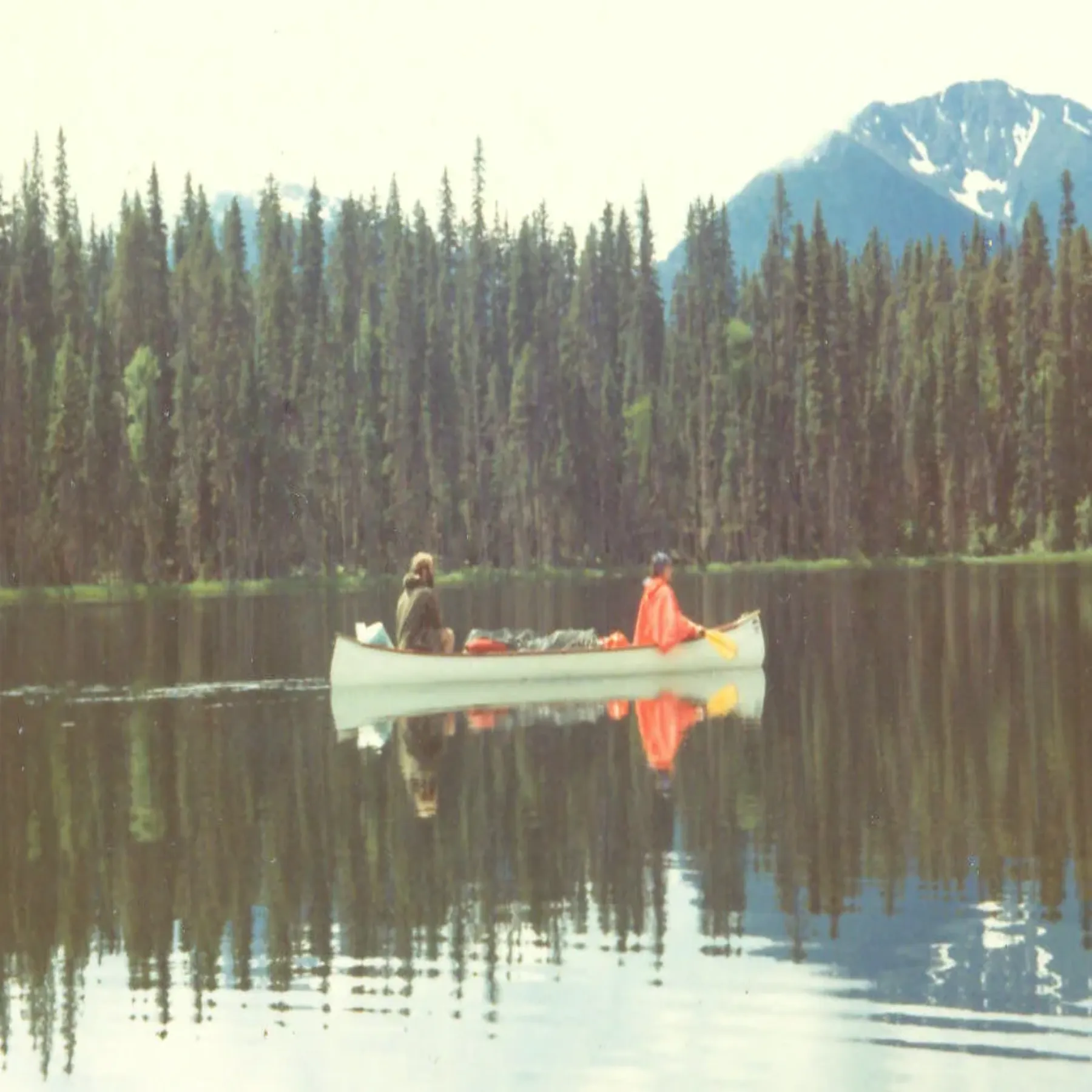
This multi-day route links a chain of lakes and rivers in the Cariboo Mountains. Portages connect the waterways, so the trip involves repeated carries as well as paddling and backcountry camping.
Reserve the circuit in advance; the reservation includes the required backcountry camping permit. Attend the orientation on your start day, and bring or rent a canoe and backcountry equipment. BC Parks recommends prior backcountry canoeing experience. The full circuit usually takes six to ten days, so build in time for weather and travel to the start.
View in GoExploringWalk to Helmcken Falls
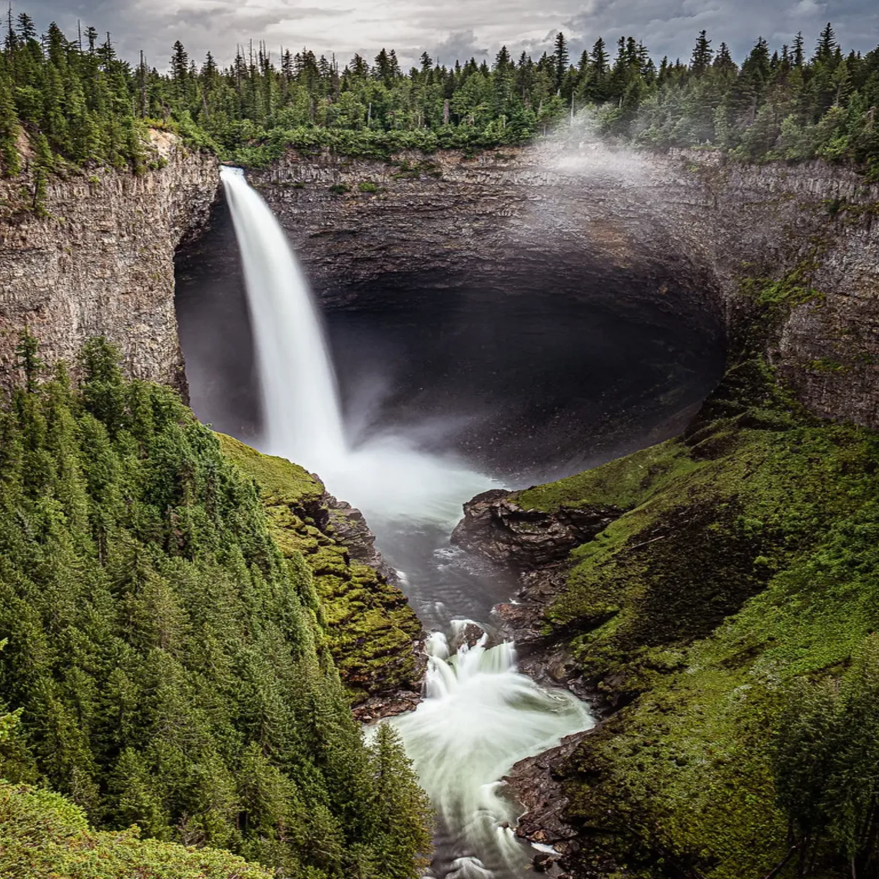
Helmcken Falls drops into a deep canyon in Wells Gray Provincial Park. The main viewpoint is reached on a short walk, making it an accessible way to see the park's volcanic terrain and one of its signature waterfalls.
Stay on the marked paths and behind barriers at the viewpoints. The rim can be icy in winter and slick after rain; keep children close near exposed edges. Check current park notices before driving into the area.
View in GoExploringSoak in the Alpha Pool at Liard River Hot Springs
In northern British Columbia, a boardwalk crosses warm, wetland forest to the Alpha Pool at Liard River Hot Springs. The hot spring is a welcome stop on the Alaska Highway, but the surrounding habitat remains wild and can include wildlife.
Use the designated boardwalk and bathing area, and follow posted closures or wildlife instructions. Bring sandals for the path and take care on wet surfaces. Do not leave food or scented items unattended.
View in GoExploringHike from Lake Louise to the Plain of Six Glaciers
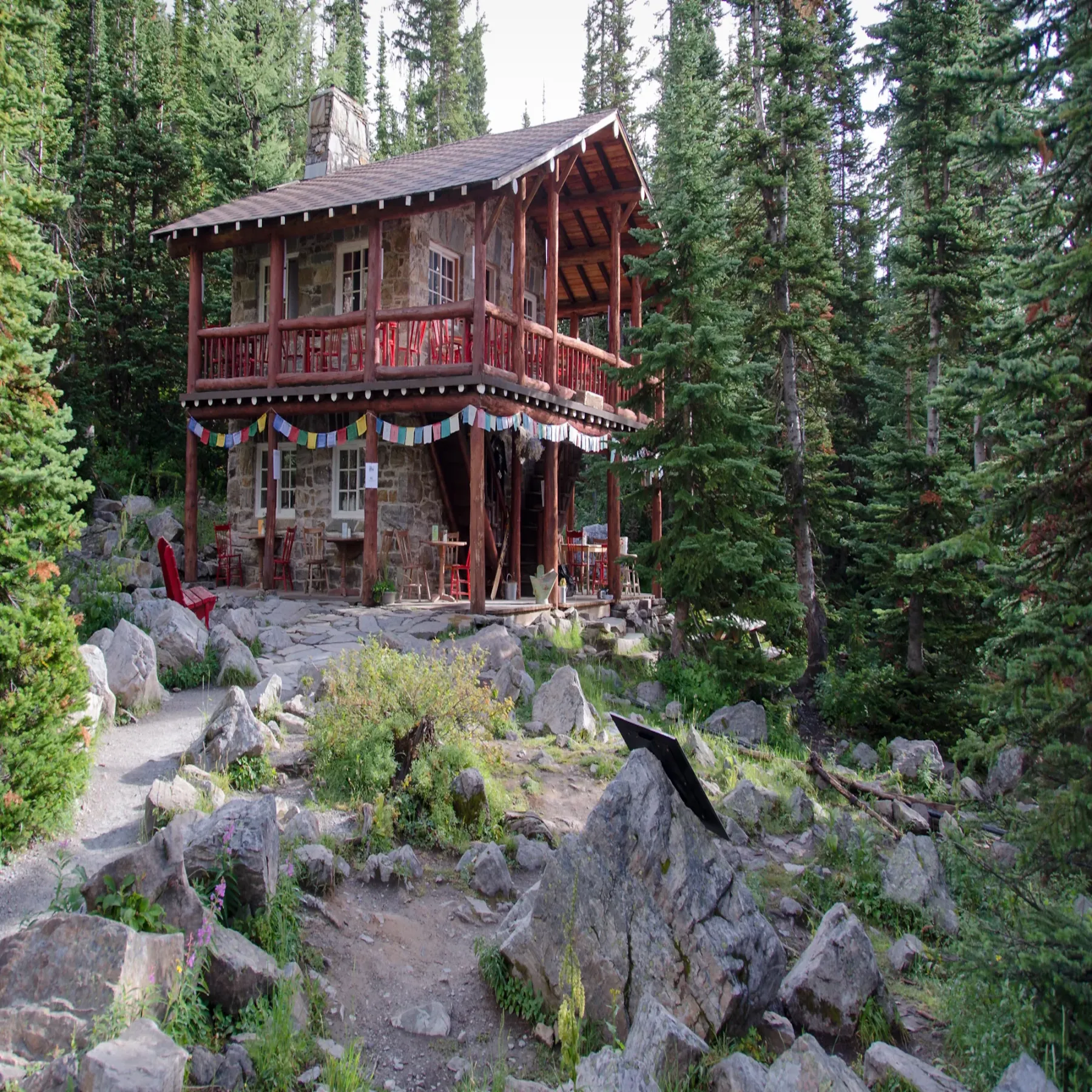
The trail climbs from Lake Louise through forest and open alpine terrain to a teahouse beneath the Victoria Glacier. Beyond the teahouse, a signed continuation reaches a viewpoint facing the glacier and surrounding peaks.
This is a popular route with sustained climbing. Check trail and avalanche conditions, carry layers and water, and leave enough daylight for the return. Book transport ahead: Parks Canada shuttle reservations are required for its shuttle service, and Moraine Lake Road is closed to private vehicles year-round. Parks Canada visitor information
View in GoExploringHike to Crypt Lake
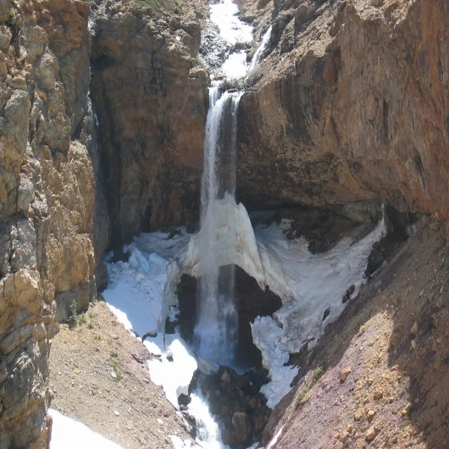
In Waterton Lakes National Park, the Crypt Lake trail starts with a boat ride across Upper Waterton Lake. The route then climbs through forest and a waterfall area before a tunnel, ladder and exposed ledges lead toward the hanging lake.
The combination of boat timing, steep terrain and exposed sections makes this a full-day outing. Confirm boat operations and trail status before travelling, start early, and carry food, water and layers. Turn back if the narrow sections or weather are beyond your comfort level.
View in GoExploringHike the 70 Mile Butte loop
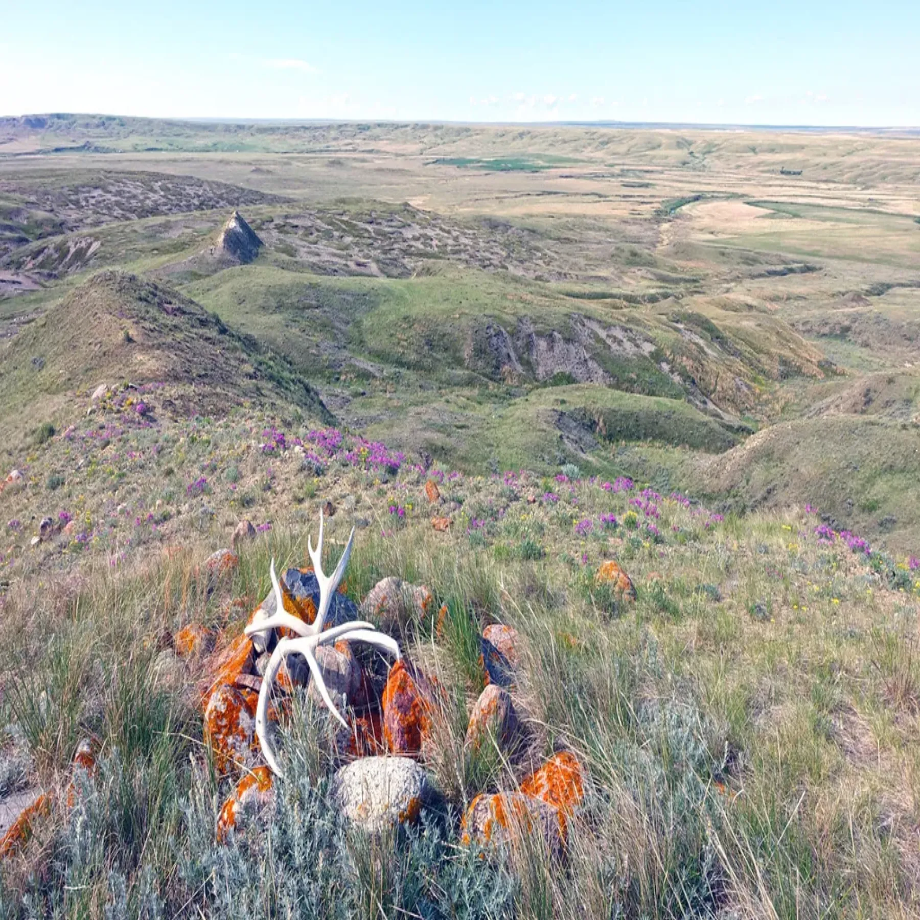
Grassland and badlands meet at 70 Mile Butte in Grasslands National Park, Saskatchewan. The loop climbs to an open ridge with views across a region where the horizon is unusually wide and the terrain is easy to underestimate.
There is little shade and summer heat can be intense. Carry water, protect yourself from sun and check park conditions before setting out. Stay on the route to protect the fragile prairie and avoid disturbing wildlife.
View in GoExploringWatch Churchill polar bears from a tundra vehicle
Churchill, on Hudson Bay in Manitoba, is known for seasonal polar bear movement along the coast. A tundra vehicle lets visitors travel with an experienced operator across remote terrain while keeping a safe distance from the bears.
Book with an established local operator and follow staff instructions throughout the trip. Polar bears are dangerous wild animals; never approach them on foot or leave a vehicle without permission. Sightings depend on wildlife movement and are never guaranteed.
View in GoExploringWalk behind Horseshoe Falls
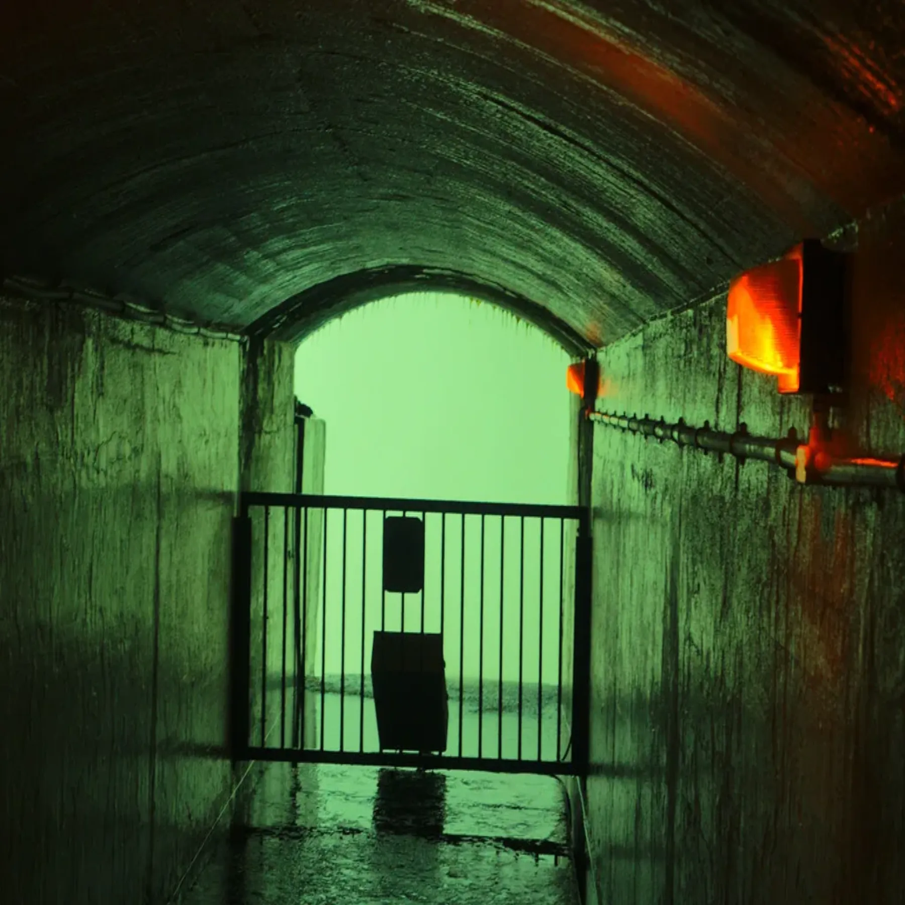
At Niagara Falls, an access route leads through tunnels to portals behind the curtain of Horseshoe Falls. The sound and force of the water fill the rock passage, while viewing openings look through the falling water.
This is a managed, ticketed attraction. Check current operating hours and access arrangements before visiting, wear the supplied rain poncho, and follow staff directions around wet floors and railings.
View in GoExploringClimb through The Crack in Killarney
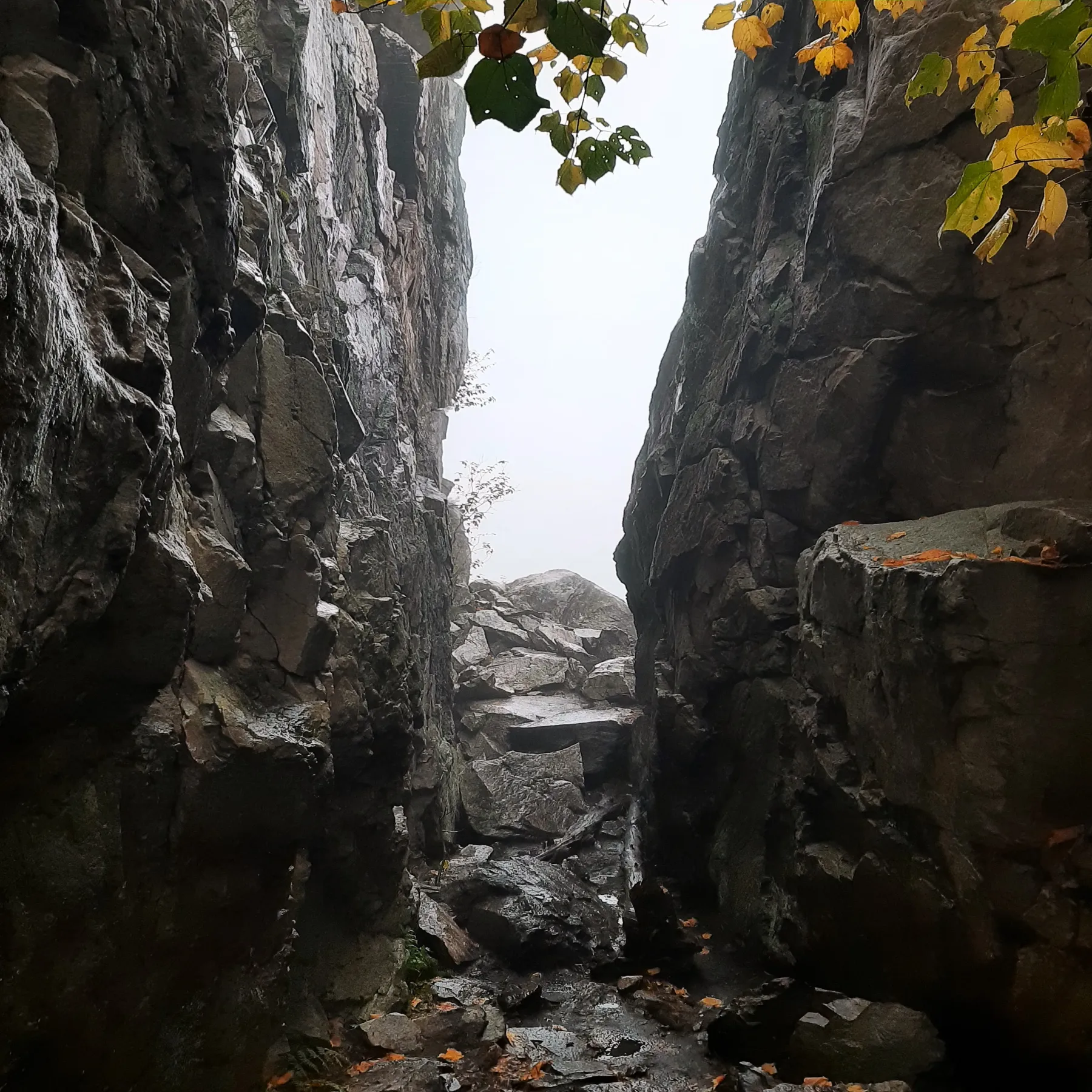
The trail to The Crack in Killarney Provincial Park climbs over exposed white quartzite and through a narrow cleft in the La Cloche Mountains. From the upper ridge, the view stretches across forest, lakes and pale rock.
Expect a steep, rocky climb that calls for sure footing and hands in places. Check the park's trail conditions, bring water and avoid the route when rock is wet or icy. Stay on the path to protect the thin soils and plants on the ridge.
View in GoExploringPaddle the Saguenay Fjord by sea kayak
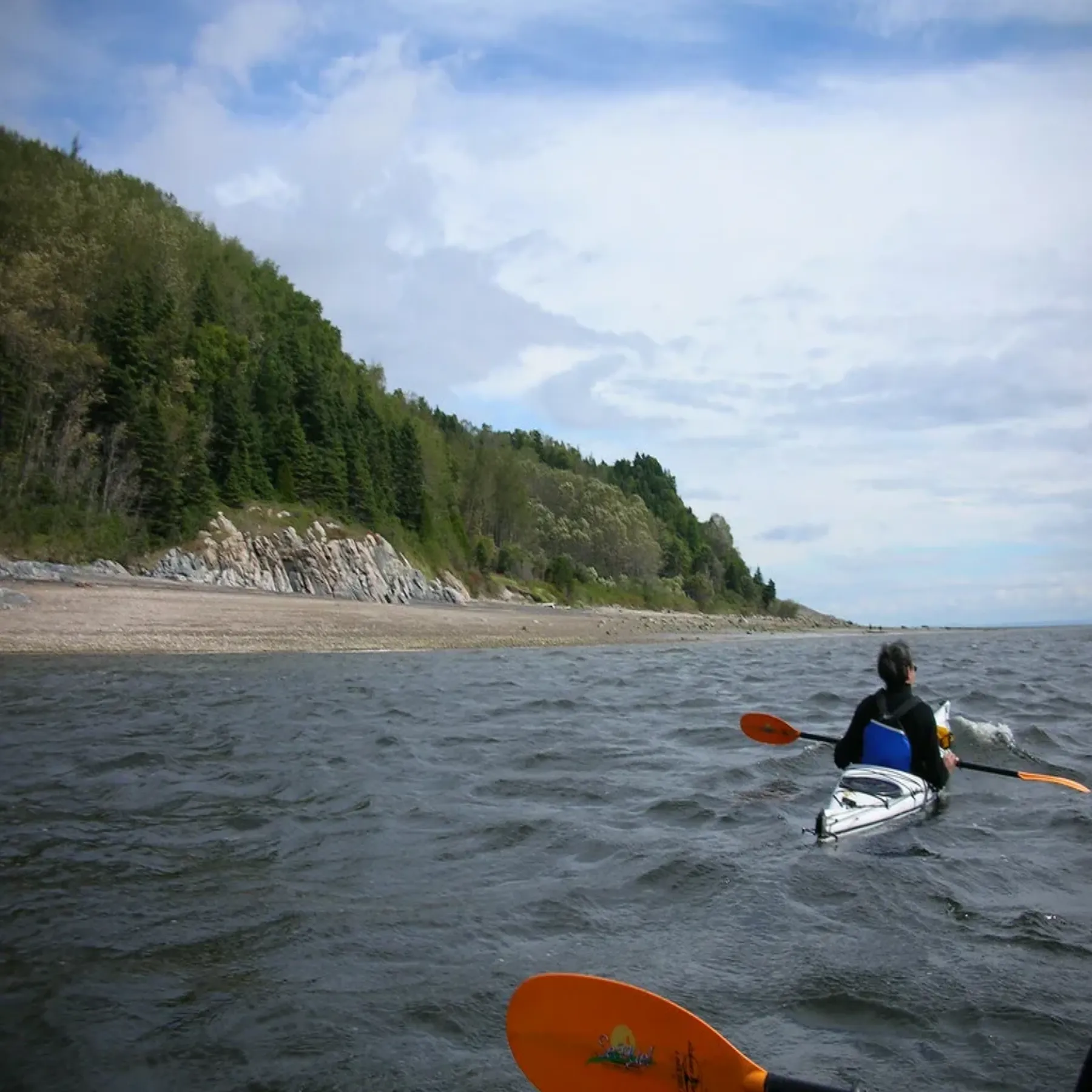
The Saguenay Fjord cuts inland from the St. Lawrence, with steep wooded walls above cold, deep water. A guided sea-kayak trip gives a close view of the shoreline and the meeting of fjord and estuary.
Conditions can change quickly, and currents, wind and cold water raise the stakes. Choose a qualified local operator, wear a properly fitted flotation device and follow the guide's route and safety instructions. Keep a respectful distance from whales and other marine wildlife.
View in GoExploringWalk the ocean floor at Hopewell Rocks
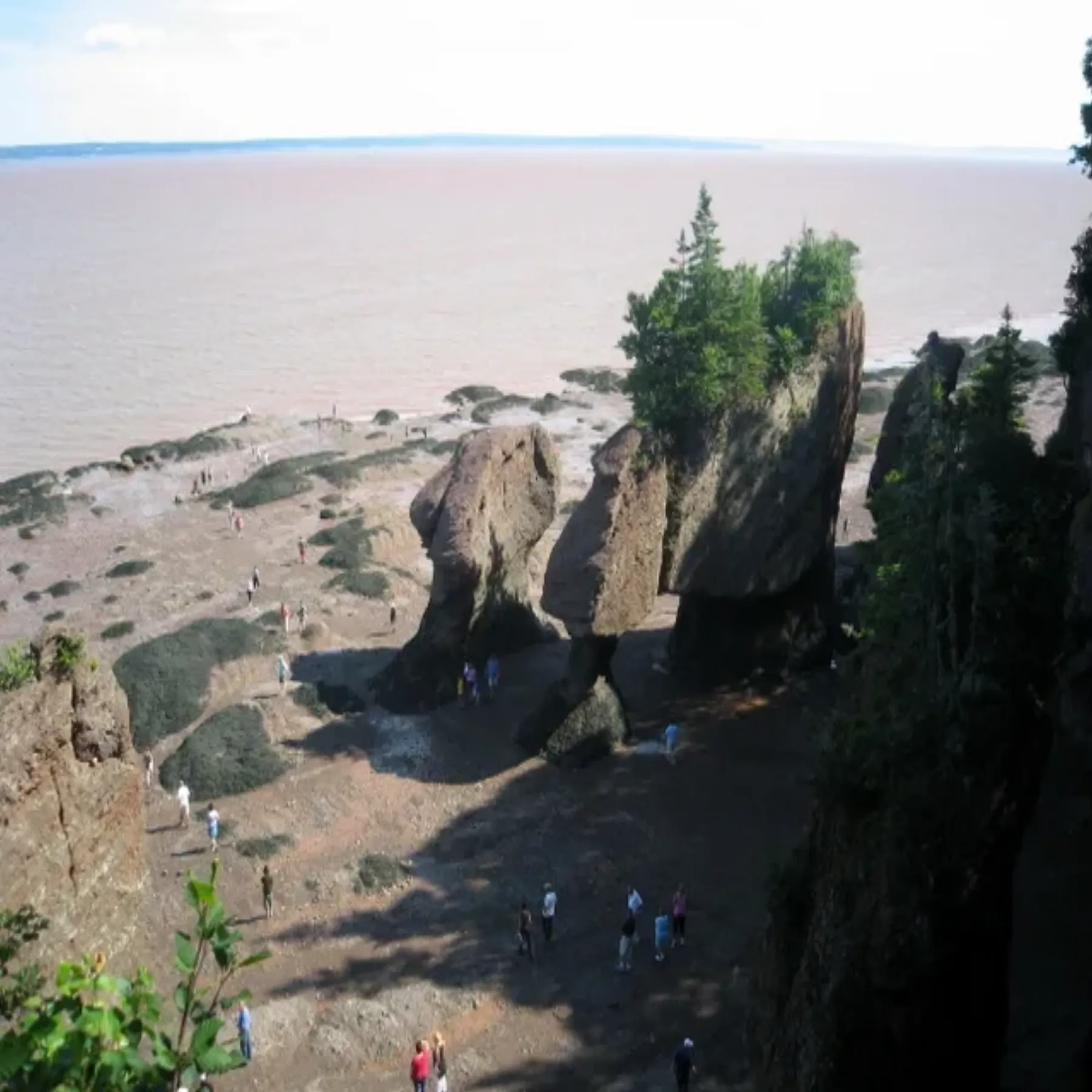
At Hopewell Rocks on New Brunswick's Bay of Fundy, the tide exposes the shore beneath the flowerpot-shaped sea stacks. At high tide, the same area is covered by water, so a visit can show two very different coastlines in one day.
Check the official tide schedule before entering the ocean floor and leave well before the incoming water cuts off your return. Use marked access points, watch for falling rock and respect closures. Hopewell Rocks visitor information
View in GoExploringBackpack the Fundy Footpath
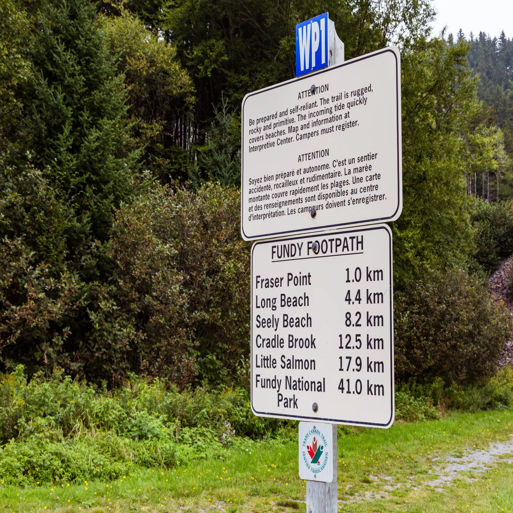
The Fundy Footpath follows a rugged stretch of New Brunswick coastline through forest, river valleys and steep ravines. Repeated descents and climbs make this a demanding multi-day route, despite its modest map distance.
Plan camps, water and transport before starting, and check tide tables for coastal sections. Carry navigation and emergency gear, and allow extra time for mud, rain and river crossings. Choose this route if you already have backcountry hiking experience.
View in GoExploringHike the Skyline Trail in Cape Breton Highlands
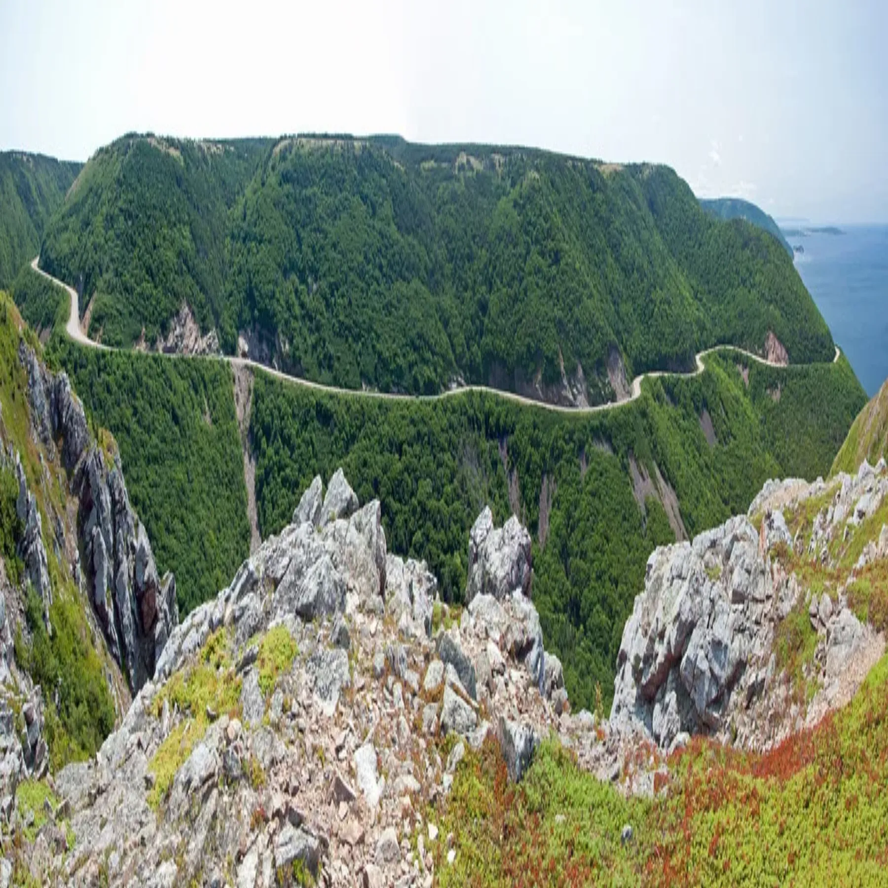
The Skyline Trail reaches a headland above the Gulf of St. Lawrence, where a long boardwalk looks over the coast and the Cabot Trail. The route crosses forest before opening onto the cliffs.
Stay on the boardwalk and keep well back from the edge, where moose and steep drop-offs call for care. Parking reservations apply during the park's busiest 2026 season, June 26 to October 25; confirm the current system before you go. Parks Canada trail details
View in GoExploringWalk the marked Tablelands trail
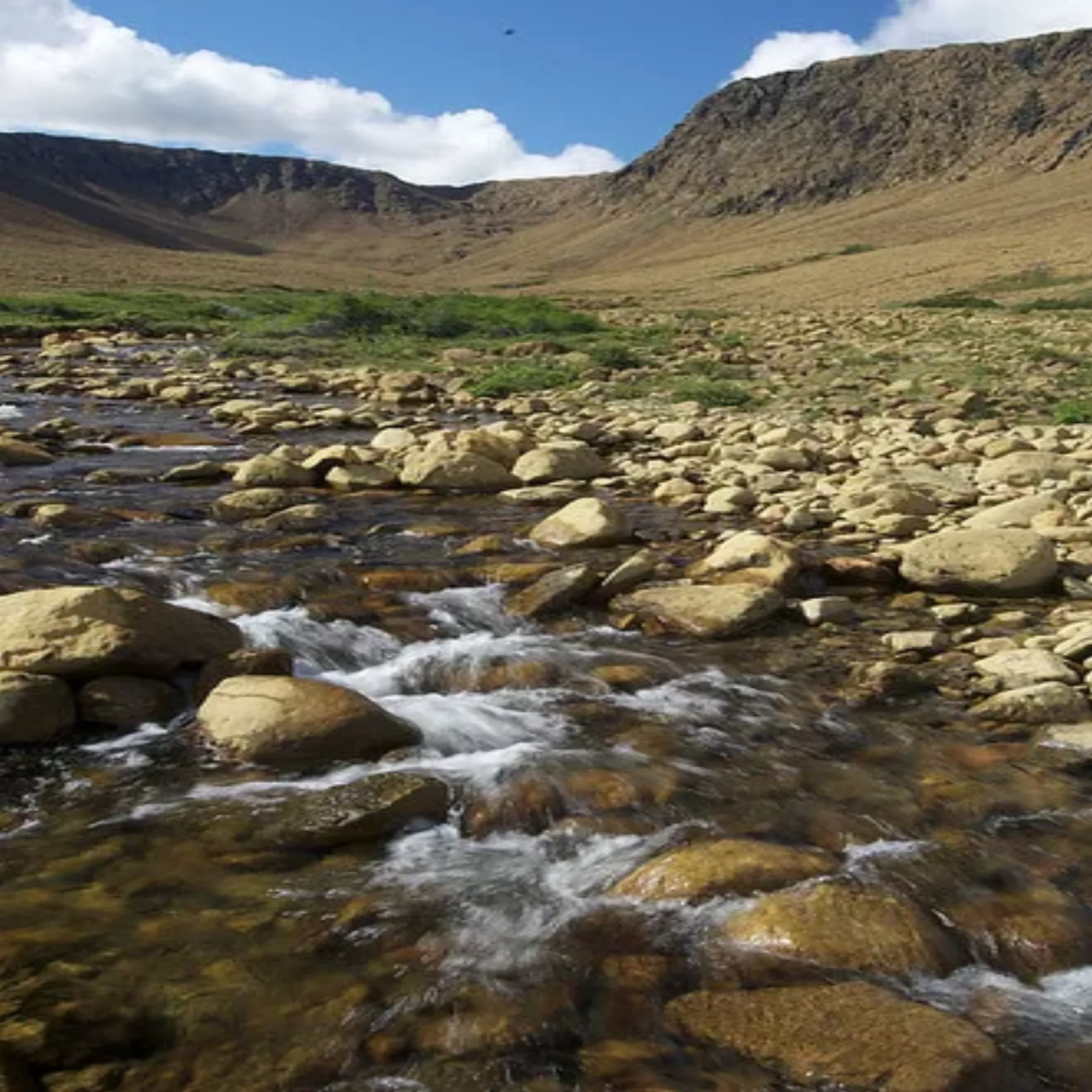
The Tablelands in Gros Morne National Park expose rock from deep within Earth's mantle. The marked trail follows an old roadbed along the base of the rust-coloured plateau, through terrain with sparse vegetation and unusual geology.
The main route is a relatively short walk, but open weather and loose stone can make it feel remote. Stay on the marked trail because the thin plant communities are easily damaged. Parks Canada also runs guided walks that explain the geology; check the park schedule if you want one. Parks Canada: The Tablelands
View in GoExploringHike the Skerwink Trail
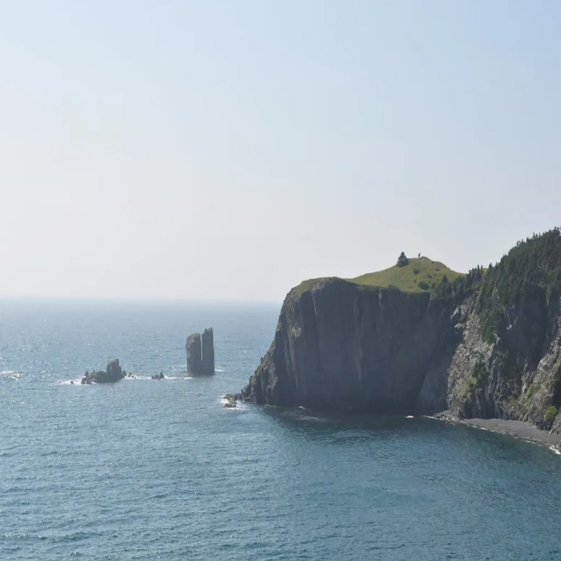
Near Trinity, Newfoundland, the Skerwink Trail loops along Atlantic headlands, past sea stacks, coves and cliffs. It is a rewarding half-day walk with open views and stretches of forest path.
The route has uneven ground and exposed viewpoints. Wear shoes with grip, keep back from cliff edges and check the weather before leaving. Coastal fog can reduce visibility, and wind makes the headlands feel colder than nearby towns.
View in GoExploringPaddle the South Nahanni to Náįlįcho
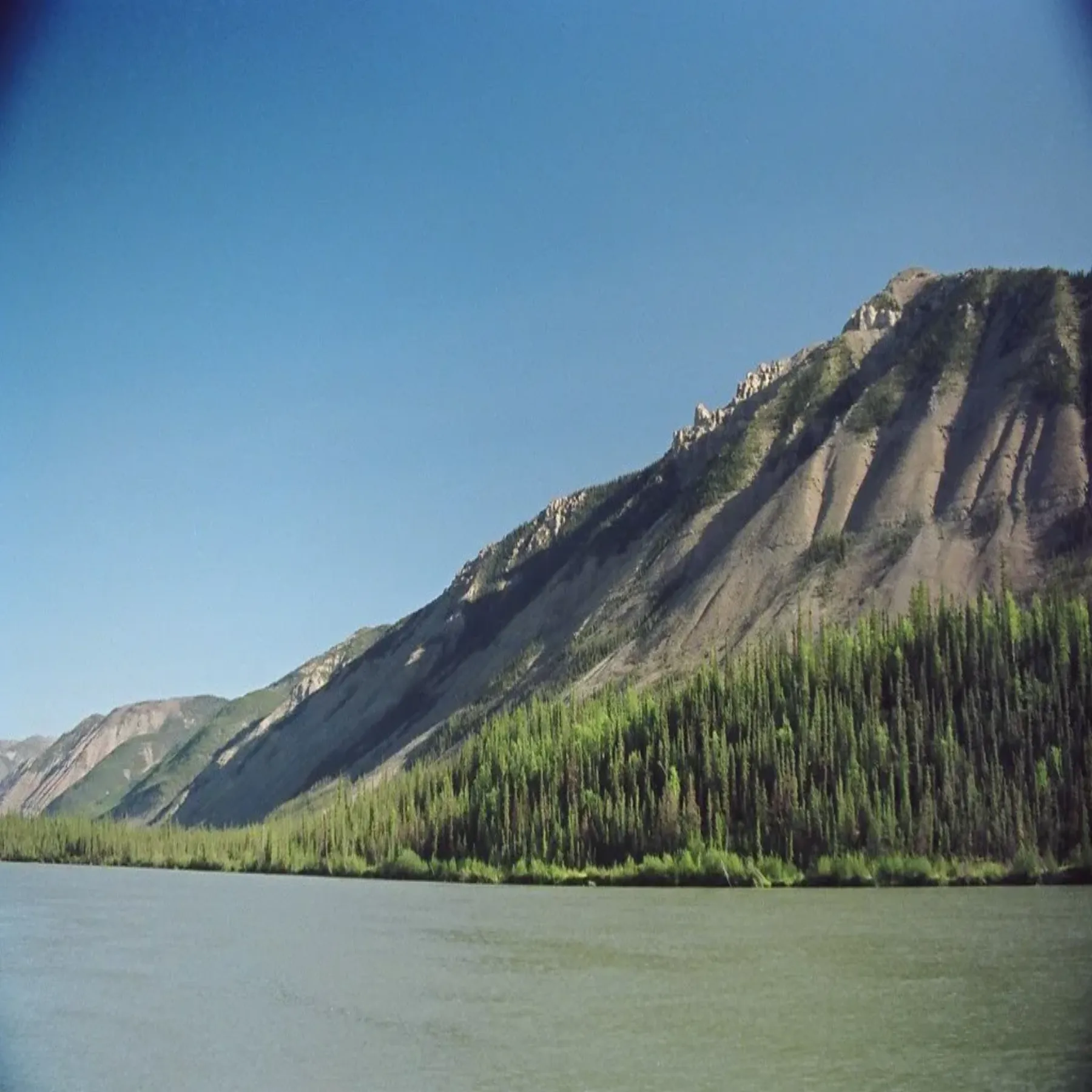
The South Nahanni River runs through the Northwest Territories' remote mountain country. Paddling to Náįlįcho (Virginia Falls) is part of a wilderness expedition, with long stretches between access points and no quick road exit.
This trip needs whitewater judgment, expedition planning and a way to manage emergencies far from help. Arrange flights and permits where required, carry appropriate river and camping equipment, and check current park rules. First-time wilderness paddlers should travel with an experienced outfitter.
View in GoExploringTrek across Akshayuk Pass in Auyuittuq
Akshayuk Pass crosses Baffin Island's Arctic landscape between towering granite peaks, glaciers and broad river valleys. The route in Auyuittuq National Park is a serious multi-day trek where weather, cold and river crossings shape each day's plan.
Register with Parks Canada before entering the park and check current travel advisories. Carry suitable cold-weather shelter, navigation and emergency equipment, and know how to respond to polar bears. Conditions can change fast; build flexibility into your itinerary.
View in GoExploringClimb Gros Morne Mountain
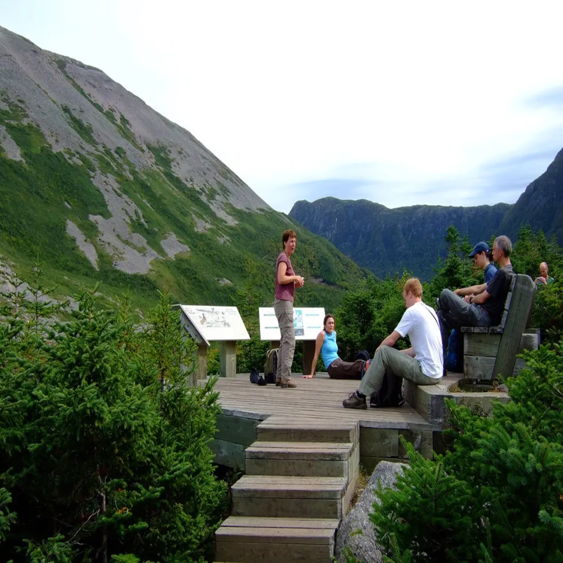
Gros Morne Mountain rises above the park's fjords and coastal lowlands in Newfoundland. The summit route climbs through forest and rock to an alpine plateau, then returns by the same way. Parks Canada describes it as a challenging 17-kilometre hike.
Check the trail report and forecast, start early and carry enough water, food and layers for a full day. The upper route is steep and exposed, and conditions can change quickly. Follow the marked route and turn back if cloud or weather removes a safe margin. Parks Canada: Gros Morne National Park
View in GoExploring